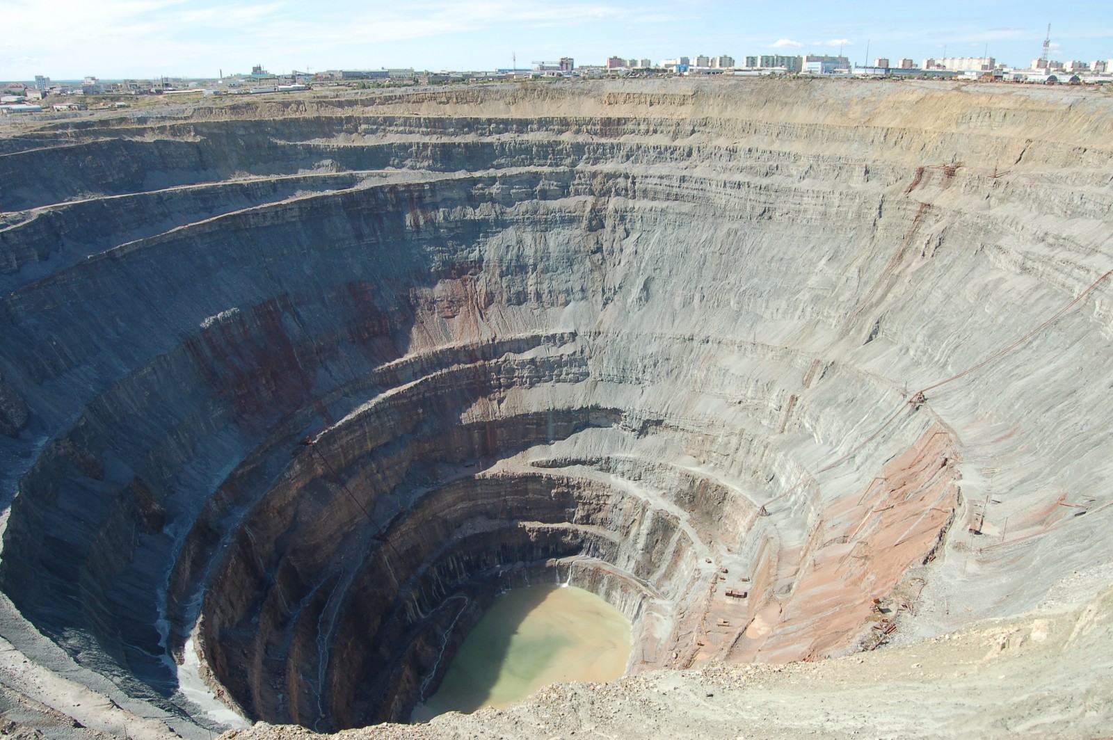
ERE
Energy, Resources and the Environment

Suzanne Hangx

Suzanne Hangx is a post-doctoral researcher at the High Pressure and Temperature Laboratory of Utrecht University, the Netherlands. Her research focusses on fluid-rock interactions and how they affect the mechanical properties of rocks. By breaking rocks on a (more or less) day-to-day basis, she aims to make a contribution to potential solutions of societally relevant earth scientific issues, such as subsurface CO2 storage or surface subsidence induced by hydrocarbon or groundwater pumping. Suzanne is currently the Subsurface Officer of the Energy, Resources and Environment (ERE) Division of the European Geosciences Union (EGU).

The Scorpion and the… Trees: Surface mining (im)practical implications

The Scorpion and the Frog. This old tale, which was first documented by the movie Mr. Arkadin by Orson Welles, reports a scorpion that wants to cross a river… and asks a frog for a ride. Embarking on a lose-lose situation, both the frog and the scorpion are doomed in the tale.

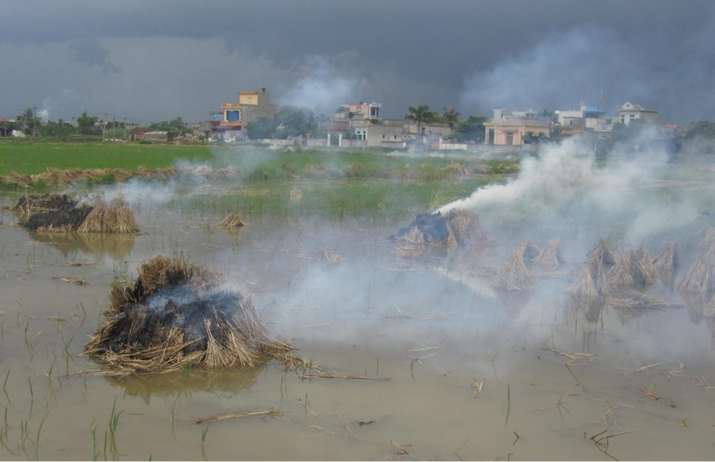
Dramatic, this fable severely resembles how humans conduct their quest for resource extraction. Surface mining, a particular type of resource extraction, is devastating. It involves strip mining, open-pit mining and mountaintop-removal mining and accounts for more than 80% of ore mined each year (Ramani, 2012). Surface mining disturbs the landscape and impacts habitat integrity, environmental flows and ecosystem functions; it raises concerns about water (Miller and Zégre, 2014), air and soil quality (Mummey et al., 2002), and often also public health. Legacies of surface mining may include loss of soil structure and fertility, altered hydrology, and long-term leaching of contaminants from tailings and end-pit lakes (Isosaari and Sillanpää, 2010; Li, 2006; Ramani, 2012).

A new study debates the possible routes to deal with the legacies of surface mining. In a first instance, the authors revisit the terms remediation, reclamation, restoration and rehabilitation (R4) and clearly distinguish them in terms of the end-goal. While remediation is a more technical term and aims at removing pollutants and avoiding human exposure to them, restoration proposes the full recovery of the original ecosystem, prior to mining. Although frequently claimed as the end-goal, restoration may often not be feasible because of a myriad of constrictions.

To find out more about how the R4 is differentiated and where surface mining will likely happen in the future, check out the full study by Dr. Lima and her co-workers here.

dr-ana-limaDr. Ana Theresa Lima is an Adjunct Assistant Professor at the Ecohydrology group, Department of Earth and Environmental Sciences, University of Waterloo, Canada, and a Visiting Associate Professor at the Department of Environmental Engineering, Universidade Federal de Espirito Santo, Vitória, Brazil. Her research interests include electrokinetics, urban soils and the impact of human activity on them, organic and inorganic pollution and possible remediation techniques, and environmental policy.

References

Miller, A., Zégre, N., 2014. Mountaintop removal mining and catchment hydrology. Water 6, 472–499. doi:10.3390/w6030472

Mummey, D.L., Stahl, P.D., Buyer, J.S., 2002. Soil microbiological properties 20 years after surface mine reclamation: spatial analysis of reclaimed and undisturbed sites. Soil Biol. Biochem. 34, 1717–1725. doi:10.1016/S0038-0717(02)00158-X

Isosaari, P., Sillanpää, M., 2010. Electromigration of arsenic and co-existing metals in mine tailings. Chemosphere 81, 1155–1158.

Li, M.S., 2006. Ecological restoration of mineland with particular reference to the metalliferous mine wasteland in China: A review of research and practice. Sci. Total Environ. 357, 38–53. doi:10.1016/j.scitotenv.2005.05.003

Ramani, R. V., 2012. Surface Mining Technology: Progress and Prospects. Procedia Eng. 46, 9 – 21.

Take a deep breath… Or not!

We all know that pollution, of any kind, is not good news and that it may lead to health risks. Air pollution, such as smog, is something many large cities experience, especially in low- and middle-income countries. The World Health Organisation reports that “As urban air quality declines, the risk of stroke, heart disease, lung cancer, and chronic and acute respiratory diseases, including asthma, increases for the people who live in them.”  But how do these health risks impact premature mortality?

A recent study on air pollution in urban areas in India has estimated that fine particulate matter (i.e. very small airborne particles released by various sources, such as fossil fuel or organic matter burning) exposure has lead to over half a million premature deaths. Though this number was not obtained by studying who actually died from air pollution, but rather via statistical extrapolation of data obtained in less polluted areas, the study suggests that air pollution in India leads to about 3.4 life years lost.

Read the whole article by Chelsea Harvey in the Energy and Environment section of the Washington Post here.

Are you READY for a flood event?

As evidenced by the EU Floods Directive (2007/60/EC), flood management strategies in Europe have undergone a shift in focus in recent years. The goal of flood prevention using structural measures has been replaced by an emphasis on the management of flood risks using non-structural measures. One implication of this is that public authorities alone not only take responsibility for flood management. A broader range of stakeholders, who may personally experience the negative effects of flooding, also take on responsibility for protecting themselves. Therefore, it is vital that information concerning flood risks is conveyed to those who may be affected in order to facilitate the self-protection of citizens. Experience shows that problems persist even where efforts have been made to communicate flood risks.

There is a need for the development of new tools that are able to rapidly disseminate flood-risk information to the general public. To be useful these tools must be able to present information relevant to the location of the user. Moreover, the content and design of the tool need to be adjusted to laypeople’s needs. Dissemination and communication influence both people’s access to and understanding of natural risk information. Such a tool could be a useful aid to effective management of flood risks.

To address this gap, a web-based geographical information system (WebGIS) has been developed through the collaborative efforts of a group of scientists, hazard and risk analysts and managers, GIS analysts, system developers and communication designers.

This tool, called “READY: Risk, Extreme Events, Adaptation, Defend Yourself”, aims to enhance the general public knowledge of flood risk, making citizens more capable of responding appropriately during a flood event. The READY WebGIS has allowed for the visualization and easy querying of a complex hazard and risk database thanks to a high degree of interactivity and easily read maps. In this way, READY has enabled fast exploration of alternative flood scenarios or past calamitous events. Combined also with a system of graphic symbols designed ad hoc for communication of self-protection behaviours, it is believed READY could lead to an increase in citizen participation, informed discussion and consensus building.

The platform has been developed for a site-specific application: the Basilicata region, Italy, has been selected as pilot application area. The goal of the prototype is to raise citizen awareness of flood risks and to build social capacity and enhanced resilience to flood events.

Read the whole paper here: Albano, R., Sole, A., and Adamowski, J.: READY: a web-based geographical information system for enhanced flood resilience through raising awareness in citizens, Nat. Hazards Earth Syst. Sci., 15, 1645-1658, doi:10.5194/nhess-15-1645-2015, 2015.

Example of the recommendations, provided by the READY platform, for behavioural actions in case of alert, intended for selfprotection enhancement.

Example of the recommendations, provided by the READY platform, for behavioural actions in case of alert, intended for selfprotection enhancement.

Can climate data help to better predict floods?

Can climate data help to better predict floods?

Many studies report that hydrologic regimes are modulated by large-scale modes of climate variability such as the El Niño Southern Oscillation (ENSO) or the North Atlantic Oscillation (NAO). Climate-informed frequency analysis models have therefore been proposed to condition the distribution of hydrologic variables on climate indices. However, standard climate indices may be poor predictors in some regions. Instead of trying to describe climatic cycles using a single parameter, Renard and Lall developed a model using a range of parameters.

You can read the whole paper here: Renard, B., and U. Lall (2014), Regional frequency analysis conditioned on large-scale atmospheric or oceanic fields, Water Resour. Res., 50, 95369554, doi:10.1002/2014WR016277.