Drones are not only a cool toy to play with. They are also a useful instrument to monitor and study glaciers and ice caps. By taking thousands of images flying above the ice, we can make 3D models of ice masses at centimetre resolution. Using drones, we can now survey small to medium sized glaciers and ice caps in unprecedented detail. In recent years, we have conducted several surveys on glaciers ...[Read More]
Cryo Adventures – Droning on glaciers and ice caps in Kyrgyzstan
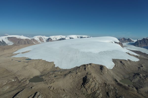
The Grigoriev ice cap, seen from drone perspective at about 1 km distance and at 4800 m a.s.l. [Credit: Lander Van Tricht]