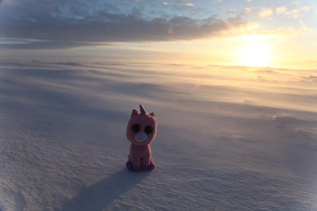

December 2014, 11:50 p.m., the sun licks the horizon on Derwael ice rise; It’s time to go back to the tent … The shot was taken during the 2014 IceCon Field campaign in East Antarctica (read Brice’s blog post telllling about his first journey to Antarctica). Here, you can also read about the 2016 field season of …[Read More]
Image of the Week — Greetings from Antarctica
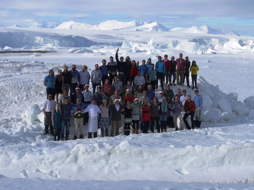
Christmas greetings from people at Rothera Research Station, Adelaide Island, Antarctica. Rothera, which is the British Antarctic Survey’s largest base in Antarctica, is a centre for marine biology and gateway for getting scientists into their deep field camps. Christmas Day is a regular working day for the staff of around 90. However the chefs will …[Read More]
Image of the Week — AGU Fall Meeting 2015
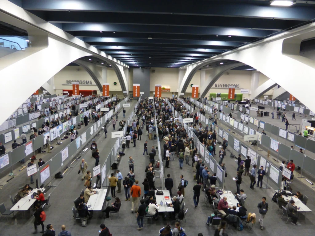
The American Geophysical Union (AGU) Fall Meeting, which takes place every December in San Francisco is ending today. With more than 24 000 attendees, 14 000 poster presentations and 7 000 talks, the AGU meeting is the largest conference on geophysical sciences in the World. The cryosphere is one the topics covered by the meeting …[Read More]
Image of the Week — Future Decline of sea-ice extent in the Arctic (from IPCC)
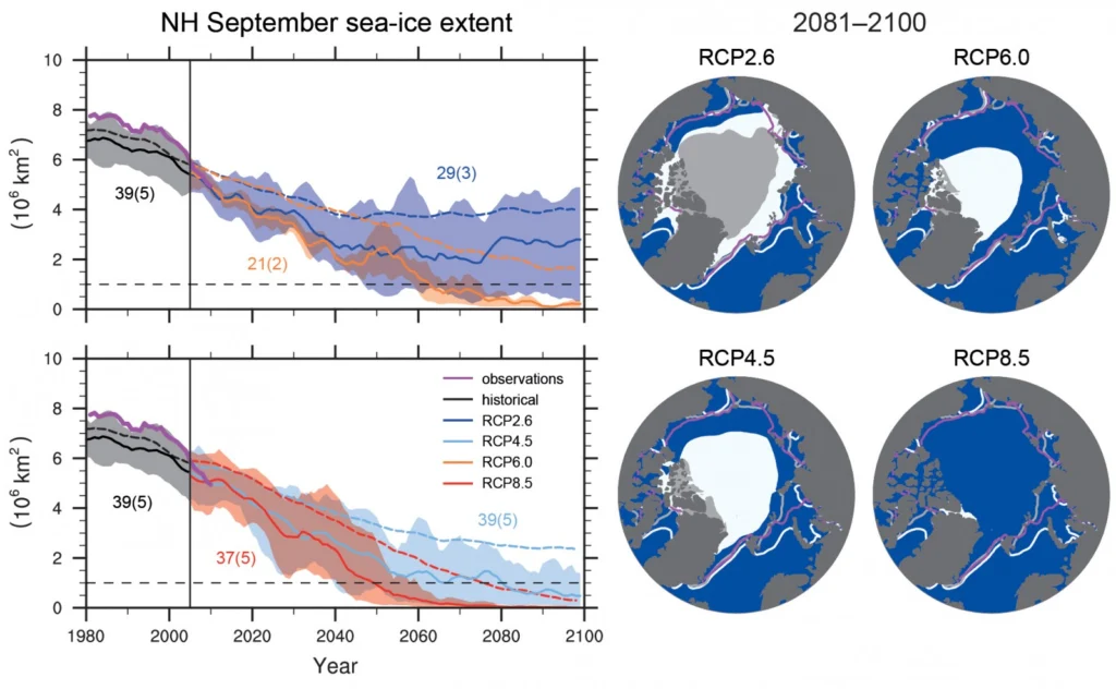
The Arctic sea-ice extent has declined in the past 20 years and its future is uncertain. In the end, greenhouse gas emissions will determine the impact on the sea-ice from man-made climate change through radiative forcing (i.e. Representative Concentration Pathways or RCPs). The COP21 can determine the path we will follow and which course we will take to …[Read More]
Image of the Week — Ice Sheets and Sea Level Rise (from IPCC)
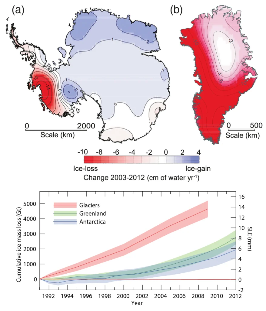
Context On the eve of the COP21, it is of paramount importance to recall how strongly the cryosphere is affected by Climate Change. Today, we present the impact of melting ice on sea level rise, as it is presented in the latest assessment report of the Intergovernmental Panel on Climate Change. Quick facts -Since 1992, …[Read More]
Image of the Week: Under the Sea
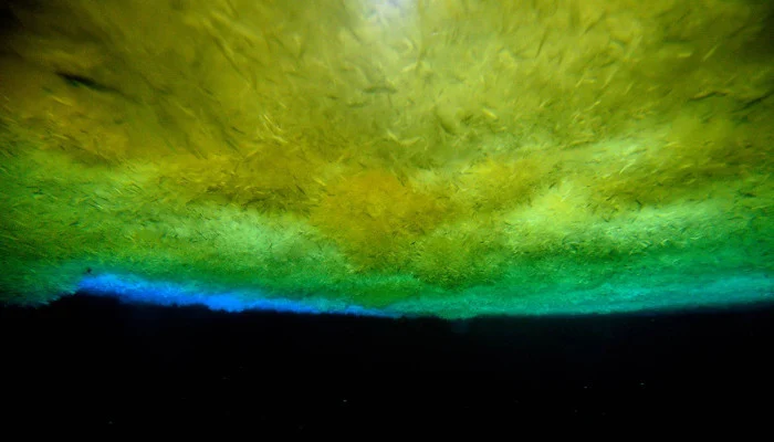
Always wondered how it looks like under the sea ice? Getting an answer is simpler than you might think: Just go out to the front of McMurdo ice shelf in Antarctica and drill a tube into the sea ice. Then let people climb down and take pictures of the ice from below. More information: – …[Read More]
Image of the Week — What’s up with the sea-ice leads?
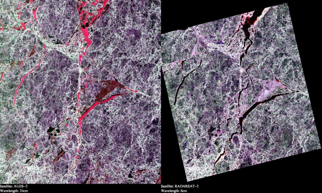
This illustration shows two Synthetic Aperture Radar (SAR) images taken over sea ice in the Arctic Ocean. Both images are polarimetric and the different colours reflect the different polarimetric channels of the SAR (red = VV, green = HV and blue = HH). The two images are from the two satellites “ALOS-2” and “RADARSAT-2”. These …[Read More]
Image of the Week : 63 years of the Muir Glacier’s retreat
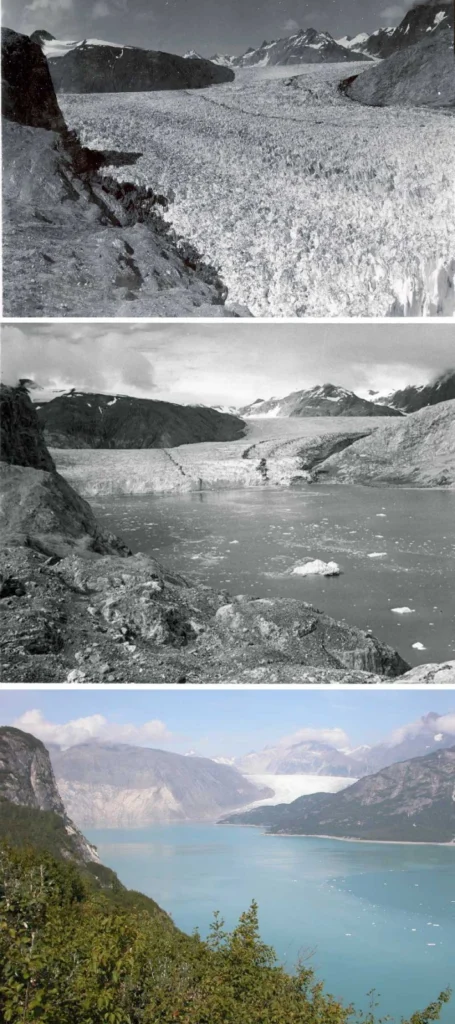
The Muir is a valley glacier (Alaska) that has significantly retreated over the last 2 centuries. The 3 pictures have the same field of view and record the changes that occurred during the 63 years separating 1941 and 2004. In the 1941, the terminus of the glacier is on the lower right corner of the …[Read More]
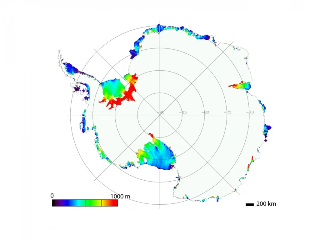
Image of the Week: Antarctic ice-shelf thickness
Thickness of floating ice shelves in Antarctica. Ice thickness is greatest close to the grounding line where it can reach 1000 meters or more (red). Away from the grounding line, the ice rapidly thins to reach a few hundreds of meters at the calving front. Ice thickness varies greatly from one ice shelf to another. …[Read More]
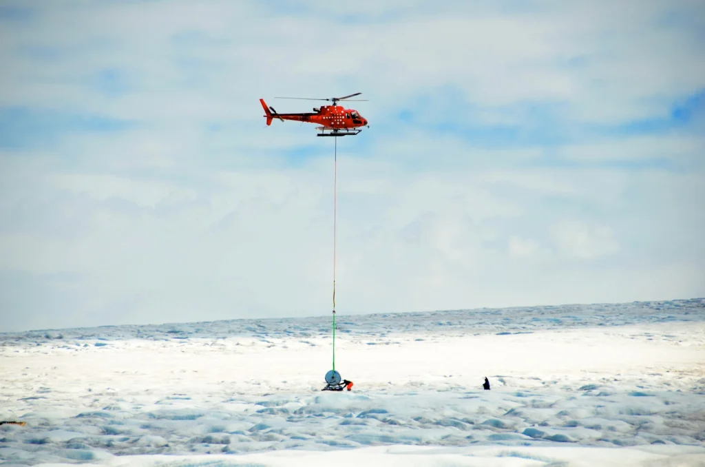
Image of the Week : SAFIRE team getting ready to drill in Greenland
How do you get a hot water drill onto an ice sheet? The Subglacial Access and Fast Ice Research Experiment (SAFIRE) uses a hot water drill to directly access and observe the physical and geothermal properties where the ice meets rock or sediment at the glacier-bed interface. Here, SAFIRE principal investigator Bryn Hubbard and post-doc …[Read More]