Drones are not only a cool toy to play with. They are also a useful instrument to monitor and study glaciers and ice caps. By taking thousands of images flying above the ice, we can make 3D models of ice masses at centimetre resolution. Using drones, we can now survey small to medium sized glaciers and ice caps in unprecedented detail. In recent years, we have conducted several surveys on glaciers and one ice cap in the “Heavenly Mountains”, the Tien Shan, in Kyrgyzstan, Central Asia. Here I share some of our ice-stories with you!
Why do we care about glaciers in Kyrgyzstan?
The mountains of High Mountain Asia are considered Central Asia’s water towers. Their glaciers are a vital source of water for the people and nature in this otherwise arid region, and are also referred to as the globe’s ‘third pole’. During dry periods in summer, more than 75% of the region’s water supply can originate from glacial meltwater. Hence, households, (irrigation) agriculture, industry and electricity (through hydropower) all depend largely on meltwater from the glaciers.
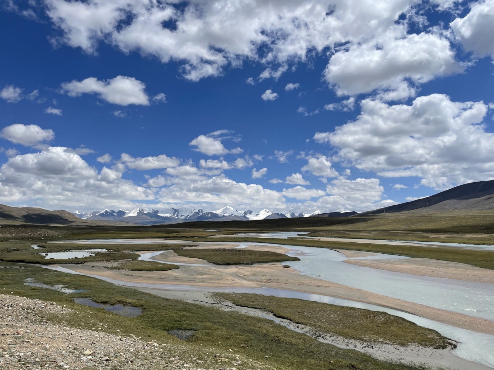
The Arabel-Suu River drains meltwater of the glaciers and ice caps in the Inner Tien-Shan over the Arabel plateau system. [Credit: Lander Van Tricht]
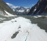
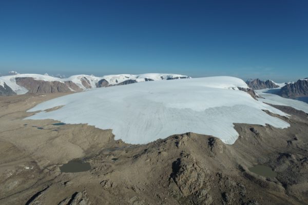
The Ashu-Tor glacier, one of the glaciers of which we measured the ice thickness and the surface elevation. [Credit: Lander Van Tricht]
Droning to get 3D data
In-situ data, more specifically ice thickness, mass balance and surface height data, are exceedingly scarce in the Tien Shan, compared to some other mountain ranges, such as the Alps. We therefore decided to collaborate with regional partners from the Tien Shan High Mountain Research Center and Kumtor Gold Mine to monitor and study some individual ice masses in detail. For several years now, we have measured different glaciers’ ice thickness (using a ground penetrating radar) and their surface elevation (using GPS and drones).
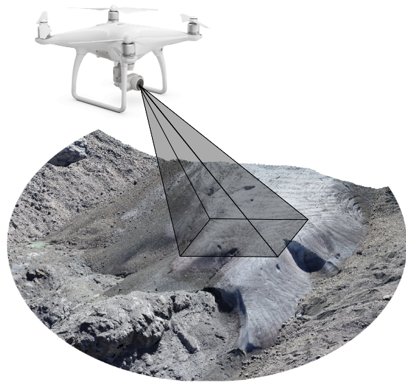
We use a Phantom 4 Pro and Phantom 4 RTK to image the glaciers. [Credit: Lander Van Tricht]
Adventurous fieldwork
To obtain these images, it is not as easy as just letting the drone up and waiting half an hour for it to return with pictures. Due to the limited battery lifetime and the often-large altitude differences between different parts of the ice masses, the most time-consuming part is getting to the take-off location. Furthermore, the need to distribute control points or check points across the ice surface requires adventurous walks between crevasses, looking for the safest path. To reduce the kilometres travelled, in 2021, we used an RTK drone. The RTK system provides the location of the drone at centimetre accuracy which ensures that no (or only few) control points or check points are needed. This makes our fieldwork significantly more efficient (and comfortable!).
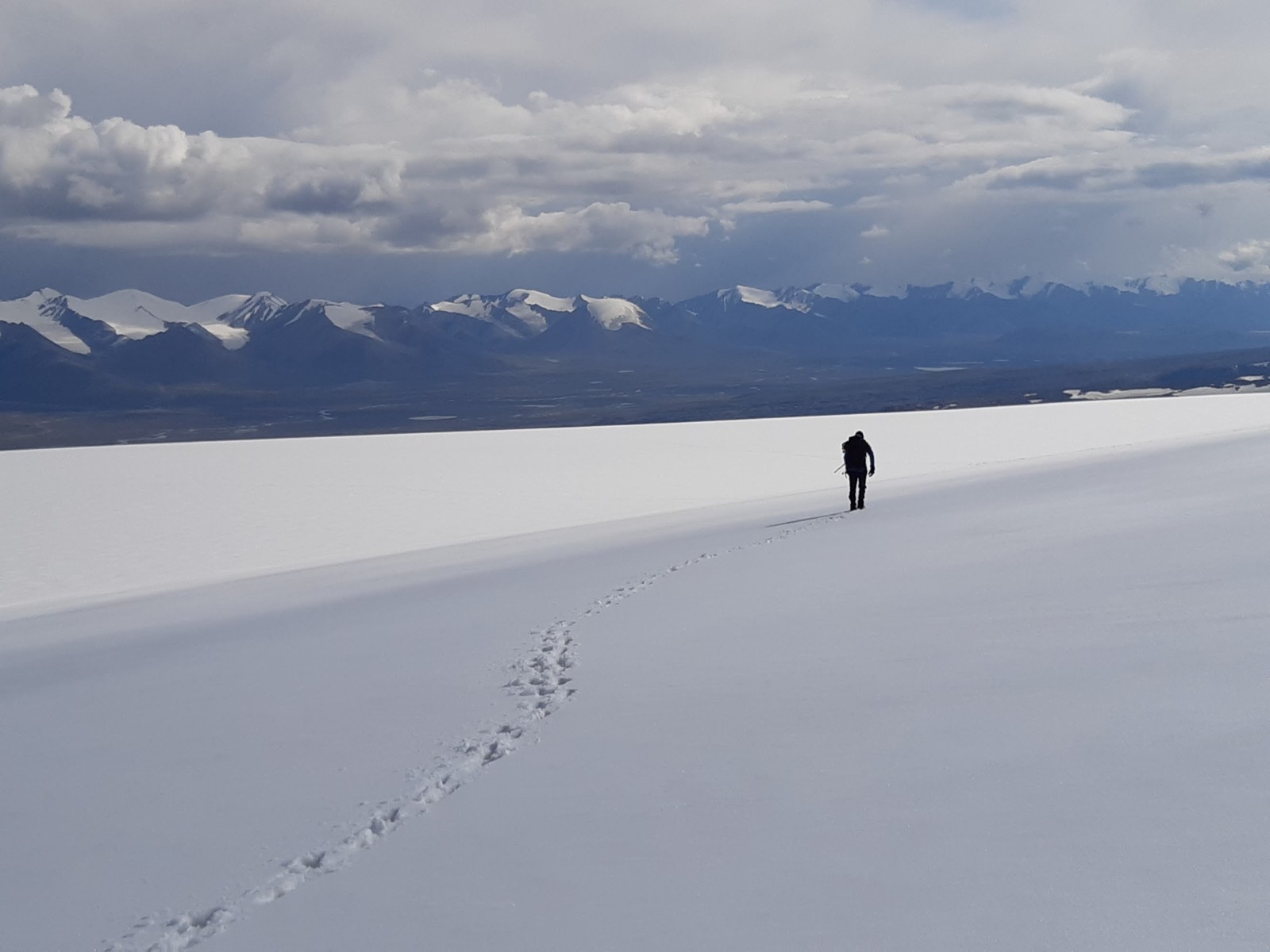
Endless walking on snow and ice to reach a good take-off location and to spread control and validation points. [Credit: Benjamin Vanbiervliet]
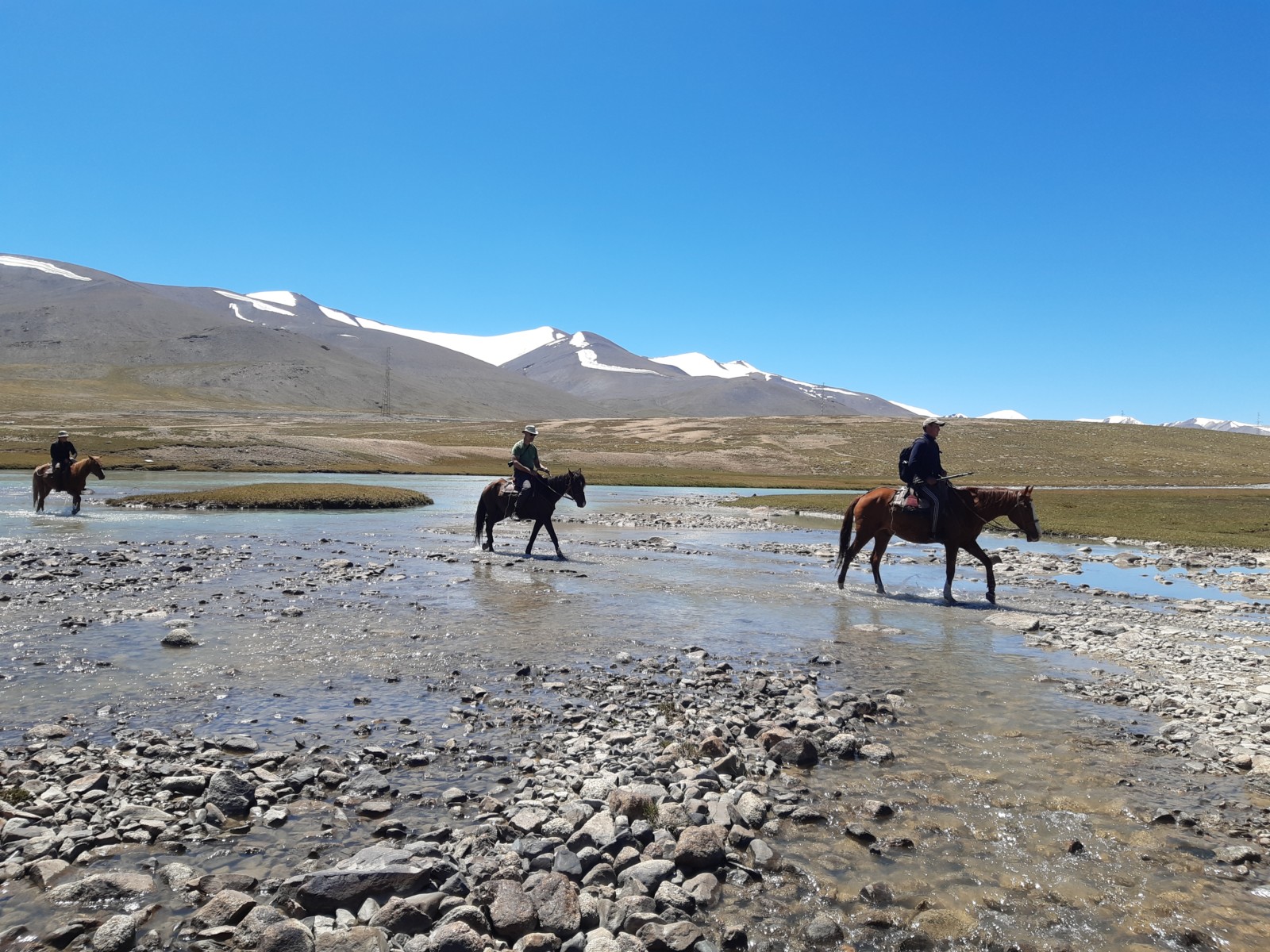
To get to the ice masses to set up a basecamp, we get assistance of our local partners from the Tien Shan High Mountain Research Center and Kumtor Gold Mine, on horseback! [Credit: Lander Van Tricht]
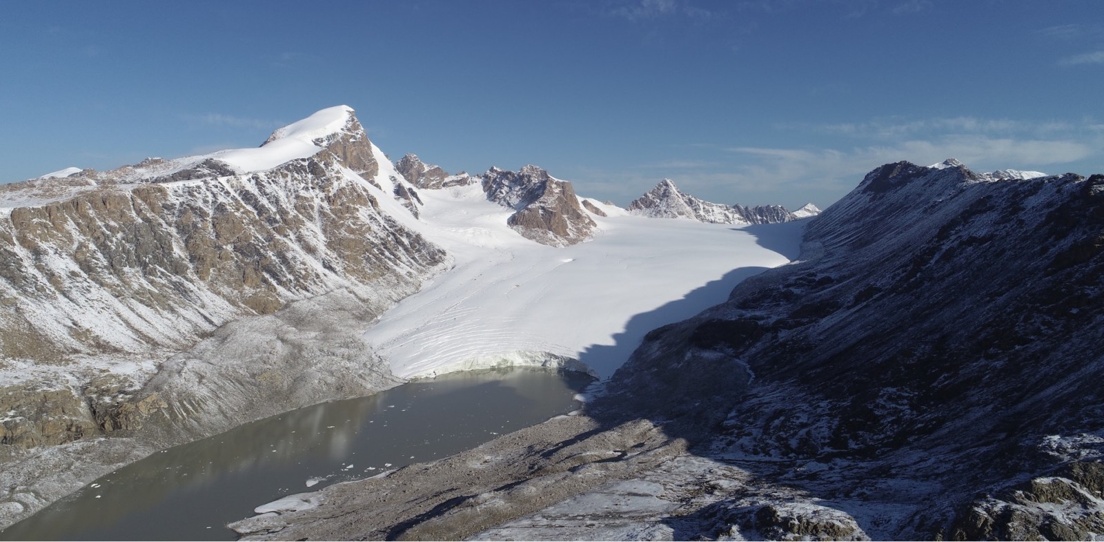
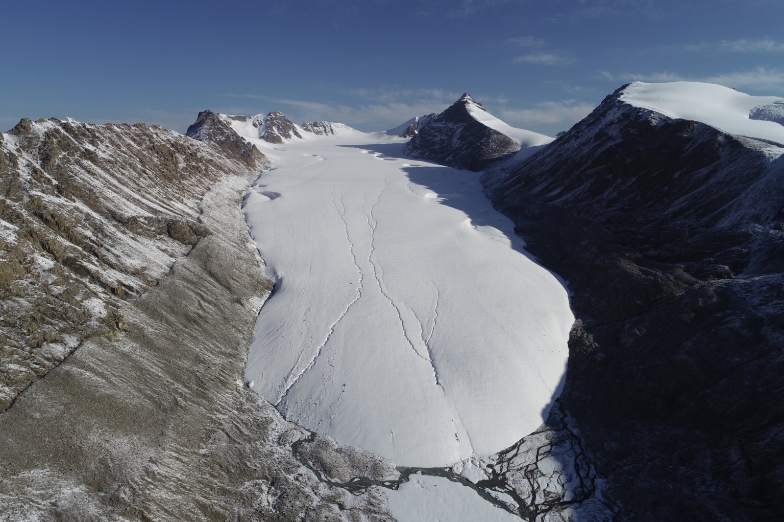
The western Ashu-Tor glacier, which ends in a proglacial lake. [Credit: Lander Van Tricht]
Analysing data back at home
Back at home (in my case Belgium), we create 3D models of the ice masses, by processing all the images, applying algorithms, and correcting the positions thanks to control points. From these up-to-date representations of the ice surface elevation and thickness, we can then for instance also infer the bedrock elevation. Besides that, when we have 3D models of different years, we can calculate ice thickness differences, and surface velocities by tracking visible features at the surface. Such high-resolution data can be an addition to the typical mass balance stake measurements carried out annually . After 10 months of analysing and using the data, now, in June, new fieldwork preparations and plans are being made. The glaciers are still there, and are waiting for us to measure them anew this new summer!
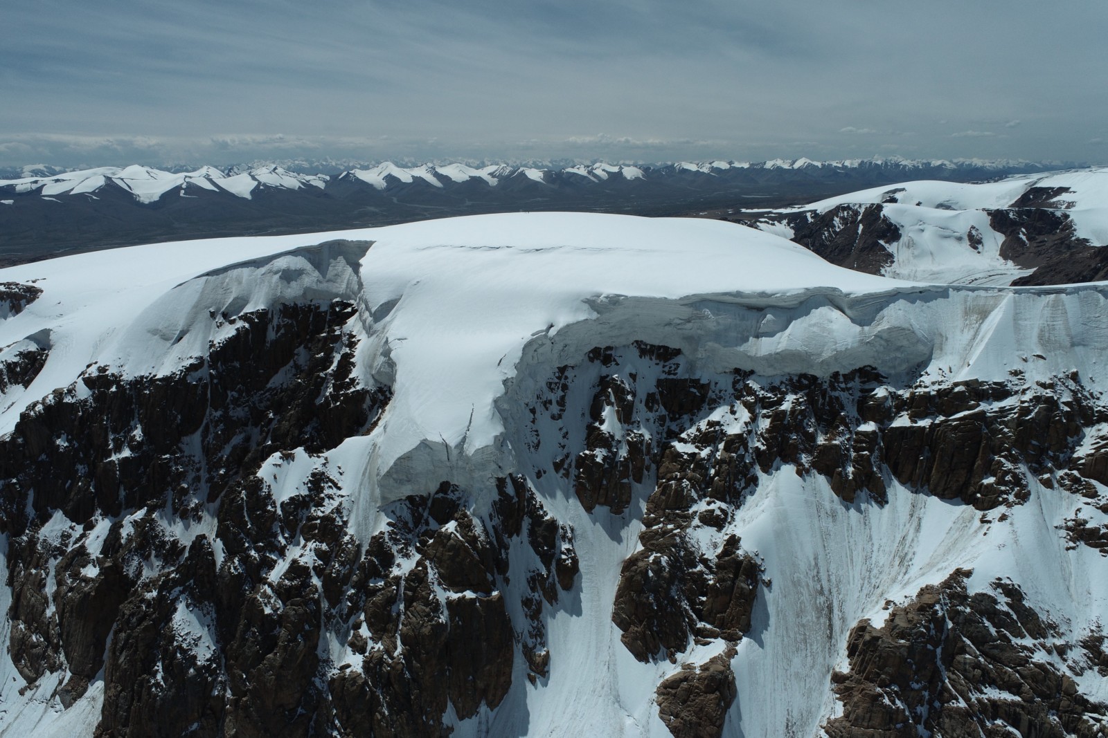
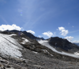
The upper part of the Grigoriev ice cap. This area is only reachable using a drone. [Credit: Lander Van Tricht]
Further reading
- Van Tricht et al. (2021) Measuring and inferring the ice thickness distribution of four glaciers in the Tien Shan, Kyrgyzstan. Journal of Glaciology 67:269-286.
- Van Tricht et al. (2021) Estimating surface mass balance patterns from unoccupied aerial vehicle measurements in the ablation area of the Morteratsch–Pers glacier complex (Switzerland). The Cryosphere 15:4445–4464.
Many thanks to our local partners at the Tien Shan High Mountain Research Center (logistics, transport, horses) and Kumtor Gold Mine (accommodation, transport) for their support of this project.
Edited by Larissa van der Laan and Giovanni Baccolo
 Lander Van Tricht is a PhD student at the Vrije Universiteit Brussel, Belgium. His research focusses on monitoring and modelling glaciers in the Kyrgyz Tien Shan, Central-Asia. His intention is to use innovative techniques and methods, such as drones, to perform glaciological measurements. He tweets as @lander_vt and you can contact him via lander.van.tricht@vub.be