The interface between a glacier and its underlying bedrock is known as the subglacial zone. Here lie subglacial sediments, the product of mechanical crushing of the rock by the glacial ice. Despite their lack of sunlight, nutrients and oxygen, subglacial sediments host active and diverse communities of microorganisms. What we (don’t) know about subglacial microorganisms The past few decades ...[Read More]
Image of the Week — Microbes munch on iron beneath glaciers
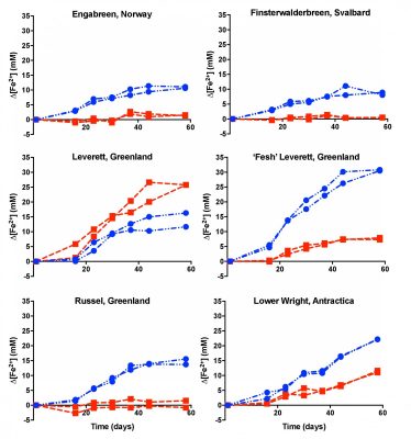
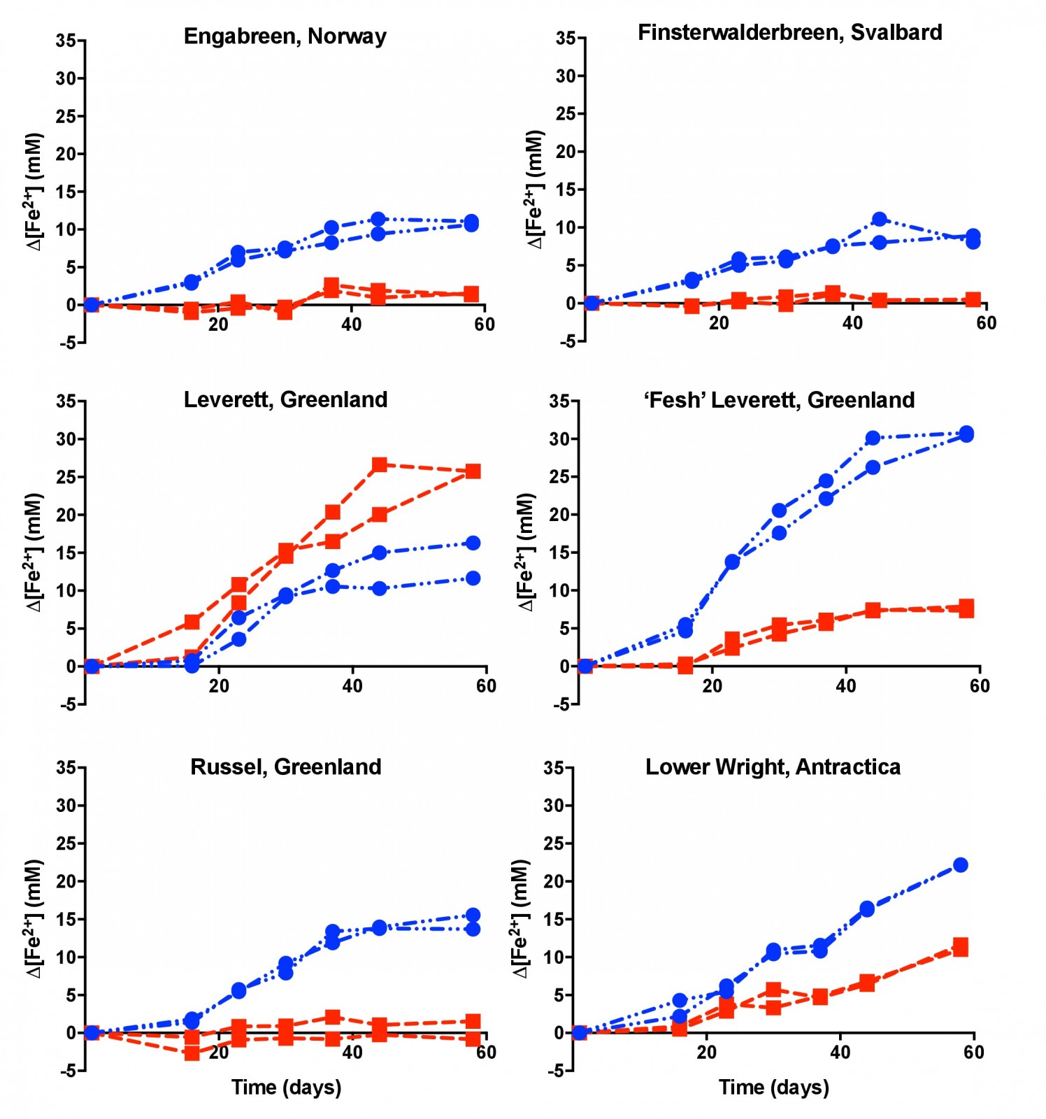
Experiment showing that microbes in subglacial sediment reduce more iron when it's colder (blue lines, i.e. 4°C ) than when it's warmer (red lines, 15°C.) [Credit: adapted from Nixon et al, (2017) Fig.1]
Click here here to enlarge the image.

