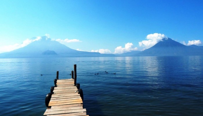
Lake Atitlan, Guatemala.
A picture we’ve shared on this blog before – but well worth including in our Images from Guatemala series. Taken from Panajachel, and looking across to the volcanoes of Atitlan (right) and Toliman (left). The small mound in front of Toliman is known as Cerro de Oro.
The lake fills a significant caldera (volcanic crater), formed from an eruption known as the Los Chocoyos Eruption, dispersing volcanic material as far as Florida in the north and Ecuador in the south. The water level is currently rising, as evident from the many flooded houses and submerged trees along the shoreline (see next weeks images!)
(Credit: Geology for Global Development, 2014)
—-
Every Friday we are publishing an image from Guatemala to promote our ‘100 x 100’ fundraising campaign. We are working with students, recent graduates and others in the UK to raise money to support efforts to reduce the impact of volcanic hazards in Guatemala.
Find out more: www.gfgd.org/guatemala
Register your interest: Submit your information here