Over the next couple of months, Joel Gill (GfGD Founding Director) will be reporting live from Guatemala, whilst undertaking interdisciplinary field research relating to natural hazards and disaster risk reduction. This fieldwork forms part of a NERC/ESRC funded PhD, supervised by staff in the Department of Geography at King’s College London.
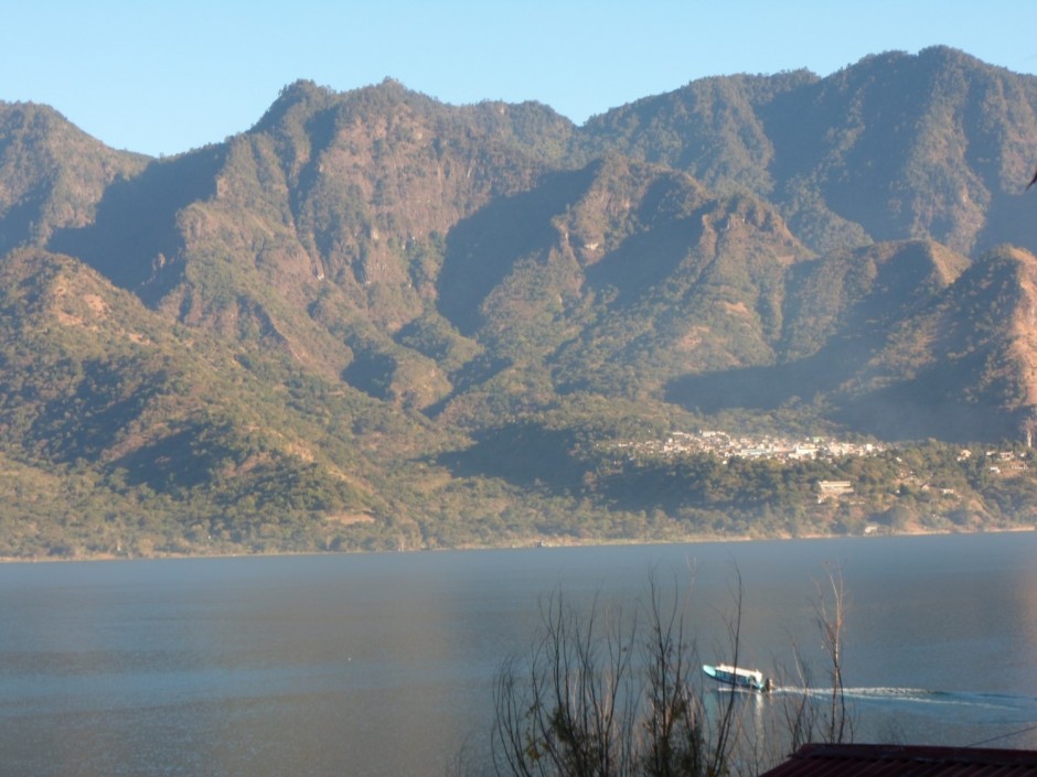
Lago De Atitlan, Guatemala (Credit: Joel Gill)
One of the first things I want to do when arriving in a new country (other than sleep and shower after 20 hours on planes) is explore my surroundings. Being able to picture the streets, the shops, the people, the food and the topography immediately helps you to feel more at ease, imagine what lies ahead over the course of the research, and starts to satisfy the huge curiosity that builds during months of preparatory reading and googling.
There is much to see here. Guatemala has incredible landscapes, dynamic volcanoes, stunning lakes (one of which I’m sat next to now, sipping Guatemala coffee) and mountains rich in forest. It is also a place with incredible colours – the materials, the street markets, even many of the buses are a multi-coloured beauty. Observation is not a difficult thing to do in Guatemala (it is also a very enjoyable thing to do), but to really understand my location there is much more I have to do.
Let me set out a little of why understanding place, and the context of a location is important for geoscientists. There is of course, the obvious understanding of landscape – why it looks as it does. Fieldwork, geological mapping, reading the literature all can help inform aspects of the ‘why?’. For many geoscientists this is where we stop. This is the information we need, and it answers our research questions. Alternatively, there are aspects of place relating to history, politics, culture and society that are rarely relevant to our practice and research objectives – or are they?
On the surface it would seem that I don’t need to understand much about the culture of Guatemala in order to do research on tectonic processes here, or the mineralogy of lavas. In reality, however, a basic understanding of culture, history and sensitivities can avoid frustration, misunderstandings and causing offence. When trying to collect data or map you will need access to land, resources and local knowledge.
It is also essential to understanding how to disseminate information to those that need to know it. Communication can be incredibly difficult across cultures. It is a lot more than just a different language (i.e. if I can speak Spanish I will not be able to disseminate just as easily as if I was in the UK?). Differences in what meaning cultures place on aspects of society and life, on religions and practices, all hinder communication. Methods of learning, of knowledge going from being heard to being understood and acted upon can also be very different across cultures (and even within cultures).
 So my exploring of a place needs to start in a library (and of course, via google, local museums and talking with others). The quality of my research can only be enhanced by taking the time to read about Guatemala’s history, culture and politics. Learning to observe AND understand in physical geography/geology/earth science is what we are trained to do. Developing the ability to observe and understand culture and society rarely makes it into our syllabuses. This gives geographers (as hard as this may be to admit!) a great advantage. There is no reason, however, why this understanding cannot be emphasised more within our geology courses as well. It is essential for high-quality engagement and dissemination, be that on water, mining, engineering geology or hazards based work.
We started learning this kind of approach at secondary school in both geography and geology courses (why do people still live on volcanoes/landslide-prone slopes, even though they are dangerous? – or in more technical language, what drives communities to tolerate a greater degree of risk than perhaps I would currently accept?). We should continue to pursue this interdisciplinary approach to our work, ensuring that our results, engagement and dissemination reach their full potential through understanding (and not just observing) the history/culture of the location we are working within.
Pingback: Climate and Policy Roundup – January 2014 | Four Degrees