 Ana Heureux (GfGD Ambassador, Oxford) writes about a recent talk to the Oxford GfGD University Group. Chris Phillips came to Oxford on November 5th and gave the first talk of the academic year, talking about his work with MapAction.
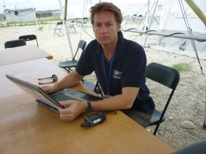
Credit: MapAction
Between work at the Ordnance Survey, travelling and volunteering for MapAction and travelling for pleasure, Chris
Phillips keeps himself busy. When Chris arrived at the Earth Sciences department at Oxford University, he was fresh off the plane from a trip to France, had finished a deployment in Khartoum (Sudan) a few weeks before, and would be off again to Cape Town (South Africa) by the end of the week. But when I met Chris in the atrium he didn’t seem jet-lagged, he was enthusiastic as ever to be in Oxford and to talk to us about his work with MapAction. Chris and I had time for a coffee before the talk started so I got to learn a bit more about MapAction and the role Chris plays for them.
When I first asked Chris what it was like volunteering for MapAction, he summed it up very well with the response, “You have to be the type of person and have the type of job that if you got a call one day and the voice on the other line says ‘There’s a disaster, can you be in Kenya tomorrow morning?’ you don’t hesitate to say yes.”
MapAction is a non-governmental organisation (NGO) made up of volunteers with expertise in geographical information systems (GIS) and specially trained in disaster response. MapAction is unique because due to the flexibility of the volunteers and its affiliation with the United Nations, it is the only charitable organisation that can deploy mapping resources around the world within hours or days of an event.
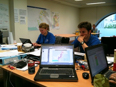
MapAction Office (Credit: MapAction)
My next question for Chris was, what happens after the initial deployment? What happens once you are on the ground? Chris started by explaining that every single mission is different and part of the challenge is knowing how to adapt. But one thing that is always the same is that once they are on the ground, they start making maps. MapAction produces maps of all kinds and as quickly as possible because they are picked up as fast as they can print them. Chris went on to explain that when the MapAction team arrives, it is never very long until they set up camp and get to work. And I got the impression that once they started work, they didn’t stop until their computers were too dusty and hot to turn on, their printers refused to print another page or until the team could hand over the project to the other disaster relief teams on the ground. Chris gave an example of a deployment where their printer actually caught fire, but that didn’t seem to stop the MapAction team.
Later during his talk, Chris explained the type of maps that MapAction typically provides. The purpose of their maps, he said, are to let all of the other aid workers and people in the area know “who is doing what and where.” If MapAction can provide a spatial understanding of what is going on, where the people are and where the resources are, they have done their job. Chris listed the four essential requirements for disaster victims: food, water, shelter and medicine. There are, of course, a number of other necessary components of disaster survival, but he said they always start there. MapAction produces daily and sometimes hourly maps, constantly updating and revising them, of these essential human needs from the start of the disaster.
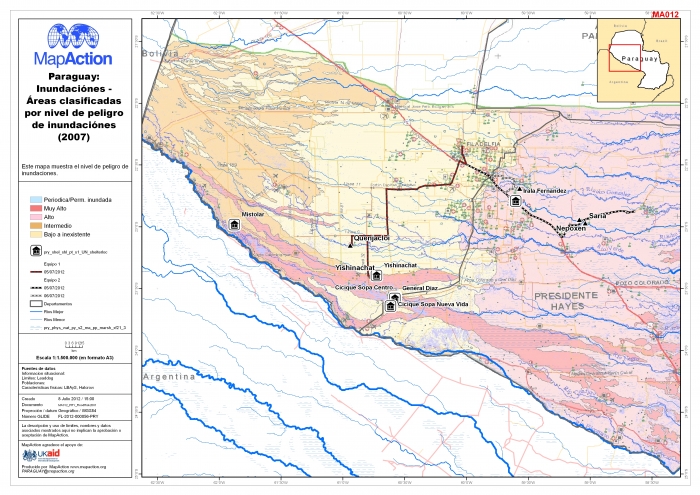
A typical MapAction output from Paraguay (Credit: MapAction)
Chris made us all think about the role that maps play in disaster management. When thinking about mediating the effects of a disaster, one might immediately think about the need for food, water, shelter, but not necessarily think about how that need is satisfied. How do we get food to the people who need it? How can we build camps in the most useful places? How can we access existing sources of food/water? And the answer is always maps. Disaster management needs maps to bring supply and demand together. Without maps, providing resources during a disaster can help, but only with maps can needs be met as efficiently and quickly as possible.
Chris gave the example of an aid worker coming back to MapAction with information about a camp in Haiti, but when asked about the location, he had not kept a record. In this case, there was nothing they could do with the information and information is key. Chris’s talk provided great insight into how MapAction has filled the important role of putting coordinates to key components of disaster risk and management.
To learn more or to make a donation to MapAction, visit their website at http://www.mapaction.org.
Editor’s Note: If you are interested in learning more about the application of GIS to natural hazard events – the Department of Geography, King’s College London, are hosting a free talk on Friday 22nd November 2013 (5.15-6.45pm) entitled “Geographical Information Systems for Natural Hazards Preparedness and Response.” The talk will include presentations by Dr Richard Teeuw (Portsmouth) and Matthew Hogan (London Resilience Network). To submit your interest (and help the organisers prepare) please add your details here – http://goo.gl/LiZD4
Pingback: Upcoming GfGD Events/Deadlines | Geology for Global Development
Pingback: From Our Archives: Guest Blogs (1) | Geology for Global Development