 Tim Middleton is a first year PhD student in the Department of Earth Science at Oxford University – studying active tectonics in central and eastern Asia. He has recently joined the GfGD National Committee as our Advocacy Development Officer. Here, Tim describes his experience of fieldwork in Kazakhstan and the importance of studying the landscape to assess the risk of future disasters. Tim gives us a real insight into what life is like for a geologist in the field, and what modern seismic hazard research is all about!
Almaty is a bustling city in the southeast corner of Kazakhstan. Until 1997, it was the country’s capital and it is still home to around 1.5 million people. The city nestles against the Zailysky Mountains to the south and on a clear day there are splendid views across the city to the snow-capped peaks of Kyrgyzstan in the distance. In recent times, Kazakhstan’s oil wealth has lead to prosperity; between 2000 and 2007 GDP grew by around 10% per year. The streets of Almaty now boast western restaurants, fashion boutiques and expensive hotels; up in the mountains, there’s a cable car and a ski resort.
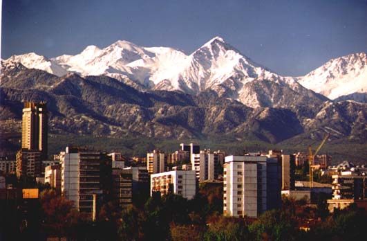
A view looking south across Almaty to the Zailysky mountains in the background. Source [wikipedia]
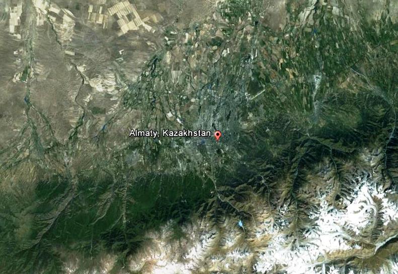
Google Earth image of Almaty, Kazakhstan. The mountains to the south are the Zailysky Alatau and a major range front fault runs along the base of these mountains.
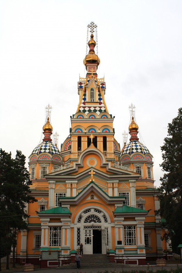
The Cathedral of the Holy Ascension. The former, stone cathedral was destroyed in the 1887 earthquake and was replaced by the current building—one of the tallest wooden buildings in the world—in 1907.
In September 2012, I was fortunate enough to be part of a research expedition to study these, and other, active faults in Kazakhstan. Earthquakes occur in Central Asia because India is moving north into Asia at 40 millimetres per year. However, instead of forming a simple plate boundary, deformation occurs across a broad section of the continent. The earthquakes, rather than being confined to narrow zones, are distributed throughout a whole network of faults. Plate tectonic theory (with seismic zones concentrated along boundaries between discrete continental blocks) doesn’t fully describe the behaviour in Central Asia and these continental earthquakes that occur within plates pose a significant seismic hazard. Of the 130 earthquakes that have each killed more than 1000 people in the last 120 years, 100 of them occurred in continental interiors (see England & Jackson, 2011). Furthermore, the mountains in southern Kazakhstan are thought to be some of the youngest ranges created by the ongoing collision of India and Asia; studying these faults, therefore, allows us to examine mountain-building processes at a very early stage.
Many of the active faults can be identified from satellite photos, so much of our time was spent negotiating pot-holed highways and perilous mountain tracks to get to what we knew could be seen from the air. Fortunately, Ivan—our driver—not only happened to be a dab hand at coaxing Mitsubishi vans up impossible inclines, but also spent half the year as a car mechanic and knew how to deal with cracked engine heads!
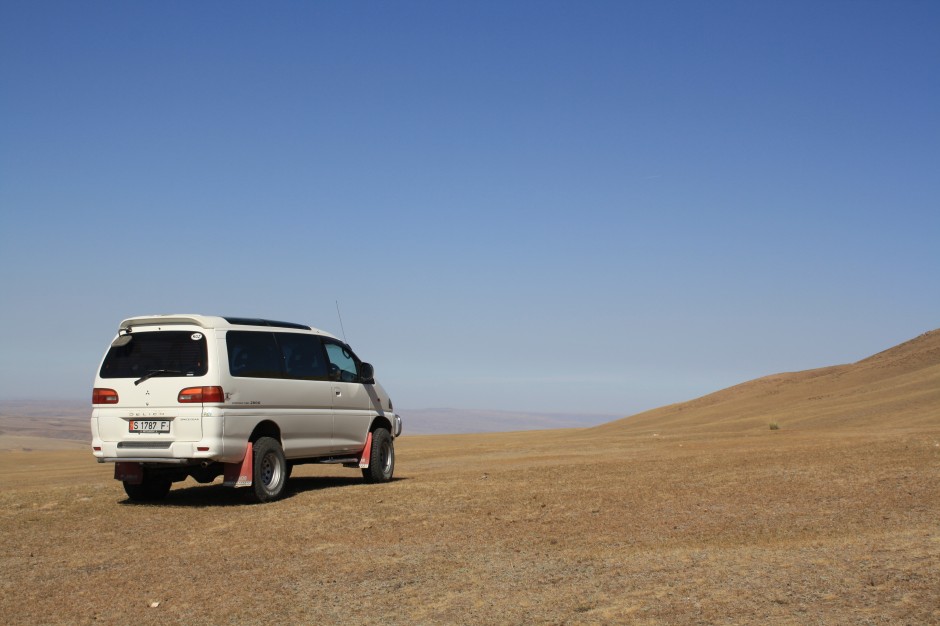
One of our vans – rather a long way from the nearest road.
Once at the faults, we wanted to find sites that would allow us to date the earthquakes and estimate the recent slip rate on the fault. If we know the slip rate, we can work out what role that particular fault plays in the regional tectonics and make a rough estimate of how frequently earthquakes occur in that particular location. We took GPS profiles across the fault scarps so as to accurately measure their height, and made digital elevation models of the local topography in order to view how the fault had influenced the surrounding landscape. For example, in some locations we were able to see small ridges and valleys that had been offset by a fault that cut across them. Some of the fault scarps were incredibly clear—10 metre high steps that ran across the flat steppe; whilst others, typically from older earthquakes, were heavily eroded and harder to identify.
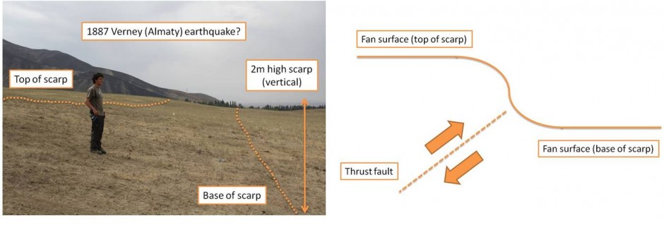
Photo and sketch cross-section of the range-front fault at the edge of the Zailysky Mountains, where the fault crosses an alluvial fan. The fault scarp has been smoothed by erosion. It is possible that this is the scarp for the 1887 earthquake that affected Almaty.
In order to date the fault scarps, we looked for ponded rivers and abandoned ‘ghost’ channels. Sediment deposited in a pond that abuts the fault scarp must post-date the earthquake, whilst sediment from a ‘ghost’ channel on the up-thrown side pre-dates the event. By collecting samples from these locations for radiocarbon and optically stimulated luminescence (OSL) dating, we hope to be able to place bounds on the date the earthquake occurred.
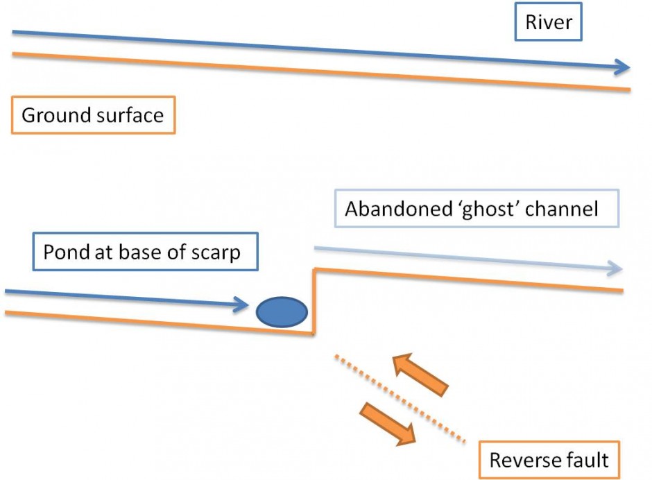
Formation of scarp ponds and ‘ghost’ channels.
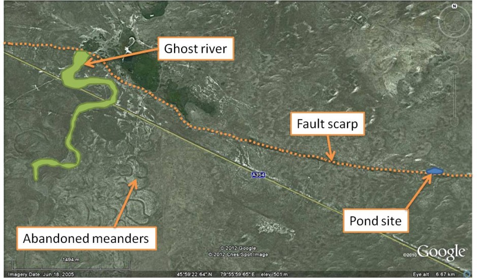
Google Earth image showing a ‘ghost’ river and pond site on one of the faults.
Sample collection is no mean feat: it usually involves digging a pit at least a metre deep and hammering pieces of steel tube into the sediment. By a stroke of good fortune our job was made a great deal easier at one of our rather remote sites when we came across three Kazakhs quarrying for sand with an old digger. They saved us about two days’ of hole-digging in the 30 degree heat!
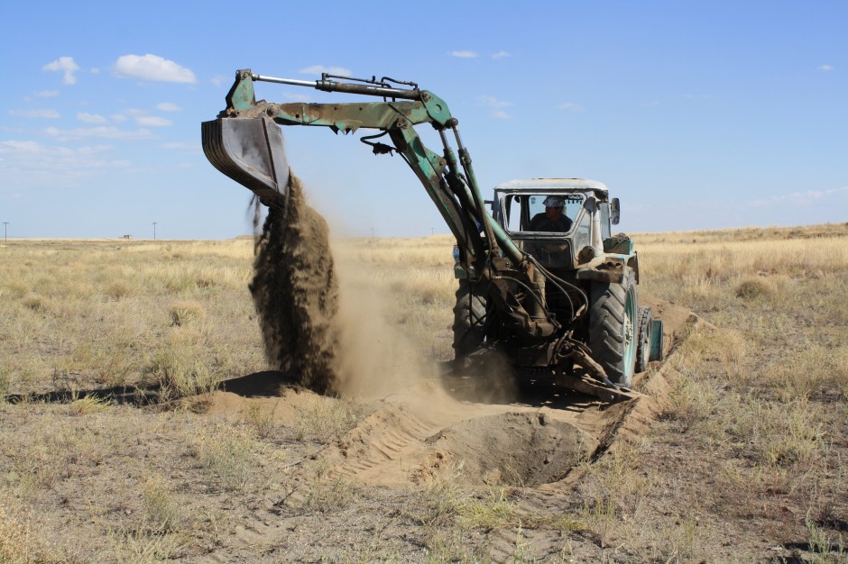
Help with our sample collection.
Kazakhstan is vast—the largest land-locked country in the world—and we were only able to study a small proportion of the faults in the southeast corner of the country. The sheer scale of the place makes the logistics of doing fieldwork something of a challenge; distances are deceptive and travelling from place to place isn’t quick. We were very lucky to have a local geologist, Kanatbek Abdrakhmatov, from the Institute of Seismology in Kyrgyzstan to act as our guide and translator.
But it is a beautiful place to do fieldwork. The bevelled mountains rise abruptly from the flat plains; every morning you emerge from your tent to be confronted with a huge expanse of steppe and sky; and every evening the setting sun casts a golden sheen across the landscape. In fact, the scenery almost made up for the lack of showers!
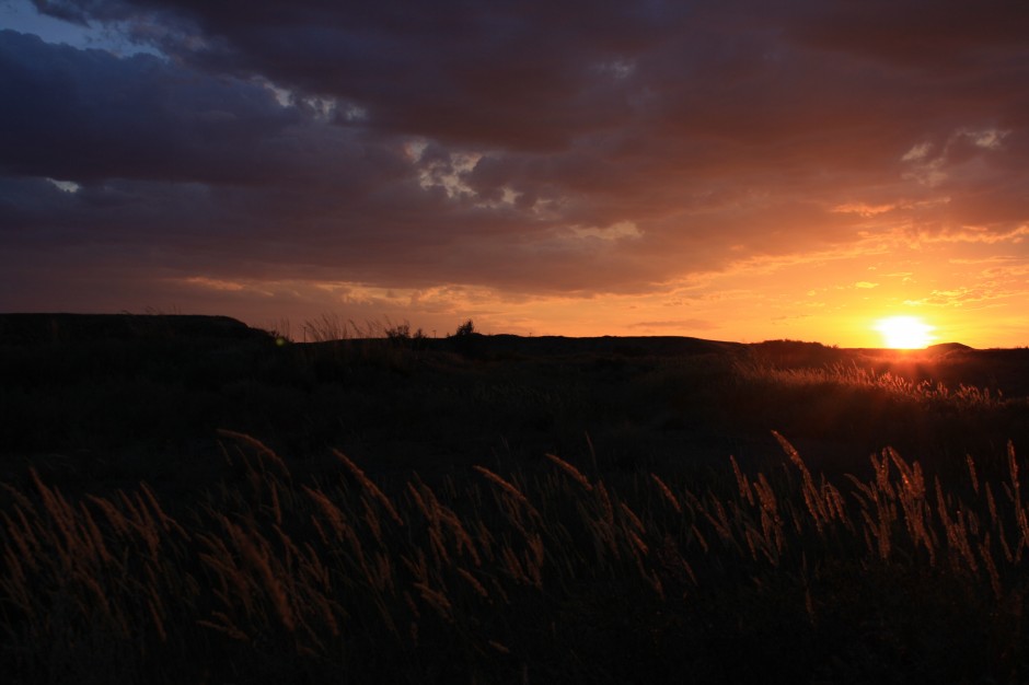
Sunset, with a fault scarp visible to the left of the image.
With thanks to: Richard Walker, James Jackson, Kanatbek Abdrakhmatov, Grace Campbell, David Mackenzie, Eynagul and Ivan.