EGU Blogs

Matt Herod

Matt Herod is a Ph.D Candidate in the Department of Earth Sciences at the University of Ottawa in Ontario, Canada. His research focuses on the geochemistry of iodine and the radioactive isotope iodine-129. His work involves characterizing the cycle and sources of 129I in the Canadian Arctic and applying this to long term radioactive waste disposal and the effect of Fukushima fallout. His project includes field work and lab work at the André E. Lalonde 3MV AMS Laboratory. Matt blogs about any topic in geology that interests him, and attempts to make these topics understandable to everyone. Tweets as @GeoHerod.

A Year in Review

As of October 1st I have been a part of the now 1 year old EGU blog network for a year. I was honoured to be one of the original three network bloggers and looking back this had been a great year of geology blogging. Since we started the network has now grown from three to 10 great geology blogs. So here is a quick look back at the highlights of year 1.

A Slice of Earth Cake Geology Inspiration

Some nice digital birthday cake for us all! (Source)

A year by the numbers

Days: 365 (that one was easy)

Posts: 68

Total visits: 14,447

Total pageviews: 19,010

Average visit duration: 59 seconds

Most visits in a day: 547

Most pageviews in a day: 627

% New Visitors: 67.4

Number of countries: 130

All in all I am quite pleased and honoured that this many people have read or at least glanced at this blog.

Funny Search Terms

– are snakes part of the geosphere – Depends who you ask I suppose.

 house of commons verbal sparring – I am truly thrilled that this term found my blog, although I am not sure why this makes me so happy?

– scientific problem solved iodine-129 – Yay! Someone else but me searches Google for 129I.

spongebob – I used a pic of him as an analogy for pore space, but maybe I just taught a 7 year old about hydrogeology? I can hope!

geological mysteries – I try and explain as many geological mysteries as I can.

cantley quarry – Announcement for uOttawa first year geology students do not copy this post! You will be caught!

– #51 love poems – I have no idea how this found my blog, but awesome!

– canadian awesome – No argument here.

– green teach velocirators – This one is for Jon.

– i was holding three bottls of mineral in the dream – What a strange dream. I wonder what caused it….too much of something.

These are just the first 10 that I could find easily. There are loads more

Views from Interesting Nations

As of October 1, 2013 the blog had received visits from 130 countries or about 66.7% of all the nations in the world. Some of the more unusual ones to visit include: Greenland, the Maldives, Papua New Guinea, Fiji, Qatar and the Faroe Islands. There are lots of others but these ones seemed interesting to me. The countries that represent the most views of this blog are: the US, Canada, the UK, Germany and Australia. It is not really a surprise the 4 of the top 5 are mainly English speaking.

Highlights:

Being named a Science Seeker Award finalist for my post about radon.

Remotely being able to blog the EGU 2013 annual meeting using the online press releases. Here are the posts: 1, 2.

Blogging the 2013 Goldschmidt geochemistry conference from Florence, Italy on behalf of the EGU and EAG. Here are posts: 1, 2, 3, 4.

Banner stolen from the EGU Blog Network Hub (Source). A great place to visit for your daily geoscience reading.

Finally, thanks to everyone that has visited, read and commented on this blog. I really appreciate the support and here is looking forward to another year of great blogging…well 11 months!

Matt

The Accretionary Wedge #60 – Momentous Discoveries in Geology Summary Post

I have to admit I have been a bit lax with the summary post for AW60.  I blame turkeys. It was the Canadian Thanksgiving weekend recently and what with school, the holiday and other things blogging slipped a little lower on my list of priorities that I would like. I also had to submit a paper recently so most of my October writing mojo went into getting that out. My apologies to the submitters to this blog carnival. However, hopefully this post can remedy that.

For the 60th Wedge I asked people to post about momentous discoveries in geology. We all work in or hobby in? a field that is rife with discoveries and more are being made every day. Past me explains it nicely below:

For this wedge the topic will be momentous discoveries in geology or its sub-disciplines that you feel have altered or shaped our understanding of how the Earth works, or opened new doors into research that had never been considered before. The discovery you choose does not have to be universally recognized as momentous but should be in your opinion. It could be something that we take for granted every day, but is in actuality part of the underpinnings of our science.

This topic got a great response within the geoblogger community and I am grateful to all those who wrote such fantastic posts.  Here they are in no particular order:

Hollis of In the Company of Plants and Rocks wrote a great post about Nicholas Steno, a true father of geoscience, and someone who made some of the first observations that have since become basic tenets of geology.

My fellow EGU blogger Simon Redfern wrote an inspiring piece commemorating the 50th anniversary of a very special paper by Vine and Matthews that describes the birth of plate tectonics by observing the magnetic anomalies that occur over mid-ocean ridges. In this seminal paper they postulated that crust was being created at these ridges and preserving the signature of the Earth’s magnetic field as it cooled. This observation has to be one of the most paradigm shifting in geology within the last century.

Photo stolen from Simon.


Sara Mynott, and EGU official blogger, wrote a wonderful post about an interesting tool that goes by the innocuous initials CTD and how this tool has revolutionized the field of oceanography. The CTD is used to detect the conductivity, temperature and depth of the water column once it is deployed from a ship and some can even take samples for further analysis.

This is a CTD (left). Often deployed off research ships with a large bundle of sampling bottles known as a rosette (right), CTDs record the conductivity (and hence, salinity), temperature and depth of water in the ocean, allowing physical oceanographers to get a good look at it’s structure and work out which water masses are moving where. (Both the CTD and rosette images are credited to NOAA)


Next up is a post by Holly Ferrie of Cambriangirl about something that I had never heard of before: GBinSAR technology, “a piece of space tech that fell to Earth” as she puts it. Ground-Based Interferometric Synthetic Aperture Radar is used to monitor any sort of ground movement from space. It can even detect glacial flow! Holly points out that this marvellous piece of technology can even be used to save lives.

Next up is EGU blogger Flo Bullough’s post at Four Degrees about the discovery of the magical world of nano. Flo describes the early history of nanoparticles, which extends much earlier into human history than I every considered. Flo then describes the official discovery of nanoparticles and the technological advancements that have made their study possible and opened the microscopic world to science.

The Lycurgus Cup – a 4th-century Roman glass cage cup , which shows a different colour depending on whether or not light is passing through it; red when lit from behind and green when lit from in front due to the incorporation of nanoparticles – You can go and see it in the British Museum! Source – Johnbod, Wikimedia Commons.


Fellow EGU blogger, Will Morgan of Polluting the Internet also made a wonderful contribution about the discovery Aitken nuclei by a fellow named John Aitken…surprise! These Aitken nuclei of which will writes are particles that promote the formation of clouds, also known as condensation nuclei, and their discovery has had wide reaching effects in understanding how clouds form, the chemistry of these partcles and how they all come together to affect climate on Earth. The condensation nuclei under 100 nanometres are called Aitken nuclei.

Next up is Mary Beth from The Rocks Know who is discussing the contribution of a guy name Gene Shoemaker. Dr. Shoemaker studied impact craters and the strange high-pressure minerals that can form in them. He was also the first person to observe the collision of a comet with another planet, which opened the door to the entire field of study for near-Earth objects.

Fellow EGU blogger Marion Ferrat, also of Four Degrees, wrote a great post about the discovery of the Earth’s inner core by Danish seismologist Inge Lehmann. Lehmann discovered the solid inner core of the Earth by observing the behaviour of seismic waves following an earthquake and carefully studying the locations they were recorded. Her observations led her to postulate the existence of an inner core that refracts and reflects seismic waves in a ways that had not been considered. The seismic boundary between the inner and outer core is now known as the Lehmann discontinuity.

Seismic waves travelling through a layer of the Earth - Source: Julia Schäfer, Wikimedia Commons.

Seismic waves travelling through a layer of the Earth – Source: Julia Schäfer, Wikimedia Commons.


Last, but not least, is my own contribution. I wrote about one of my favourite topics in the geosciences and certainly one of the most useful: radioactivity. In my post I tried to highlight the incredibly wide range of uses that radioactivity has as tool within geology. The first to come to mind is radioactive dating, but I also discussed using radioactviy as a tracer, and some of the different isotopes and elements that can be used in this way by environmental geologists.

Cherrenekoff radiation is a pretty way to demonstrate radiation. (Photo: Matt Herod)

Cherenkov radiation is a pretty way to demonstrate radioactivity. (Photo: Matt Herod)


To conclude, I’d like to thank all of the contributors to this edition of the wedge. I apologize again for my tardiness in getting this summary post out, but I think after looking at all of the wonderful posts listed here it is hard not to be amazed a the scope of geology and the incredible magnitude of the discoveries over the past century and before!

Thanks for reading and contributing!

Matt


AW# 60 – Radioactivity: What’s the use?

AW# 60 – Radioactivity: What’s the use?

I am very excited to be hosting the 60th Accretionary Wedge at GeoSphere! Sorry my own contribution is so slow in coming…it has been a busy month PhD wise. In fact, I expect it will be a busy year PhD wise since I am hoping to submit in the Fall of 2014 and I have got a LOT of writing to do. Anyway, in the call for posts I said:

For this wedge the topic will be momentous discoveries in geology or its sub-disciplines that you feel have altered or shaped our understanding of how the Earth works, or opened new doors into research that had never been considered before. The discovery you choose does not have to be universally recognized as momentous but should be in your opinion. It could be something that we take for granted every day, but is in actuality part of the underpinnings of our science.

The discovery I am going to discuss is one that a wide variety of different geoscience disciplines uses every day and one that is particularly near and dear to my heart, since my PhD. is about an application of this discovery: radioactivity and radioactive isotopes. The consequences of the discovery of radioactivity have been extremely far reaching in many fields, particularly the geosciences. For this post I am not going to describe what radioactivity is, but rather some of the fantastic applications and subsequent discoveries that have hinged on the initial discovery of radioactivity and radioactive elements. There are a lot, so for the ones I don’t talk about I’d love to see comments on.

Cherrenekoff radiation is a pretty way to demonstrate radiation. (Photo: Matt Herod)

Cherenkov radiation is a pretty way to demonstrate radioactivity. (Photo: Matt Herod)

The Earth is constantly in a state of change. The process that move and shape the Earth are doing so in front of our very eyes. If only we had a means to see it happen….oh wait. Radioactive isotopes can often be used as tracers of natural processes. Sometimes the isotopes are naturally occurring and sometimes they are added through human activities. Either way, we can use them to uncover Earth’s mysteries.

The first thing that everyone thinks about when discussing application of radioisotopes in geology is radioactive dating.  The basic principle of radioactive dating was discovered by Ernest Rutherford in 1905 and states that if we know the half life and the concentration of the decay product we can use that information to calculate how much of the parent isotope there was and then how old the material the daughter product was measured in is. This basic idea has spawned a wide variety of dating techniques using different isotopes with a range of half lives from very short to very, very long. Radioactive dating is the reason we know old the Earth is, when the dinosaurs lived and died, when ancient volcanoes erupted, what sort of tectonics took place on the early Earth, how long ago our ancestors lived and so much more. The problems to which radioactive dating can be applied are limited by the presence of a usable isotope rather than running out of questions. Indeed, there will always be more things to date using the wide varity of isotopes available. It is possible to date recent things using Carbon 14 or Tritium (Hydrogen), which both have fairly short half lives. The furthest back that I have seen dating methods go is for rocks from the Isua Greenstone belt, which were dated at 4.28 billion years using the samarium-neodymium isotope system (Note: This work was done by J. O’Neil a new prof at uOttawa). Either way, if it is new or old radioisotopes can date it.

Occasionally pollution can be useful. It goes without saying that pollution is bad. However, on occasion its presence can be used to solve scientific problems when nature does not provide a means to do so. One instance of this is using radioactive releases from nuclear fuel reprocessing to trace ocean currents in the North Atlantic ocean. The releases themselves are extremely low level, and are not dangerous to humans or the ecosystem in any way. However, they are easily detectable and therefore can be used. Fuel reprocessing releases a lot of iodine-129 and cesium-137, as well as some other isotopes. These isotopes are then released into the Atlantic ocean and circulate with currents. Using these isotopes to trace the depth profile of currents, where they move and how long it takes for them to circulate is a burgeoning field in oceanography research.

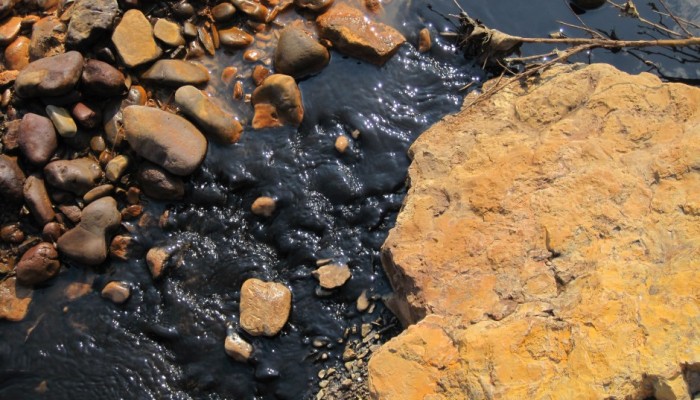
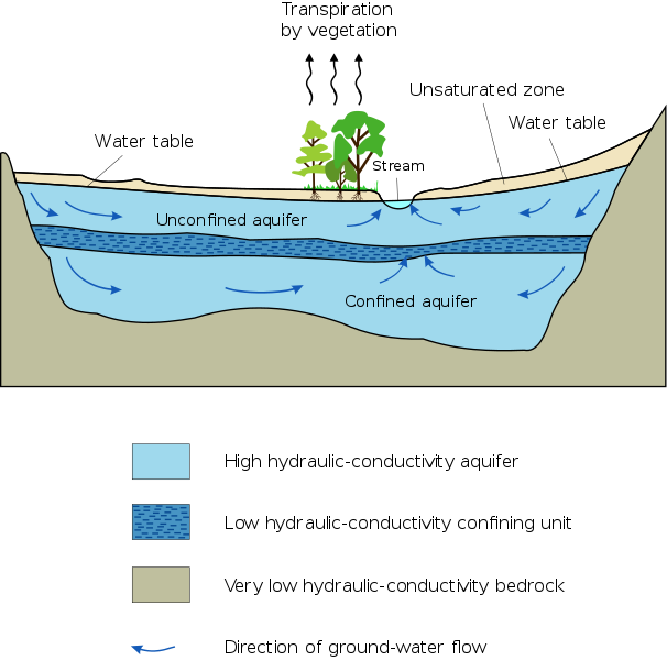
Not all radiotracers are pollution though. Ideally, we can use naturally produced radiotracers to tell us about the environment. For example, contaminated places aside, radon is produced by the decay of naturally occurring uranium-238. It can then be incorporated into groundwater or pass through the soil as a gas. One immediately obvious use of radon is in uranium exploration. If there is a higher concentration of uranium in the rocks more radon will be produced. Therefore, if soil gas sampling for uranium exploration finds elevated radon that could be an indication of a possible economic uranium enrichment. Another way of using radon is something that I have some personal experience with: tracing groundwater discharge into surface water. When groundwater comes in contact with uranium minerals it dissolves some of them or dissolves the radon gas directly. If this groundwater then discharges into a lake or a river for example we might expect to find higher radon at the discharge point. I did a lot of sampling for this one summer during my undergrad and we did find a few places where the radon concentrations were higher than background, which is an indication of groundwater discharge. We also canoed down an entire river with the instrument dangling out the side, sampling as we went. No radon was found in that instance, but it was really fun.

Radioactivity is also useful in the lab. In fact, I use the radioisotope iodine-125 almost every day as a tracer of a lab method I have been developing for the extraction of iodine-129 and 127 from organic materials. The process that I am using to extract iodine is combustion under a pure oxygen atmosphere and then trapping the iodine in a bubbler containing a hydroxide solution. However, it is often difficult to know if the extraction has been successful or not, particularly if I am playing with flow rates or temperature settings. The sample may be burnt, but did I capture the iodine? In order to test whether or not my combustion has been successful I add some iodine-125 to the sample before it is combusted. Then all I have to do at the end is see if my 125I, which is tested via gamma counting, is in my trap solution and I know if I got the other isotopes as well, because they all behave the same chemically. This line can also be used to extract other radiohalides from organic materials. In fact, as I type this a visitor from the Lamont-Doherty Earth Observatory is extracting chlorine-36 from vegetation and rat poop.

IMG_3801

My iodine combustion line. The paper describing the work done on this will be submitted very soon! (Photo: Matt Herod)

Cosmogenic isotopes are one of the most useful tools in the surficial geochemists arsenal and their use is very wide ranging. I wrote a very long post about cosmic rays and cosmogenic isotopes previously. See here. The big uses that I discussed for cosmogenics, which are radioisotopes that are produced when cosmic rays collide with particles in the atmosphere or directly with minerals to produce other isotopes that can then be used for a wide range of dating applications.

Exposure age dating is one of the principle uses of cosmogenic isotopes and several different ones have been employed to this end. Exposure age dating is when we use cosmogenic isotopes to date how long something has been exposed to secondary cosmic rays at the Earth’s surface. For example, a rock at the toe of a glacier may have just been exposed to cosmic rays a year ago and its exposure age date will tell us this. Another rock, 20 metres further from the glacier toe may have been exposed 5 years ago and this difference will be recorded. Basically, the clock starts ticking once cosmic rays are able to reach the rock or bone, or whatever material is being dated.

Carbon 14 is unquestionably the most used of any of the cosmogenic isotopes. 14C is produced primarily when neutrons collide with nitrogen in the atmosphere replacing a proton in the nitrogen nucleus and transforming it into carbon-14, although atmospheric nuclear weapons testing also produced a substantial amount of 14C. The primary use of 14C, or radiocarbon, is radiocarbon dating. Once radiocarbon is produced it enters the global carbon cycle and disperses throughout the environment. Since it is part of the carbon cycle it becomes incorporated into all living things, including people and animals. 14C continues to enter our bodies while we are alive. Once we die, there is no further addition of 14C and therefore, the clock starts ticking on its use as a dating tool. 14C has a 5,730 year half life and is therefore useful as a dating tool for biological materials up to ~45,000 years ago.

Sick of reading about how useful radioactivity is in geology? I don’t blame you. However, what I have presented here is just the tip of a very large iceberg. Other examples, include helium-tritium dating, helium ratios, tritium in natural systems, gamma logs for oil and gas exploration, and much, much more. It is all thanks to that very momentous discovery in 1896 by Henri Becquerel. If you have examples of the use of radioisotopes or radioactivity in geology please comment about it below.

The summary post for September’s AW will be up in a few days. So if you have a late submission you can still get it in.

Matt

Back to Basics on Groundwater

Back to Basics on Groundwater

When many people hear the word groundwater they imagine a raging underground torrent of water flowing along a pathway called an aquifer. Well, sorry to disappoint you, but you could not be more wrong about how groundwater exists and flows. In this post we will discuss the very basics of groundwater science (hydrogeology) and flow.

What is groundwater?
As the name implies groundwater is simply water that exists underground. It is the opposite of surface water, which exists on the surface of the Earth such as lakes, rivers and oceans. Groundwater is an extremely important resource for industry, drinking water and other applications, however, it is generally quite poorly understood. The branch of geology that researches groundwater is called hydrogeology and is still a relatively new sector of the geological sciences.

As I have already mentioned groundwater exists underground. However, there are still lots of misconceptions about how people envision groundwater. Many see large underground lakes and rivers, and while those do exist, they represent an infinitesimally small percentage of all groundwater. Generally speaking groundwater exists in the pore spaces between grains of soil and rocks. Imagine a water filled sponge. All of the holes in that sponge are water-filled. By squeezing that sponge we force the water out, similarly, by pumping an aquifer we force the water out of pore spaces.

Notice that SpongeBob is full of pore spaces…I’m not sure if they are water-filled though. (Source: Wikipedia)

There are lots of terms in hydrogeology, most of which are very simple, but essential. Here are a few of the big ones and their meanings.

Porosity: Porosity is an intrinsic property of every material. It refers to the amount of empty space within a given material. In a soil or rock the porosity (empty space) exists between the grains of minerals. In a material like gravel the grains are large and there is lots of empty space between them since they don’t fit together very well. However, in a material like a gravel, sand and clay mixture the porosity is much less as the smaller grains fill the spaces. The amount of water a material can hold is directly related to the porosity since water will try and fill the empty spaces in a material. We measure porosity by the percentage of empty space that exists within a particular porous media.

File:Well sorted vs poorly sorted porosity.svg

Porosity in two different media. The image on the left is analagous to gravel whereas on the right smaller particles are filling some of the pores and displacing water. Therefore, the water content of the material on the right is less. (Source: Wikipedia)

Permeability: Permeability is another intrinsic property of all materials and is closely related to porosity. Permeability refers to how connected pore spaces are to one another. If the material has high permeability than pore spaces are connected to one another allowing water to flow from one to another, however, if there is low permeability then the pore spaces are isolated and water is trapped within them. For example, in a gravel all of the pores well connected one another allowing water to flow through it, however, in a clay most of the pore spaces are blocked, meaning water cannot flow through it easily.

Video showing how connected pores have high permeability and can transport water easily. Note that some pores are isolated and cannot transport water trapped within them. (Source)

Aquifer: An aquifer is a term for a type of soil or rock that can hold and transfer water that is completely saturated with water. That means that all it is simply a layer of soil or rock that has a reasonably high porosity and permeability that allows it to contain water and transfer it from pore to pore relatively quickly and all of the pore spaces are filled with water. Good examples of aquifers are glacial till or sandy soils which have both high porosity and high permeability. Aquifers allows us to recover groundwater by pumping quickly and easily. However, overpumping can easily reduce the amount of water in an aquifer and cause it to dry up. Aquifers are replenished when surface water infiltrates through the ground and refills the pore spaces in the aquifer. This process is called recharge. It is especially important to ensure that recharge is clean and uncontaminated or the entire aquifer could become polluted. There are two main types of aquifer. An unconfined aquifer is one that does not have an aquitard above it but usually does below it. The other type is a confined aquifer that has an aquitard above and below it.
Aquitard: An aquitard is basically the opposite of an aquifer with one key exception. Aquitards have very low permeability and do not transfer water well at all. In fact, in the ground they often act as a barrier to water flow and separate two aquifers. The one key exception is that aquitards can have high porosity and hold lots of water however, due to the their low permeability they are unable to transmit it from pore to  pore and therefore water cannot flow within an aquitard very well. A good example of an aquitard is a layer of clay. Clay often has high porosity but almost no permeability meaning it is essentially a barrier which water cannot flow through and the water within it is trapped. However, there is still limited water flow within aquitards due to other processes that I won’t get into now.
File:Aquifer en.svg
Water Table: The water table is a term that hydrogeologists use to describe an imaginary surface that usually exists underground. Below the water table all pore spaces are completely filled with water and above it they are filled with air. The water table is the boundary between these two zones called the saturated and unsaturated (vadose) zone. In order to imagine the water table it helps to imagine a layer that exists underground rather than a line as the water table is a surface that extends in every direction. The top of the water table is determined by water pressure. When water pressure in the pore spaces is the same as air pressure we are at the water table. The water table is subject to rise and fall depending on pumping of water out of the aquifer or other changes. Finally, if the water table and the surface of the Earth intersect we have a spring.
File:Water table.svg

Cross section of what the water table looks like as a line. Remember it is actually a surface that extends in every direction. Note that the water in the well only rises to the surface of the water table because air pressure and water pressure are equal at the water table. (Source: Wikipedia) 

Groundwater Flow

The study of hydrogeology is a very mathy one. There are lots of complicated equations, Greek letters, and funny squiggles. However, you don’t need an advanced degree in math to understand the basics, but it helps to know a little bit. Basically all ground water flow can be described by a single simple equation. Sure, there have been lots of modifications made to fit specific conditions and circumstances, but it all comes back to the same basic principles outlined in a single equation. That equation is called Darcy’s Law (cue dramatic music).

Henry Darcy – “The father of hydrogeology”

Darcy’s law states that the velocity water flows is dependant on the material which it flows through and the hydraulic gradient, which is the difference in water level between two points of measurement divided by the distance between them. In mathematical terms it looks like this:

Darcy’s Law

Q is the discharge or the amount of water that flows out of a given material over a set amount of time.

K is called the hydraulic conductivity and is a property of every material that tells us the speed any liquid moves through a given material. It is directly related to the porosity and permeability of the the material and the density of the liquid in question. For water we don’t need to worry about the density though, just the porosity and permeability.
(h1-h2)/l is usually represented by the letter i and is called the hydraulic gradient. It is the difference in water level between the two points of measurement divided by the distance between them.
Here is a graphical representation of the properties that make up Darcy’s law:

Graphical representation of Darcy’s Law in a hypothetical porous medium with two points of measurement (h1 and h2) and a hydraulic conductivity of K. (Matt Herod – 2011)

So now we understand some of the basic principles governing groundwater flow, but we haven’t discussed why it would flow from one place to another. We all take it for granted that groundwater is not stationary and moves, but why is that? The answer is shockingly simple, and lies in the fact that everything in nature is in a constant struggle to find balance.

Water flows from areas of high energy to low energy in an attempt to distribute that energy evenly throughout the water table. In this case energy is not a synonym for electricity, but energy in all forms, such as pressure or concentration differences. In the case of the water table the driving force is usually differences in pressure and elevation along the surface of the water table which lead to water flow. In hydrogeological terms these energy differences are referred to as hydraulic head, which can be measured at any point in the water table. It is helpful to imagine the weather when we think of groundwater flow. We all know that wind moves from areas of high air pressure to low air pressure bringing weather changes and temperature fronts in with it. Groundwater behaves the same and moves from places with high hydraulic head to low hydraulic head the same as the wind.

Obviously there is much more to discuss in the field of hydrogeology. The big topics being this like contamination or freshwater resources. However, in order to discuss those topics properly it is crucial to have a solid grasp on groundwater terms and basics. Please feel free to to comment if you have any suggestions for future posts on groundwater. Thanks for reading.

Matt

Note: This is a re-post from my old, less visited geo-blog. It was previously posted on June 13, 2011.