EGU Blogs

Daniel Schillereff

Daniel Schillereff has been employed as a Teaching Fellow in Physical Geography at King's College London since September 2015, contributing to teaching across the broad curriculum. Prior to this post he held a Post-doctoral position jointly at the Centre of Ecology and Hydrology in Lancaster and the University of Liverpool on the NERC-funded LTLS project. This research looked at sources, fluxes and interactions of carbon, nitrogen and phosphorus across the UK over the last 200 years. He submitted his PhD thesis at the University of Liverpool in 2014 that analysed basal sediments from lakes to determine whether imprints of extreme historical floods could be detected. He tweets as @dschillereff and his personal webpage is danielschillereff-cv.com.

Moraines in Costa Rica? Really?

Moraines in Costa Rica? Really?

During a recent trip to Costa Rica in May, I had a conversation with some family and friends in which I uttered those words: “Moraines in Costa Rica? Really?” as they were describing a trek they’d undertaken earlier this year to the summit of Cerro Chirripó. This is the highest peak in the country (3819 m a.s.l.), part of the Cordillera de Talamanca (9°30′ N, 83°30′ W) in southern central Costa Rica.
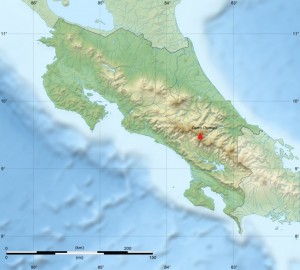
Relief of Costa Rica and location of Cerro Chirripó. Base map courtesy of Sting (WikiCommons CC BY-SA 3.0)

Relief of Costa Rica and location of Cerro Chirripó. Base map courtesy of Sting (WikiCommons CC BY-SA 3.0)

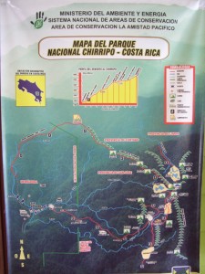
Map board at entrance to Parque Nationale Chirrippo. Photo courtesy of Scott Schillereff.

Map board at entrance to Parque Nationale Chirrippo. Photo courtesy of Scott Schillereff.

While the photographs looked stunning (on a clear day, both oceans are visible from the summit), I was especially intrigued by their description of the landscape surrounding the peak: curved valleys, moraines and other landforms often associated with glacial activity were visible as they were above the tree-line. There are certainly no glaciers there at present (apparently hail occurs occasionally at the summit) and Costa Rica can definitely be classified as a tropical environment today. However this inspired me to track down research confirming (or not) that these landforms are indeed glacial in origin and, if so, discover the timing and duration of this period of high-altitude tropical glaciation.

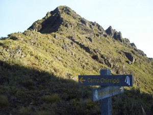
The summit of Chirrippo (trail with hikers on left for scale). Photo courtesy of Scott Schillereff.

The summit of Chirrippo (trail with hikers on left for scale). Photo courtesy of Scott Schillereff.

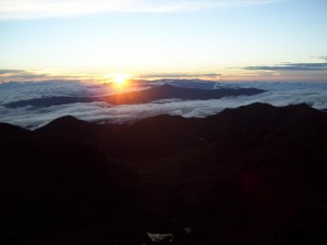
Sunrise over the Caribbean from the summit of Cerro Chirripó. Photo courtesy of Scott Schillereff.

Sunrise over the Caribbean from the summit of Cerro Chirripó. Photo courtesy of Scott Schillereff.

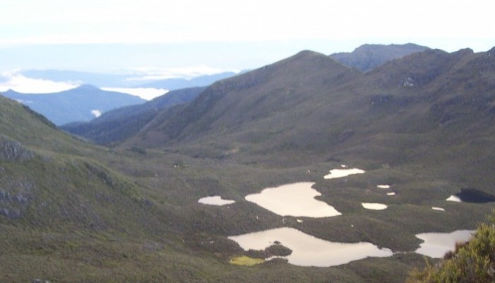
It turns out the first papers on episodic glaciations in Costa Rica and other Central American countries emerged in the 1950s and investigations have continued through to the present day (particularly by researchers at the University of Tennessee). Much of the peer-reviewed research I found for Cerro Chirripó in particular is based on geomorphic surveys as well as analysis of sediment cores extracted from lakes located on valley floors along the flanks of the mountain. Many of these lakes have formed behind what appear to be moraines (see photo). A particularly interesting feature near the base of these sediment cores is a distinct shift from light-coloured material dominated by mineral particles to much darker brown or black sediments rich in organic matter. This transition is observed in lacustrine sequences all over the world, and certainly here in the UK, and is commonly attributed to the transition from the Younger Dryas interstadial at the end of the last glacial period into the early Holocene. The dark, more organic sediments are typical of deposition through the Holocene as the climate warmed and vegetation cover expanded around the world. A series of radiocarbon dates confirm a similar timing for these sediment transitions in multiple lakes around Cerro Chirripó, ranging between 12, 360 and 9, 470 calibrated years Before Present (BP) within the dating uncertainties (Horn, 1990; Orvis and Horn, 2000). The span of these dates likely relates to the relative position of the each lake with respect to the retreating glacier during the period of deglaciation, and the timing corresponds nicely with the Younger Dryas event (12, 900 – 11, 600 cal. yr BP). In fact, evidence for a Younger Dryas re-advance has been reported elsewhere in the neotropics including the Columbian Cordillera, the Eastern Cordillera of Equador, the Cordillera Real in Bolivia and around the Malinche volcano in central Mexico (references are found in Lachniet, 2004).

Panoramic view from summit of Cerro Chirripó with lakes visible in the foreground that have formed behind what appear to be moraines. Photo courtesy of Peter Anderson (WikiCommons CC BY-SA 3.0)

Panoramic view from summit of Cerro Chirripó with lakes visible in the foreground that have formed behind what appear to be moraines. Photo courtesy of Peter Anderson (WikiCommons CC BY-SA 3.0)

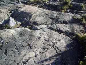
In terms of geomorphic evidence, phases of glacial advance and retreat are recorded by the large medial (a ridge running through the middle of a valley where two glaciers meet), lateral (two parallel ridges on either side of a glacier) and terminal (ridges formed at the end of a glacier) moraines found in the valleys around Cerro Chirripó. These fingerprints are found up to four hundred metres below the summit (Lachniet, 2004). Other field evidence includes striated bedrock (smoothed and grooved rock formed as ice moves across the surface; see photo).

Striated bedrock near Cerro Chirripó. Photo courtesy of Scott Schillereff.

Striated bedrock near Cerro Chirripó. Photo courtesy of Scott Schillereff.

To date, researchers have been unable to find suitable organic material at the base of the moraines to attempt radiocarbon dating but they are assumed to represent the maximum extent of the last ice advance, equating to a total ice-covered area of 35 km2. Similar features found at lower elevations in other parts of the Cordillera may point towards even more extensive ice cover during stages earlier in the Pleistocene but no effort to date these landforms has yet been invested. A recent review paper (Lachniet and Roy, 2011) emphasised that obtaining further radiocarbon dates from the lake sediments and landforms is critical to better understand the timing and duration of local and wider tropical glaciations. They also suggest OSL may be suitable, but cosmogenic radionuclide dating has been largely unsuccessful due to intense weathering of rock surfaces in the humid tropical environment.

Looking into the research and browsing through photographs of Cerro Chirripó has certainly inspired me to aim to hike up the mountain on my next visit to Costa Rica. One of the amazing things about Costa Rica and other Central American countries that I have backpacked through is how much the climate and landscape and culture can vary across relatively short distances – but trying to imagine glaciers sweeping down the valleys is very difficult to imagine!!

References

Horn, S.P. (1990) Timing of deglaciation in the Cordillera de Talamanca, Costa Rica. Climate Research 1, 81-83. PDF

Lachniet, M. (2004) Late Quaternary glaciation of Costa Rica and Guatemala, Central America. In: Ehlers, J., Gibbard, P. (Eds.) Quaternary Glaciations – Extent and Chronology Part III: South America, Asia, Africa, Australasia, Antarctica. Elsevier, Amsterdam, 135-138. DOI: 10.1016/S1571-0866(04)80118-0

Lachniet, M. and Roy, A. (2011) Costa Rica and Guatemala. In: Ehlers, J., Gibbard, P., Hughes, P. (Eds.) Quaternary Glaciations: Extent and Chronology. Elsevier, Amsterdam, 843-848. DOI: 10.1016/B978-0-444-53447-7.00060-X

Orvis, K. and Horn, S.P. (2000) Quaternary glaciers and climate on Cerro Chirripó, Costa Rica. Quaternary Research 54, 24-37. DOI: 10.1006/qres.2000.2142

Anthropocene featuring heavily at the EGU

Among other sessions on Tuesday (Day 2 at EGU2014), I (Daniel) ventured to the EGU Press Conference featuring four experts from different scientific disciplines debating the Anthropocene concept. This term is fast becoming well-known in the popular media, politics and a vast spectrum of scientific disciplines and refers to the possibility that we, humanity, are living in a new geological time period in which our activities are the driving force behind present-day landscape evolution and surpass natural processes. As my own research spans geomorphology, Quaternary environmental and climatic change and past landscape evolution in general, I’m keen to keep abreast of the latest developments pertaining to the Anthropocene so it seemed like an opportune session to attend.

First up was Professor John Burrows, an atmospheric chemist who briefly presented data obtained from satellites of atmospheric emissions driven by human activity, particularly around urbanised regions, and likely future trends. Tony Brown, a Professor of Physical Geography at Southampton, and the chair of the British Society of Geomorphology Working Group on the Anthropocene then spent some time outlining the stratigraphic signature of the Anthropocene we can seek within alluvial sediments. Brown re-emphasised that a depositional feature or an erosional hiatus that is laterally extensive is required for any Anthropocene ‘boundary’ to be considered. His case study of the River Severn basin and its sub-basins showed a tremendous increase in sediment load after around 3000 years ago, directly driven by the introduction of agricultural practices in late-Neolithic and early-Bronze Age times. The removal of forest cover left a hilly landscape highly susceptible to erosion and a dramatic spike in sediment flux is thus recorded. Such a signal is found in different sedimentary environments in many areas of the world, including river systems and lake sediment cores, and is well-supported by archaeological data. The difficulty arises from the time-transgressive nature of such deposits because the agricultural revolution arrived in different regions of the world at very different periods. One interesting point Brown made relates to the need for any signature to persist through time preserved within the rock record. His calculated sediment load stored within floodplains is so large that, based on contemporary erosion rates, will not be removed until at least the next interglacial, thereby meeting that specific criteria. We also heard from Dr Pöppl, a geomorphologist from the University of Vienna, who showed some striking examples of the magnitude of impacts on sedimentary systems through the installation and removal of large dams.

Finally, Dr Jan Zalasiewicz, a palaeobiologist from the University of Leicester who has published some seminal papers on the Anthropocene concept, outlined the on-going work of the ‘Anthropocene Working Group’ of the International Commission on Stratigraphy examining whether it merits becoming a formal geological unit of time. One important revelation from Dr Zalasiewicz was that, while decisions taken by the ICS are lengthy processes, an interim report may appear sometime in 2016 addressing whether the Anthropocene is worthy of being designated as its own geological unit and, secondly, the date to be assigned as its onset. Dr Zalasiewicz also stated that, at present, the commission are leaning towards adapting 1950 as the ‘golden spike’, the so-called Great Acceleration as coined by Steffen et al. (2007), although he emphasised this is very much still under debate. He also highlighted that the Anthropocene Commission is unique at the ICS in that non-geologists and noted sceptics of the idea are sitting on the panel to ensure that the decision taken considers all view-points and stands up to scrutiny.

There was limited time at the end of questions from the press but one that sticks me is the relevance of the concept and whether it really matters that the Anthropocene is ratified by the ICS (or not). Burrows made the valid point that it’s imperative, in fact, that the Anthropocene be formalised as a geological entity to drive political action towards adapting a more sustainable future for the planet. That is certainly a view I share!

A couple of final points I’d like to highlight is that EGU is running a live-stream of all press conferences this week – check them out here – and the Anthropocene session taking place on Thursday: Orals in room G10, posters in Blue Room 243-279 (GM4.1/HS9.12/SSS9.18
Human-Earth interaction from the Pleistocene to the Anthropocene: state of the science and future direction).

Steffen, W., Crutzen, P. and McNeill, J. (2007) The Anthropocene: Are humans now overwhelming the great forces of nature? AMBIO 36 (8), 614-621.

Some personal perspectives from a PhD student on the peer-review system

This is a follow-up to a previous post from September 2013 entitled ‘Soliciting peer reviews from PhD students’. In that piece, I summarised the responses I’d received from a number of editors of peer-reviewed journals in the field of Quaternary Science having asked them their feelings on soliciting peer reviews from PhD students. Some recent events, most significant being the acceptance of my first paper and being invited to review a manuscript a manuscript for the first time, have encouraged me to outline my personal experiences.

Reviewing my first paper

Late last year an email out of the blue from an Editor of a peer-reviewed EGU Open Access journal arrived in my inbox inviting me to review a manuscript. I initially presumed the Editor in question had read my recently-published blog post and was following up my expression of interest, but the timing didn’t work; I received the email before the post went live. I’ll elaborate on my experience of the reviewing processes in a moment, but after I had returned my review, the Editor kindly gave me some feedback on my review and told me how I’d come to their attention: it turned out a colleague had seen a talk I gave at a recent conference, the Editor examined my online profile and judged my knowledge base to be appropriate. This certainly confirms that aiming to give oral presentations from an early stage in your PhD can lead to unexpected rewards!

The Open Access profile of EGU journals means the full manuscript is available as a Discussion version; I spent considerable time scanning the manuscript while deliberating about whether to accept. I have no qualms in admitting I was nervous! By accepting the invitation to act as a reviewer, I was, in essence, responsible for deciding whether the rigour and relevance of the work was sufficient for it to permanently enter the realm of published research. This quote from Dr Stephen Keevil (KCL) in the ‘Peer Review: The nuts and bolts’ report on the role of a reviewer was definitely on my mind:

“…to act as a gatekeeper for quality in an area of science that I know and care about”

In the end, I decided to undertake the review because I felt comfortable that my background knowledge was sufficient to assess where the work fit in the current state of science and whether the investigation carried out met the stated aims and also that sufficient more specialist expertise I’d gained during my PhD would enable me to comment on the rigour and methodology of the research.

I was most anxious about my lack of detailed knowledge pertaining to the environment from which the samples were collected. I have a general idea of the local topography and landscape but I know very little about the geology, climate and landscape history of the area in question. These characteristics can have enormous effects on the sedimentary record and I felt this was not fully addressed in the paper; thus, several questions I posed in my review sought clarification on this aspect. However, this was not the principle aim and other researchers with experience working in the same region would not require such detail to be included in a paper and I remain unsure whether it was appropriate to focus on these aspects so much.

It was interesting to read the response from the authors explaining how they had addressed the comments from both reviewers. Looking at the final published version, my view is that the majority of my suggestions to the authors were explicitly addressed but a couple of my more substantial queries (related to geomorphic setting) were deemed not sufficiently important as to alter their findings. The Editor clearly felt their revisions were sufficient and what I believe to be an interesting and high-quality manuscript is now published.

Submitting my first paper

The acceptance of my first peer-reviewed manuscript a couple of weeks ago was wonderful, although I imagine the feeling of seeing it published online with paginated formatting and a DOI number will be even more gratifying! The process has been a tremendous experience and I cannot emphasise enough to other PhD students the value of going through the peer-review system at an early stage (obviously substantive results are necessary!). Obviously it looks impressive on your CV but the reviewers raised questions that I had never before considered (and neither had my Supervisors!); I have no doubt my overall PhD, not just this paper, will be substantially improved by this experience.

Diagram from the 'Peer Review: The Nuts and Bolts' 2009 report from the Voice of Young Science network.

Diagram from the ‘Peer Review: The Nuts and Bolts’ 2009 report from the Voice of Young Science network.

The three reviews were largely positive and some of the comments were quite pleasing. The reviews were very different in terms of their length, detail and principal concerns but all three raised very good points that I needed to address. One section ultimately was removed from the original manuscript; While deleting hundreds of words was disappointing, it also made me realise I had been rather narrow-minded and too focused on one particular area of my own research and had missed some of the wider implications. I think this is easy to do when undertaking a PhD but is definitely a useful lesson. One reviewer examined the manuscript in extraordinary detail and offered numerous constructive comments and I am extremely grateful for their efforts. While I recognise the time commitment required, I do hope my future submissions receive a similar degree of attention from reviewers and it has certainly inspired me to ensure if and when I am invited to review again, I invest equivalent time and effort.

Most importantly, the revised manuscript is without doubt much better than my original submission. The Nuts and Bolts report indicated 91% of researchers felt their last paper was improved after peer-review and I certainly include myself in that section. Please do get in touch on Twitter or the Comments section if anyone has any questions about my experiences.

Towards better quantifying human impacts: Looking back on the PAGES Workshop in Leuven

Firstly, I’d like to express my sincere thanks to Dr Jennifer Clear (Czech University of Life Sciences, Prague) for her input to this blog article.

The first week of February saw dozens of scientists arrive at the Katholieke Universiteit Leuven for the PAGES Focus 4 Workshop. This event brought together geomorphologists, soil scientists, palaeoecologists, archaeologists and palaeolimnologists to discuss how we can better quantify past human impacts on the landscape. It became clear this is a research question of great importance for the present-day management and conservation of terrestrial and aquatic ecosystems, as those tasked with the job must be well-informed of what actually is the ‘natural state’ of a particular environment. However, climatic fluctuations and human activity have modified the landscape to an enormous degree throughout the Holocene (the past ~10 000 years) and beyond. Depending on how far back in time you look, the assessment of the local ‘natural’ condition is highly variable and may well be very different from the landscape observed today. Improving our estimates of human-driven land cover change was therefore the focus of this Workshop, although the approaches and the timescales of interest vary considerably, as we saw during the first two days of oral presentations and poster sessions. For those interested, the book of abstracts is available here and the full line-up of speakers is listed here.

workshoplogo

The schedule of the conference saw two full days of talks and poster sessions, followed by a field excursion on Day 3 and finished with two days of detailed small group discussions around specific topics. The breadth of talks was remarkable; those with impressive visual animations really stick in my mind, such as Dan Penny (University of Sydney) showing aerial LIDAR images of Angkor Wat (Linked to recent paper in PNAS). These images are acquired using lasers capable of penetrating dense forest cover; a remarkable pattern of roads, canals and building outlines was revealed after the vegetation cover was computationally removed. Simulations of global land cover changes through the Holocene from Jed Kaplan (many of his animations are available on the ARVE YouTube channel and Kees Klein Goldewijk were really impressive and many impressive vegetation reconstructions across Europe using various models to interpret high-resolution pollen data were also shown. Other case studies showed the dramatic effects of the agricultural revolution on sediment flux and changes in vegetation around the world. Integrating these local datasets to see more of the regional or global picture of land cover change, often termed up-scaling, arose as a focal point of discussion throughout the week and remains a key area of future work.

I was delighted to have been invited to give a talk illustrating how lake sediment sequences can contribute to our understanding of human-environment interactions on various timescales. Examples in my talk included a dramatic spike in sediment flux during the mid-Holocene linked to local human occupation and demonstrating how volumetric assessments of sediment and heavy metal fluxes can be calculated accurately by extracting multiple cores across a single lake basin. My slides are available on FigShare for anyone interested.

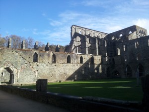
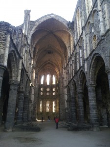
The field excursion on Day 3 was a wonderful exploration of the River Dilje catchment, where many of the Workshop organisers have invested considerable time and effort in recent years to establish a comprehensive sediment budget spanning the Holocene (for example, Notebaert et al., 2009). Other stops included a neat site where a chain of large gullies, most likely formed during the Roman occupation in the area, have been preserved beneath forest regrowth (fossilized, in essence), and the L’abbaye de Villers, one of the most impressive ruined Cistercian Abbeys I have visited. We were also treated to a coffee (and cake) stop halfway through the day from a mobile van; something I am keen to introduce to future field work expeditions here in the UK!

Photo: D. Schillereff

L’abbaye de Villers. Photo: D. Schillereff

L'abbaye de Villers. Photo: D. Schillereff

L’abbaye de Villers. Photo: D. Schillereff

The discussion sessions over the final two days were an eye-opening and invaluable experience for me. I’d been advised by experienced colleagues to get involved as much as possible and I certainly felt rewarded for doing so after some of the fascinating debates and knowledge shared from others, especially in the session focused around limnic (lake-derived) and marine sediments. As far as I can recall, I only said one stupid thing where everyone in the room looked at me quizzically! Engaging in the discourse for brainstorming future grant proposals, including identifying opportunities within the new PAGES structure and Future Earth initiative was exceptionally useful, both in terms of possibilities for opening future doors and better understanding the input required to put together large project proposals.

Some final personal observations then… I was surprised by the modest number of delegates whose research focused on lake sediments, because palaeolimnologists investigating records spanning the Holocene or more recent time periods almost always must consider humans as a possible driver of environmental changes captured in the sediment cores. I see many opportunities for further engagement with geomorphologists and soil scientists investigating catchment sediment budgets to link their assessments to lake-based reconstructions. Real progress seemed to be made during this Workshop in terms of sharing data and methodologies between disciplines, which is a great success. After my experience last week, I certainly believe all opportunities for fostering inter-disciplinary conversations on topics of mutual interest should be grasped.