This image was taken during the Arctic Ocean 2016(AO16) expedition that ventured to the central regions of the Arctic Ocean, including the North Pole. It shows a pressure ridge, or ice ridge, as viewed from onboard the deck of the icebreaker Oden. It was quite striking that the ice ridge resembled an image of a spine – sea ice being a defining characteristic of the broader Arctic environment and b ...[Read More]
Imaggeo on Mondays: Polar backbone (Arctic Ocean)
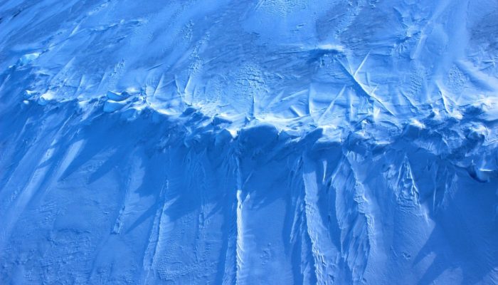
Polar backbone (Arctic Ocean)
. Credit: Grace Shephard (distributed via imaggeo.egu.eu).