Researching the Earth’s climate of the past, helps scientists make better predictions about how the climate and our environment will continue to be affected by, change and adapt to rising temperatures. One of the most invaluable sources of data, when it comes to understanding the Earth’s past climate, are historical meteorological records. Accounts of weather and climate conditions for the Souther ...[Read More]
GeoSciences Column: The ‘dirty weather’ diaries of Reverend Richard Davis
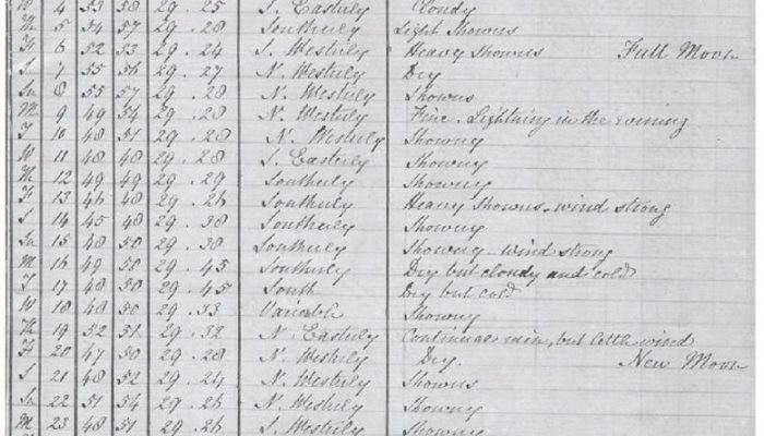
A digital scan of the Davis meteorological diary for July 1849 which also includes commentary about dirty weather and snow. From A. M. Lorrey et al. 2016.