Though now submerged under 53 m of ocean waters, there once was a land bridge which connected North America with Asia, allowing the passage of species, including early humans, between the two continents. A new study, published in the EGU’s open access journal Climate of the Past, explores when the land bridge was last inundated, cutting off the link between the two landmasses. The Bering Strait, a ...[Read More]
GeoSciences Column: When could humans last walk, on land, between Asia & America?
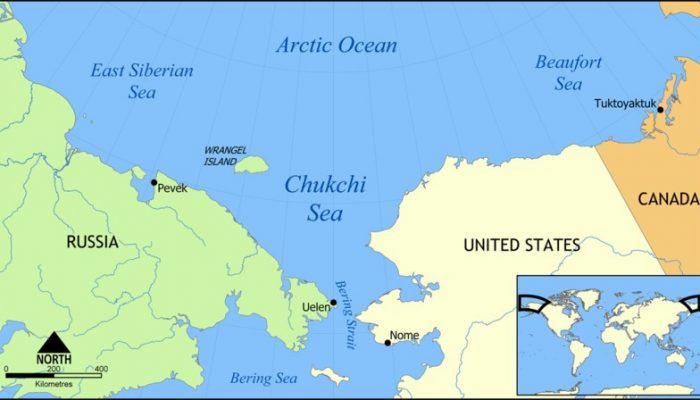
Map showing the Chukchi Sea, north of the Bering Strait and Sea, between Russia and the United States. Credit: NormanEinstein, distributed via Wikimedia Commons.
