The heat seeping from the geothermal area which is part of the Krafla volcanic system in Iceland, ‘powers’ the steaming vent at Hverir (Hverarönd). The area is well known for its mud pots and sulphuric gas fumaroles, complete with pungent eggy smell. Some of the vents are in fact boreholes drilled in the 50’s for sulphur exploration which have been turned into fumaroles, the steam is a resul ...[Read More]
Imaggeo on Mondays: Breath from the underground
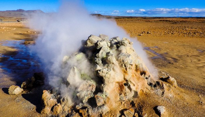
Breath of the underground . Credit: Néstor Campos (distributed via imaggeo.egu.eu).