The impressive Zagros Orogeny, as seen from a bird’s-eye view, has featured on Imaggeo on Monday’s blog posts a few times recently. From its fluvial dissection features, through to a false colour LANDSAT 7 image which reveals a velociraptor hiding among fold and thrusts, we’ve looked at the broad scale structures which shape the Zagros mountains. This week, the scale changes entirely: we zoom righ ...[Read More]
Imaggeo on Mondays: What a thin section has to say about the deformation of the Zagros Mountains
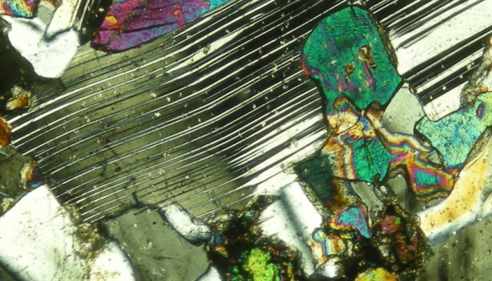
Deformation twinning . Credit: Amirhossein Mojtahedzadeh (distributed via imaggeo.egu.eu)