The EGU General Assembly 2016 programme is available here. Take a look and – if you haven’t already – register for the conference by 17 March to make the early registration rates! The scientific programme of this year’s General Assembly has been updated since 2015 and now includes Union-wide Sessions, such as Special Scientific Events (Medal Lectures, Great Debates and many more) short courses and ...[Read More]
Last chance to enter the EGU Photo Contest 2016!

If you are pre-registered for the 2016 General Assembly (Vienna, 17 -22 April), you can take part in our annual photo competition! Winners receive a free registration to next year’s General Assembly! But hurry, there are only a few days left to enter! Every year we hold a photo competition and exhibit in association with our open access image repository, Imaggeo and our annual General Assembly. Th ...[Read More]
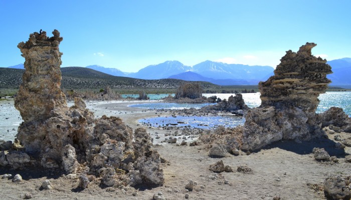
Imaggeo on Mondays: Three coloured pools

With the Imaggeo Photo Contest opening last week, what better than feature one of the 2015 competition finalists as this week’s Imaggeo on Mondays image. In this post, Irene Angeluccetti, author of the photograph, writes about the threatened ecosystem of Mono Lake. If you’ve been inspired by Irene’s photograph, why not entre the photo contest for your chance to win a free registration to the Gener ...[Read More]
EGU Photo Contest 2016

If you are pre-registered for the 2016 General Assembly (Vienna, 17 – 22 April), you can take part in our annual photo competition! Winners receive a free registration to next year’s General Assembly! The seventh annual EGU photo competition opens on 1 February. Up until 1 March, every participant pre-registered for the General Assembly can submit up three original photos and one moving image on a ...[Read More]
