For roughly the last decade, some ski resorts and other winter sport facilities have been using a pretty unusual method to ensure white slopes in winter. It’s called snow farming. The practice involves collecting natural or artificially made snow towards the end of winter, then storing the frozen mass in bulk over the summer under a thick layer of sawdust, woodchips, mulch, or other insulating mat ...[Read More]
Geosciences Column: The science behind snow farming
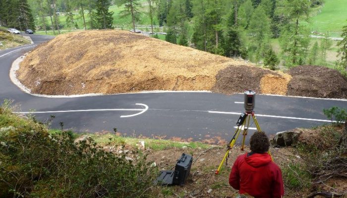
A layer of sawdust and wood chips hides a massive pile of snow in South Tyrol. The thick cover protects the snow from the summer heat. Winter sport destinations have been 'farming' snow as a way to guarantee white winters. Credit: Grünewald et al.
