The heights we go to for science… This photograph shows a member of our team preparing to abseil down a cliff in the Charyn Canyon, in the Ili River basin of southeast Kazakhstan. The Charyn River and its tributaries, a branch of the Ili River north of the Tien Shan Mountains, have cut canyons up to 300 metres deep, carving through rocks of different geologic ages, some as old as 540 million years ...[Read More]
Imaggeo on Mondays: Probing the Pliocene
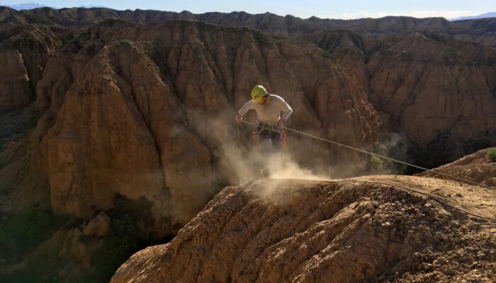
Probing the Pliocene. Credit: Kathryn Fitzsimmons (distributed via imaggeo.egu.eu)