The text of this week’s Imaggeo on Mondays comes from the photographer himself, Brenner Silva.

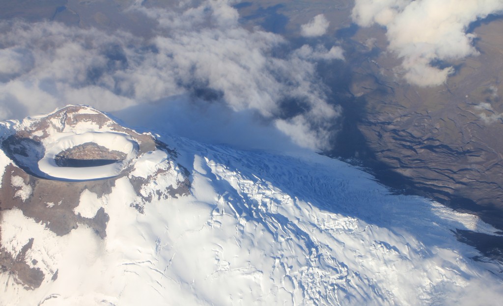
“Volcano in the tropics” by Brenner Silva, distributed by the European Geosciences Union under a Creative Commons licence
I took this picture from an airliner in September 2010 on my way to the Estación Científica San Francisco, South Ecuador, for field work. The flight route Quito-Loja goes through the two highest volcanoes, Chimborazo and Cotopaxi, of the so-called Avenue of the Volcanos in Ecuador. The pilot, attracted by the good weather, announced an unplanned manoeuvre to get closer to the Cotopaxi volcano.
The picture shows Cotopaxi, a glacier-clad and active strato-volcano at the equator (summit 5897 m a.s.l.; coordinates S 0º40’ W 78º25’). The composition, with an ice-capped cone in the foreground above tropical clouds and páramo vegetation in the background, is unique to the northern Andes.
The Andean mountains strongly affect the regional and mesoscale climate by constantly triggering the formation of clouds in the foothills and by serving as barrier to moist, low-level jets and trade winds blowing from the western Amazon basin. At the same time, the local climate is also affected by El Niño anomalies in the western Pacific — a tendency towards an increase in irradiation and temperature. The opposite holds for La Niña, the ocean-atmosphere phenomenon that was ongoing in September 2010. Consequently, the Cotopaxi glacier is susceptible to rapid changes (~30% lost in 20 years). In addition, permanent glacier receding due to climate change strongly influences plant growth and composition, and severely affects the regional hydrology and landscape.
I am investigating vegetation dynamics using mathematic models, and climate and remote sensing data in South Ecuador. Gaining knowledge through pictures is important for me and my research. I think the picture summarizes all the elements above, which I have learned with the DFG Research Unit 816 in Ecuador and the Laboratory for Climatology and Remote Sensing in Marburg, Germany.
I shot the picture with a Canon EOS 550D, 55-250 mm lens, f-stop f/10, exposure 1/125 sec., ISO-100, and focal length 36mm. The picture is the best of four tries, from 12-9-2010 23:50 ECT/17:50 LST.
By Brenner Silva
Imaggeo is the EGU’s online open access geosciences image repository. All geoscientists (and others) can submit their images to this repository and since it is open access, these photos can be used by scientists for their presentations or publications as well as by the press and public for educational purposes and otherwise. If you submit your images to Imaggeo, you retain full rights of use, since they are licensed and distributed by the EGU under a Creative Commons licence.
