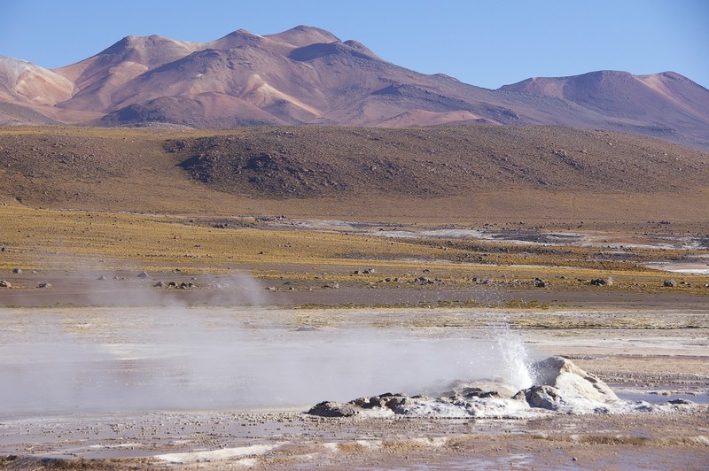
El Tatio Geyser Field by Simon Gascoin, distributed by EGU under a Creative Commons licence.
Excursions following scientific conferences often give researchers a chance to observe geosciences phenomena in remote areas. That was the case for Simon Gascoin, from the Centre d’Etudes Spatiales de la Biosphère in Toulouse, France who got to photograph geysers in a Chilean desert after the EGU Alexander von Humboldt conference in Santiago de Chile in late 2008.
“The picture shows the El Tatio geyser field, located at 4,200 metres above sea level, in the hyperarid Atacama desert. Steam columns and boiling water are caused by the high geothermal fluxes in this volcanic region, which heat the groundwater,” Gascoin explained.
The El Tatio geyser field is the largest geyser field in the southern hemisphere with no less than 80 active geysers. Eruptions of groundwater heated by magma at El Tatio have an average height of 75 centimetres, but the record steam and water jet reached some six metres above ground.
The Chilean Government declared the field a protected area in 2010.
Imaggeo is the online open access geosciences image repository of the European Geosciences Union. Every geoscientist who is an amateur photographer (but also other people) can submit their images to this repository. Being open access, it can be used by scientists for their presentations or publications as well as by the press. If you submit your images to imaggeo, you retain full rights of use, since they are licenced and distributed by EGU under a Creative Commons licence.
