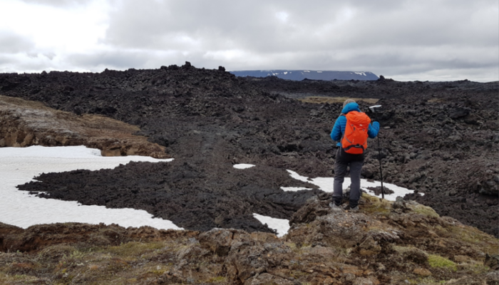
Why choose immersive virtual reality for teaching and learning about volcanoes?
This is a common question that arises when approaching this modern way to explore volcanoes. The answer is clear to those accustomed to working in these captivating regions. Traditional approaches to reaching volcanic areas are fraught with challenges (danger, complex logistics, and high costs). Moreover, these locations are often found in remote corners of the globe (e.g., Iceland, Mt. Etna, Andes), accessible primarily by air transportation, which contributes to increasing the carbon footprint.
Enter immersive Virtual Reality, a game-changing tool in geoscience education
This innovative technology brings the field into the laboratory, enabling access to geosites globally, irrespective of their geographical remoteness. The result? A more inclusive and egalitarian teaching method, that sidesteps the constraints of physical boundaries, allowing a new dimension of engagement. As technology reshapes educational landscapes, a crucial question emerges: How can we leverage virtual reality to capture students’ interest and beckon them into the geosciences field?
This versatile approach transcends educational levels. For middle and high schools, it becomes a powerful tool, kindling the curiosity of young minds. In academic settings, immersive virtual reality becomes fundamental for exploring specific geological environments and processes in unprecedented depth. Beyond academia, it emerges as an effective means to raise public awareness of geological topics. In essence, the appeal of immersive virtual reality in geoscience education lies in its ability to overcome the limitations of traditional methods, offering a transformative experience that bridges the gap between students, researchers, and the geological phenomena of our world.
Outreach with Immersive VR: A Long Story between GeoVires and EGU
Starting with the 2018 EGU Public Engagement Grant awarded to Fabio L. Bonali, the team of geoscientists of GeoVires Lab (Virtual Reality lab for Earth Sciences) has included people of all ages (>13 yrs old) and backgrounds in geological surveys thanks to the Immersive Virtual Reality (VR) (Tibaldi et al., 2020), organizing several outreach events.
Exploring a volcanic area using immersive VR – Santorini
During these events, the team guides participants through two different surveys (5 minutes each) where they can explore photo-realistic 3D models, obtained from drone and submarine surveys, of volcanically and climatically sensitive areas. Using this approach, more than 1000 people had the opportunity to explore Icelandic and Italian active volcanoes, and seafloor morphologies. These events allowed the inclusion of people affected by permanent or temporary motor disabilities, providing a unique opportunity for them to run classical geological surveys.
Icelandic volcano surveyed from a drone – 1984 Krafla
The first outreach event was held during the EGU General Assembly in 2019, where the team introduced meeting attendees to this new way of exploring geological sites. Additionally, students from the Vienna International School were able to explore Icelandic volcanoes, study earthquakes, and analyze earth morphology through the use of immersive VR, Augmented Reality and 3D printed objects thanks to the effort from the 3DTELC Erasmus+ Project team (Malcolm Whitworth, Benjamin van Wyk de Vries, Danilo Reitano and Susanna Falsaperla). The event lasted over two hours and proved to be a unique and enriching experience for all participants, including students, teachers, and geoscientists.
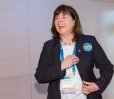
Following the positive feedback from 2019, the GeoVires team organised a second outreach event at the Vienna International School in 2023. Here, students and educators actively participated in an interactive session focused on cutting-edge technologies in geoscience, with a special focus on immersive VR. The event emphasized the importance of examining volcanic regions susceptible to both seismic activity and eruptions, as well as the impacts of climate change. Orchestrated by the GeoVires Lab at the University of Milan-Bicocca (Italy), led by Prof. Fabio L. Bonali, Dr. Luca Fallati, and two PhD students, Noemi Corti and Martina Pedicini, the event unfolded into four distinct segments.
The session started with a concise overview of volcanic regions and the application of advanced technologies to their study. Subsequently, students and their educators explored those technologies at different stands, like a “geoscience itinerary carnival”. Participants scrutinized samples of volcanic rocks using pocket-size digital microscopes, to observe minerals directly on their smartphone screens.
Attendees delved into the 3D exploration of volcanic areas in Iceland and Mt. Etna (Italy) using stereoscopes, historical aerial photos, and 3D models reconstructed from drone-captured images. Immersive VR allowed students to navigate volcanic landscapes using high-resolution models derived from drone imagery. Using stereoscopes and aerial photos gave the students the first opportunity to see a volcano in three dimensions and recognize landforms in the corresponding maps, creating a bridge and a roadmap between flat images and virtual reality.
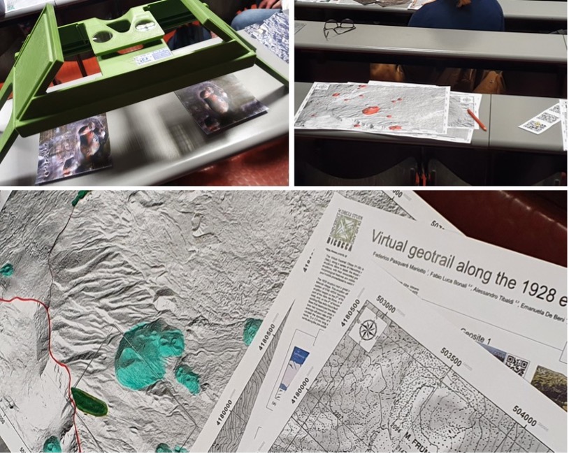
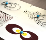
Maps provided by high school students as result of their work using stereoscopes and aerial photos to enjoy the 3-D view of a volcano.
Students confirmed the positive perception of Hi-Tech technologies to learn geoscience topics, expressing the wish to have 3D tools available during common laboratory activities at their high school, from “ancient” stereoscopes to modern immersive VR. Such feedback also comes from previous outreach activities carried out in Italy. Moreover, students highlighted the usefulness of introducing concepts relating to volcanoes with practical activities, like mapping the main morphologies on topographic maps. The proposed activities increased their attention and enthusiasm towards the learning process, which focused on the exciting world of volcanoes.
The session at VIS finally transitioned to a presentation centered on the study of coastal and marine areas, specifically addressing climate change and rising sea levels. Concluding the event, students were engaged in a dialogue, expressing their impressions of the demonstrated methods and posing questions.
Final remarks
The Geo-Educational potential of immersive VR was previously underscored by Bonali et al. (2022) during nine events in 2018 and 2019 across various locations (Vienna, Austria; Milan and Catania, Italy; Santorini, Greece). Visitors at these events had the opportunity to immerse themselves in geological landscapes reconstructed from drone-captured pictures. Post-experience, participants completed questionnaires, revealing a high rating (94% overall) for immersive VR as a geo-educational tool, with academics in Earth Sciences giving it an even higher score of 96%.
Highlighting the importance of bridging science with younger generations, Fabio Bonali, one of the guest scientists, emphasized that “It is fundamental to bring science closer to the younger generations using classical and modern approaches, especially in middle to high schools where students begin contemplating their future paths”. Students showed interest and asked questions about the team’s academic path, such as “Why did you decide to become a geoscientist?” and “What is your academic background?”.
The positive experience resonated with high school students and their educators, who exhibited enthusiasm for the activities and actively conducted a discussion with the scientists, asking about curiosities around the world of volcanoes and focusing on the importance of understanding the impact of climate change on our planet.
References and materials
Tibaldi, A., Bonali, F. L., Vitello, F., Delage, E., Nomikou, P., Antoniou, V., & Whitworth, M. (2020). Real world–based immersive Virtual Reality for research, teaching and communication in volcanology. Bulletin of Volcanology, 82, 1-12.
3D models used during the workshop are available at the website of the GeoVires Lab.
An interactive poster for Virtual Survey.
360-VR-VIDEO of a walk in Northern Iceland.
This activity is the natural follow-up of the 2018 EGU Public Engagement Grant.


