This week’s Imaggeo on Mondays highlights the vulnerability of Villarrica’s slopes and zooms in on the volcano’s spectacular crater…
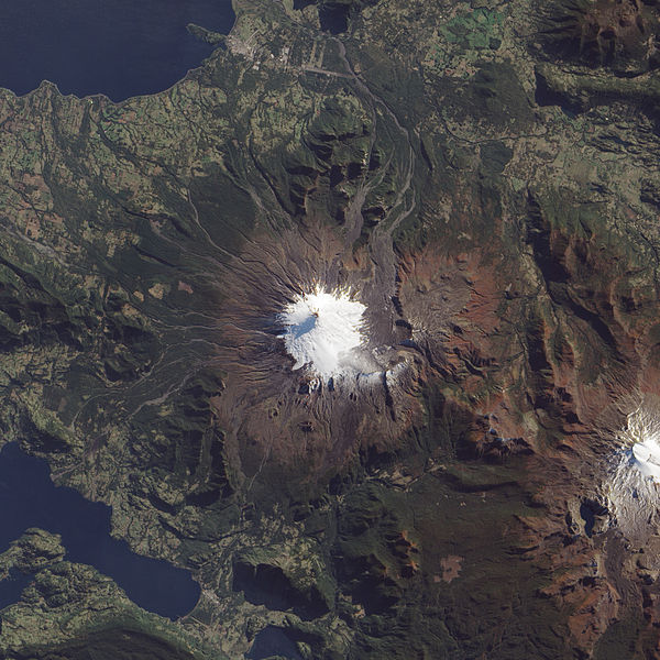
Villarrica, one of the largest stratovolcanoes in Chile, is also one of the country’s most active. The volcano is iced by glaciers that make the mountain a stunning scene, but also a dangerous one. The glaciers cover some 30 square-kilometres of the volcano and, during an eruption, the snow and ice melts to form lahars (rapid mud flows that move at 30-40 kilometres per hour). These flows present a formidable hazard to the towns that flank the volcano.

Villarrica from above – if you look closely, you can see the traces of lahars on the volcano’s northwest flanks. (Credit: NASA Earth Observatory/Jesse Allen/Robert Simmon)
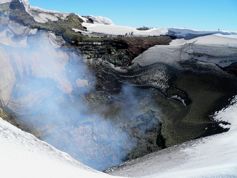
Villarica’s crater spans some 250 metres and takes the form of steeply sloping basalt. The cherry on the volcanic cake (and just out of shot here) is the lava lake at its summit. Villarrica is constantly degassing through this lava lake – a process that releases pressure below the surface. Without it, eruptions would be much more violent.

Peering into the crater of Villarrica Volcano, Chile. (Credit: Dávid Karátson via imaggeo.egu.eu)
Imaggeo is the EGU’s open access geosciences image repository. Photos uploaded to Imaggeo can be used by scientists, the press and the public provided the original author is credited. Photographers also retain full rights of use, as Imaggeo images are licensed and distributed by the EGU under a Creative Commons licence. You can submit your photos here.


