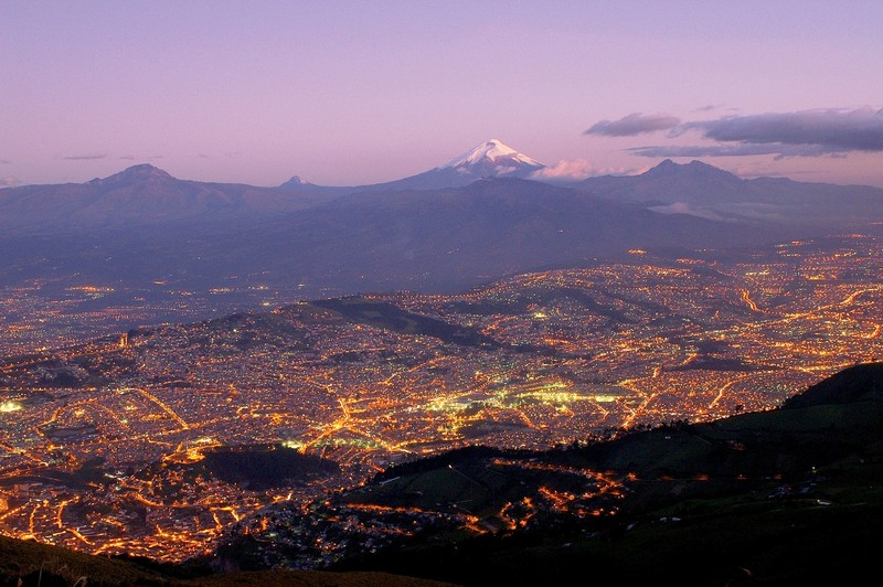
Quito and Cotopaxi by Martin Mergili, distributed by EGU under a Creative Commons licence.
The sky is painted purple in this stunning evening photo taken near Quito, Ecuador. The country’s second most populous city is illuminated by artificial light, and Cotopaxi, an active volcano forming part of the Pacific Ring of Fire, looks out in the background.
Located about 28 km south of Quito, Cotopaxi is the second highest summit in Ecuador (5,897 m) and features one of the few equatorial glaciers in the world. Since 1738, Cotopaxi has erupted more than 50 times, including some disastrous events during the 18th and 19th centuries. Its activity continues to impact the surrounding landscape considerably. A major eruption of Cotopaxi could produce a lot of meltwater from the ice cap. The resulting mudflows of volcanic fragments may also affect part of suburban Quito, thought to house over a million people.
Geomorphologist Martin Mergili took this picture in 2007 during a field excursion with a team from the University of Innsbruck, Austria. “The photo was taken from the Cruz Loma hill at an altitude of about 4,000 m in the Western Cordillera of Ecuador. In that region just south of the equator, the Andes are divided into two major chains. The Eastern Cordillera is dominated by the ice-capped Cotopaxi stratovolcano shown in the background, which is one of the highest active volcanoes worldwide. Quito, the capital of Ecuador, is located at approximately 2,850 m above sea level on a terrace above the longitudinal valley separating the Eastern and the Western Cordillera,” he explains.
To view more from Martin Mergili’s collection of photos, many of which have geoscientific relevance, please visit: www.mergili.at/worldimages.
Imaggeo is the online open access geosciences image repository of the European Geosciences Union. Every geoscientist who is an amateur photographer (but also other people) can submit their images to this repository. Being open access, it can be used by scientists for their presentations or publications as well as by the press. If you submit your images to imaggeo, you retain full rights of use, since they are licenced and distributed by EGU under a Creative Commons licence.