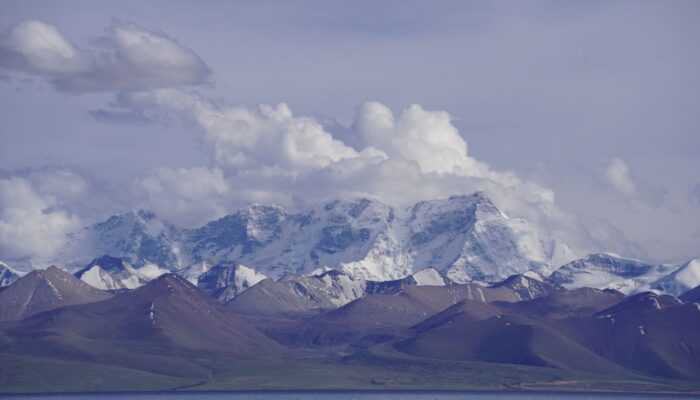
International Scientific Continental Drilling Program (ICDP) campaigns may lead scientists from all over the world to most exciting places that are often of extraordinary beauty and remoteness. All these attributes certainly apply to Lake Nam Co situated at an altitude of 4700 m above sea level on the Tibetan Plateau in the Himalayas. Today this area supplies one third of the humankind with fresh water via the great rivers of Asia that mostly have their springs here.
Lake Nam Co is of particularly high interest for geoscientists with diverse scientific backgrounds as it is located in the modern Monsoon regime. Thus, this lacustrine geo-archive is capable to record changes in large-scale atmospheric systems. Yet, it remains uncertain how the human induced global warming tendency will affect these, but especially the monsoon system is highly likely to be spatially shifted, if the seasonal imbalance between temperatures across the continents and the oceans changes. Yet, our knowledge about these effects remain poorly constrained. Given the importance of the Tibetan plateau for the water supply of billions of people, however, a better understanding of such tendencies is of crucial societal interest, which is acknowledged by the funding through ICDP.
Apart from direct climate-related research questions, the drill cores of Lake Nam Co may yield important clues on numerous other aspects, e.g., on the evolution of biota that are present in the lake (sediments) which is of special interest for biologists and ecologists. Comparing different drill cores may also lead to important findings about the local to regional tectonic setting and geomorphological and sedimentological processes in high-mountain ranges.

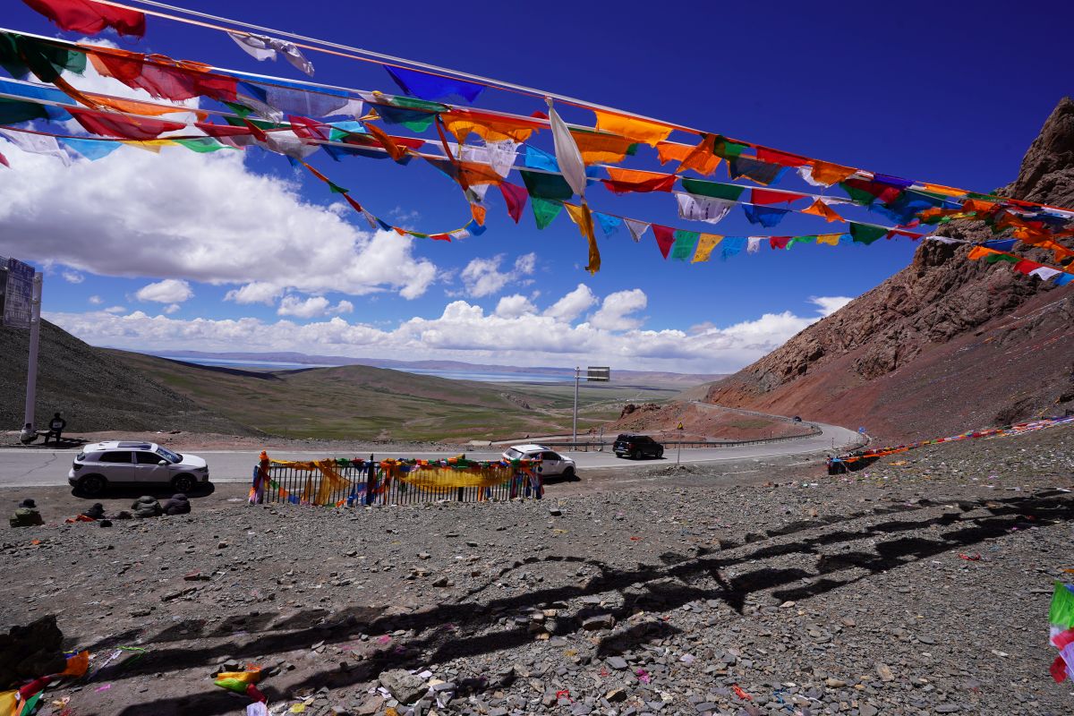
Photo 1: Tibetian prayer flags at the pass (~5,000 m a.s.l) that leads to the basin-structure hosting Lake Nam Co.
In this context, ICDP is an international consortium that aims at funding and supporting deep drillings on continents that are costly and challenging to perform. Projects that have been funded by ICDP are conducted all across the globe and need to address a broad range of important research questions at the service of society. An international team that comes with very diverse experiences and perspectives ideally leading to an enriching, creative and open-minded atmosphere can best solve these research questions.
As a scientist from the LIAG-Institute for Applied Geophysics, I had the great chance to be part of an ICDP drilling campaign at Lake Nam Co on world’s rooftop. Here I will briefly take you with me and share my experiences about this extraordinary journey with you.
All members of the team travelled independently to Beijing to meet and get in contact there. The next day, all travelled together to Lhasa (the capital of the autonomous region of Tibet) where we were kindly welcomed by Professor Wang and Professor Zhu, and their colleagues from the Institute of Tibetan Plateau Research of the Chinese Academy of Science. After a few days of acclimatization at an altitude of 3.700 m, during which we had the opportunity to visit the Potala Palace and to gain glimpses into the Tibetan culture, the team departed towards the Camp at the shores of Lake Nam Co (altitude 4.700 m a.s.l.)

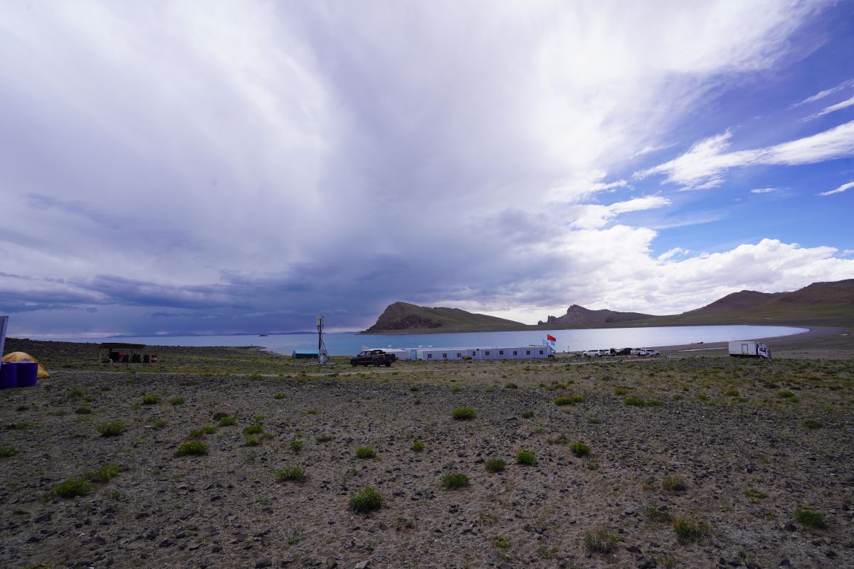
Photo 2: Location of the Nam Co camp that was situated at a bay of the Lake – a perfect habour for supplying the drilling platform with people and goods.

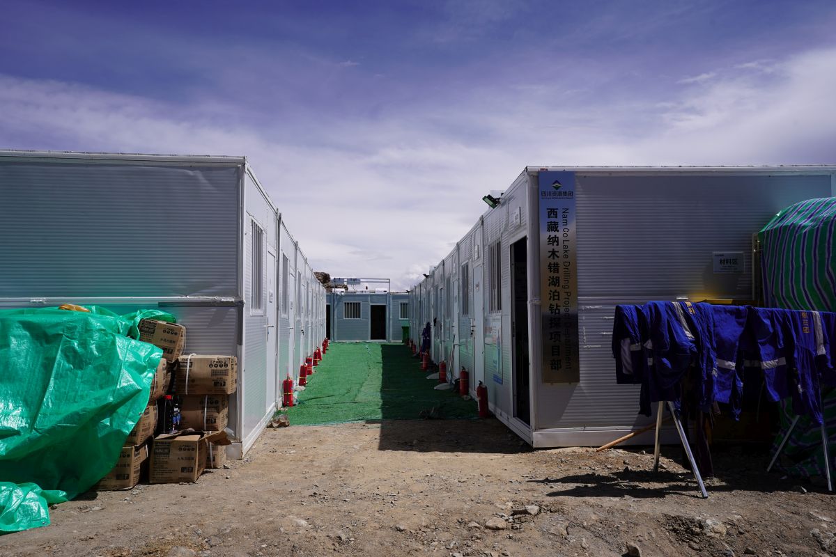
Photo 3: Insight into the Nam Co container camp that was fully equipped with containers for sleeping, dining and cooking, meeting, laundry and even a small laboratory.
The camp itself was built based on containers at a bay of Lake Nam Co (the lake has a surface area of 1,900 km2 clearly exceeding this of Lake Constance in Europe (536 km2)). Summits of mountains exceeding 7,000 m elevation where clearly visible in the skies from the camp that was located within an environment above the treeline with boulders and rocks and marmots in the surroundings. Embedded in this scenery, the meeting room container was the social melting point of the camp where day and night shifts shook hands.
These teams went to the drilling rig via a transport boat that at the beginning needed to be optimized in terms of its engine (in such an elevation, fuel burning is not the same…), but after a while the technicians and boat drivers found good solutions for these initial challenges.

Photo 4: Boats that were used to transfer the crews to the drilling platform and to transport heavy goods and supplies.
As to be expected in such endeavours, the expedition faced some complications concerning the weather conditions that are hard to predict in this high-mountain environments. In addition, the drilling operations themselves did not always go smooth due to a “difficult lithology” including thick sand layers. In the end of the day, however, the teams managed to retrieve a more than 500 m long core. This remarkable result can be ascribed to a team that consists of researchers of varying ages and experience degrees and engaged drillers at the rig that worked hard for this success.
After the drilling procedures were finalised, the work of the borehole-logging team in which I was a member began. During borehole logging, probes with different physical sensors are lowered into the borehole to determine a plethora of proxies directly in the borehole. This is of advantage as it gives the most precise depth information (core sections may expand once they are opened due to the pressure release) and there is the chance that in case of a non-complete core recovery, borehole logging data can fill gaps. Another crucial advantage is the direct availability (on-line) of borehole logging data during the measure whilst cores need much more time to be processed.

Photo 6: Core recovery at the drilling platform through joint forces of the drillers and the scientifc team
To sum it up, the Nam Co drilling campaign came with stunning impressions, challenges and chances within an international team of researchers, technicians and drillers of diverse background and age. This led and still leads to vivid scientific exchange and the recoveree and investigation of 510 m lacustrine sediments that are to be explored in detail. In this context, it is important to note that such projects are not possible without the funding from agencies like the ICDP, ITP CAS, DFG, SNSF, NERC that mainly supported the drilling operations and related subsequent analyses.
Acknowledgements:
This report was kindly approved by the PI-Team of the Nam Co ICDP project and benefited from the revision of members from the LIAG Institute for Applied Geophysics in Hannover that were involved considering the borehole logging of Lake Nam Co. Special thanks belong to Thomas Grelle (LIAG), who kindly provided the photos embedded in this blog-post.

