“SENSOR” – stands for Seismological Experiments, Network Systems, Observations and Recovery
In this blog series, curated by Chiara Civiero, we share news about recent or upcoming seismic experiments around the globe!
Could you explain what your project is about?
While downward mantle flow (subduction) is well constrained, a grand challenge in Earth sciences is to understand mid-plate, deep upward flow that cannot be explained by plate tectonics. Mantle plumes have just started to be robustly imaged, yet resolution is low and uncertainty quantification is lacking. The UPFLOW project, funded by the European Research Council (2021-2026) aims to develop an entirely new seismic imaging approach and use it to constrain plume-like mantle upwellings at unprecedented resolution. Upward flow is critical for continental growth, for returning volatiles to the atmosphere and for producing Earth’s largest melting events. These events coincide with major extinctions, supercontinent breakups and with changes in geodynamo behaviour.
Where is your study area? What do you want to know there? Why do you consider this zone scientifically interesting?
Our study area covers the Madeira-Azores-Canary island region in the North Atlantic. We aim to characterize intraplate plume upwellings in this region, their relationships to the deep mantle, including the African large low-shear-velocity province (LLSVP), and also ridge-plume interactions, notably in the context of the Azores triple junction.
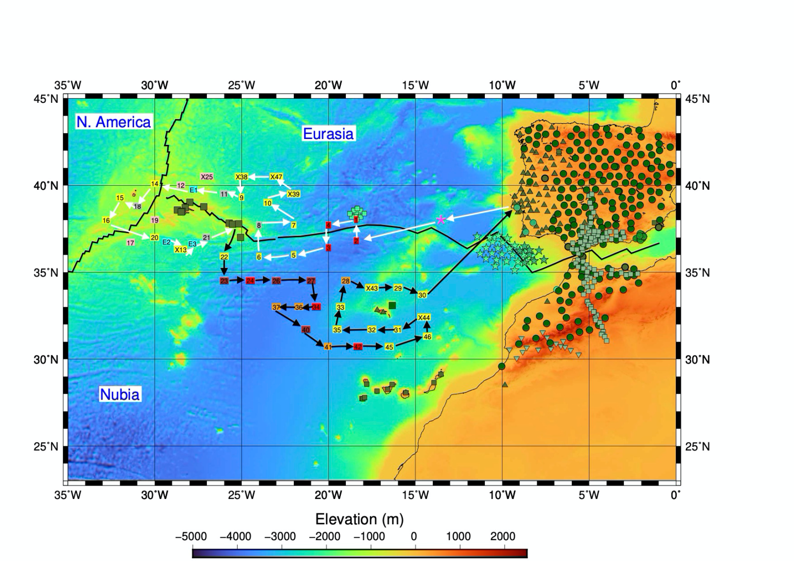
Figure 1. The study region, the route of the ship, and the location of the seismic instruments deployed.
The study area is an under-studied natural laboratory comprising significant mantle upwellings that are poorly understood in general. Knowledge about plume upwellings is crucial to understanding better the characteristics and dynamics in the Earth’s mantle and how it controls processes on the surface. The eruptions of La Palma show very well how dynamic and scientifically interesting the study area is and show the importance in characterising plume upwellings better. The valuable data of the eruptions and many other seismic events recorded by the UPFLOW-array will help to better estimate the dynamics and mechanisms of mid-plate plume upwellings. More generally, the data that we are collecting will be useful for a very wide range of applications, including environmental studies (e.g., for tracking whales, understanding the sources of noise and their relationship to ocean waves and climate, studying local seismicity and volcano behaviour).
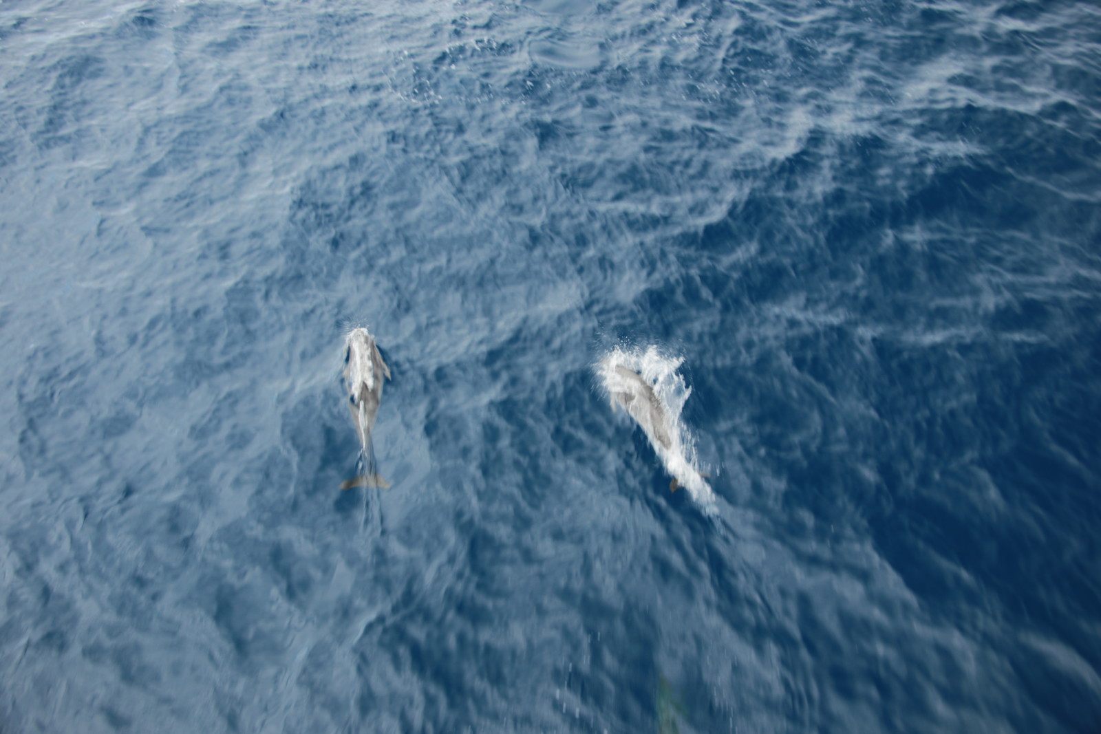
Figure 2. A couple of happy bottlenose dolphins.
Why is it important to carry out these studies in the oceans, in particular in the North Atlantic?
The North Atlantic is a very dynamic area due to the plate drifting at the mid-ocean ridge (MOR) and the Gloria Fault, but also because of the intraplate volcanism, which is fed by the upwellings of mantle plumes. However, the analysis of processes beneath the ocean is limited by sparse data coverage. We currently only have seismic land-station networks in the islands, which have very limited geometries and hence data coverage. Ocean-bottom seismometers (OBS) open the analysis of the Earth’s dynamics to a global scale. Up to now, studies analysed mainly seismic land-station data from the Canaries, Madeira or the Azores to analyse the Earth’s structure beneath the islands separately. The UPFLOW ocean-bottom network covers the area between the whole Azores-Madeira-Canary island region, which allows us to jointly analyse the plume upwellings and to interpret the processes in this region in its entirety.
What type of geophysical instruments did you deploy?
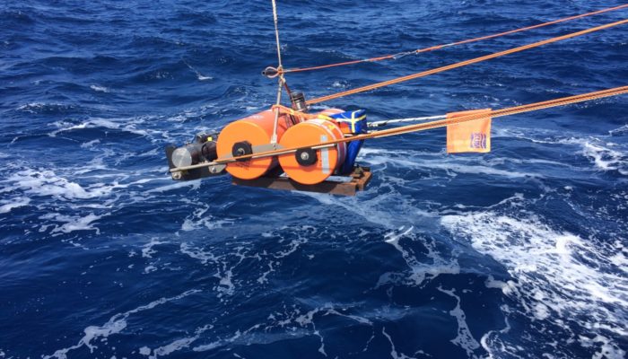
We deployed 3 different types of instruments, each equipped with a broadband ocean-bottom seismometer and a hydrophone. A big issue of OBS records is the very high noise level. Part of the noise is caused by the instruments itself, which is why different models exist, with the aim to reduce the noise level and improve the seismic analysis. We used LOBSTERs from the DEPAS Pool (AWI) and the Royal Army of Spain, and NAMMUS from the DEPAS Pool (AWI) and DIAS. The third type is brand-new and developed by the scientists from the IDL. We are very curious about the improvements of the noise level on their recordings. The instruments of the IDL are additionally equipped with biological probes [see the first SENSOR blog].

Figure 3. The OBSs ready to be deployed – in the centre are the NAMMUS OBSs, and in the foreground and at sides are the LOBSTER OBSs.
How did you decide the location of the seismic deployment? How many stations did you install?
We planned the overall aperture of the deployment and station spacing in a way such that we can probe deep inside the mantle down to the lower mantle and, on the other hand, achieve a lateral resolution of about ~150 km in the upper mantle. Finally, the detailed location of the stations was also decided depending on the bathymetry (we preferred locations with smooth and flat bathymetry to maximise our chances of recovering the instruments). In total we installed 50 instruments (see Figure 1); during the UPFLOW July-Aug 2021 expedition we deployed 46 instruments, and four additional ones were deployed beforehand (in June 2021) by GEOMAR, Germany.

Figure 4. Scientists and technicians deploying the first of the OBSs.
How difficult is the organisation of the fieldwork? What are the operational steps? Any examples of practical challenges in the field?
Organising an offshore OBS expedition is always a big challenge because it involves coordinating a ship, instrumentation and an extensive research team. In our case, it involved instruments from four different countries (Germany, Ireland, Spain and Portugal) and researchers from five different countries (same as before plus UK) and from several institutions, and so lots of coordination and discussions were needed.
The operational steps to prepare the expedition included:
– ask for authorisations from the relevant countries to navigate in their national waters (in our case, Portugal and Spain);
– ask for authorisations to use the instruments;
– arrange truck transport of equipment from the different institutions plus customs procedure;
– order 50+ packs of lithium batteries for the instruments (very challenging because there is currently a huge demand for lithium) plus consumables (e.g., anchors, smaller batteries for the releasers, etc.);
– setup legal agreements with the pools of instruments;
– carry out a detailed risk assessment of the expedition and draw a mitigation plan;
– build information sheets and a day-to-day expedition plan and distribute it to whole team;
– organise all the travel arrangements for all the expedition participants, including pre-cruise hotel quarantines and covid tests;
– discuss the detailed cruise transit plan with the ship’s captain, ship manager and research team;
– build a detailed deployment plan, including: setting up the timings of autoreleasers, station names, team rotas;
– constantly liaise and coordinate efforts with the ship’s manager about all aspects of the expedition related to the ship (e.g., safe storage and movement of equipment, food and accommodation requirements, covid regulations, covid tests, communication with the crew);
– organise many regular meetings with the research team to discuss distribution of tasks, etc.
One of the main challenges in the field is missing batteries because they were not delivered on time to the ship and also because there was no access to shops just to buy them. Another big challenge for all participants was the steady movement of the vessel, especially if the wind speed became stronger and the waves higher. The deployment of an OBS can be quite tricky during windy and wavy weather and sea conditions.

Figure 5. The research vessel Mário Ruivo.
What are you planning to do with the seismic data?
Seismology has come far by using travel-time and waveform (phase) information but has mostly ignored the amplitude information. We developed novel seismic imaging methods based on big amplitude data, showing their strong resolution. With recent computing resources and an explosion in datasets, it is now timely to use these unique expertise to lead a step-change in observational seismology: rather than relying on predefined observables (e.g. travel-times), objective statistical techniques exploring the full richness of the data will be used to design observables that provide optimal constraints on Earth structure.
The imaging technique to be developed will be applied to the new data and to existing data (Hawaii, Reunion) to obtain sharp images of mantle plumes along with their interdisciplinary interpretation. The data will be stored in GFZ’s EIDA node. It will be embargoed for a period of four years and then it will be open to everyone after that.
These results will have a major impact far beyond the study regions and across Earth Sciences (e.g. geology, geochemistry, geodynamics) since they will reveal ubiquitous, fundamental phenomena that control the global evolution of the planet.
Are you collaborating with other institution(s)? Are there ECS (early career scientists) in the teams?
The UPFLOW project is a collaboration of UCL with institutes from Portugal (IDL, IPMA), Ireland (DIAS), Spain (Royal Army) and Germany (AWI, GEOMAR, GFZ and University of Potsdam).
ECS from all over Europe are involved in the project. During the UPFLOW campaign in summer 2021, seven ECSs from Great Britain, Ireland, Germany, Spain and Portugal participated in the project and many more ECSs will be involved in the analysis of the data recorded by the UPFLOW network in the following years.


Figures 6-7. The UPFLOW team.
Do you think it is important that both the scientific and non-expert community know about this project? Did you organise any outreach and communication activities?
It is very important to introduce the scientific and non-expert community to the project, since Earth’s processes affect everybody, even if they occur in the very deep Earth. It is important to show non-experts how seismology helps to understand geodynamic processes and risks. The best example is the recent eruption in La Palma. Our science is helping to improve the understanding of the processes of the plume upwellings in this mid-plate island region. Since the results will have a major impact far beyond the study regions and across Earth Sciences (e.g. geology, geochemistry, geodynamics), it is also very important to involve the scientific community, in- and outside seismology.
We organised many outreach and communication activities. In order to involve the youth – potential future seismologists 😉 – our chief-scientist Prof. Ana Ferreira organised workshops with kids from Primary Schools in London and in cooperation with the Geo-Bus from the UCL. The kids from the primary schools and kids from all over the world were invited to name one of the instruments and draw a picture of them. Those pictures and names were all published on our website.
The very detailed website is informing about the different aspects of the project, like the study area, instruments, and crew. One will also find blog entries written by the scientists participating the campaign in Summer 2021. We further informed about the project and the campaign via instagram, youtube and twitter.
To further involve a broad community, UPFLOW is cooperating with the Jazz Musician Liam Noble from London, who is composing piano pieces inspired by the sounds and pictures from the campaign.
Everybody is very welcome to check our website, instagram, youtube or twitter channel – and the latest Geology Bites podcast!
In this blog the interviewees were Prof. Ana Ferreira (UCL, the PI of the UPFLOW project) and Theresa Rein (Potsdam), with questions from ECS representative Chiara Civiero.