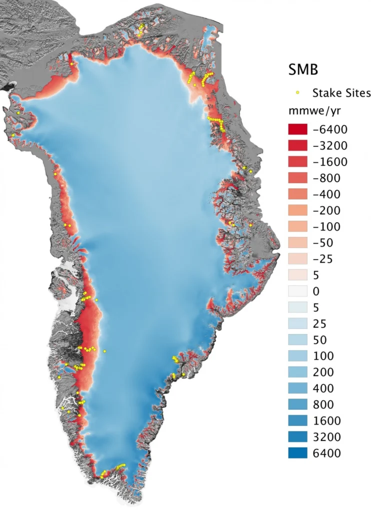
The Greenland ice sheet – the world’s second largest ice mass – stores about one tenth of the Earth’s freshwater. If totally melted, this would rise global sea level by 7.4 m, affecting low-lying regions worldwide. Since the 1990s, the warmer atmosphere and ocean have increased the melt at the surface of the Greenland ice …[Read More]
Division blogs
Tectonics and Structural Geology
Minds over Methods: Reconstruction of salt tectonic features
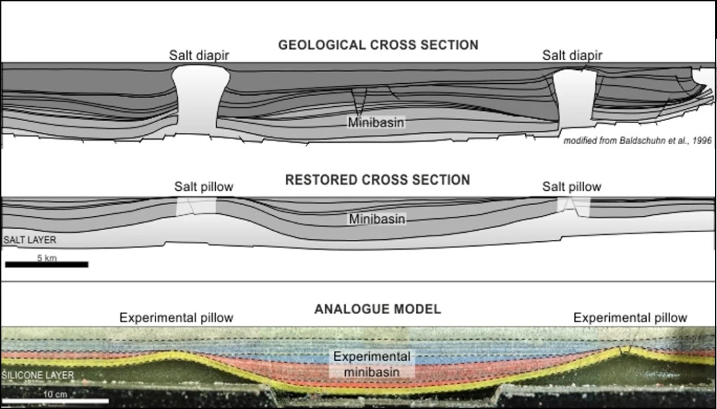
What is the influence of salt tectonics on the evolution of sedimentary basins and how can we reconstruct such salt features? Michael Warsitzka, PhD student at the Friedrich Schiller University of Jena, explains which complementary methods he uses to better understand salt structures and their relation to sedimentary basins. Enjoy! Reconstruction of salt tectonic …[Read More]
Geomorphology
European Critical Physical Geography – or how power relations can be considered during research set ups
– written by Christian Schneider (University of Leipzig) and Sabine Kraushaar (University of Vienna) – In March this year the first European Critical Physical Geography (CPG) Workshop took place in Berlin bringing together 19 scholars from different European and American research institutions and backgrounds under the lead of Rebecca Lave and Stuart Lane and the …[Read More]
Cryospheric Sciences
Image of the Week – The ups and downs of sea ice!
The reduction in Arctic sea-ice cover has been in the news a lot recently (e.g. here) – as record lows have been observed again and again within the last decade. However, it is also a topic which causes a lot of confusion as so many factors come into play. With this Image of the Week …[Read More]
Cryospheric Sciences
A year at the South Pole – an interview with Tim Ager, Research Scientist
What is it like to live at the South Pole for a year? A mechanical engineer by trade, Tim Ager, jumped at the opportunity to work for a year as a research scientist at Amundsen-Scott South Pole Station. When not traveling on various adventures he lives in Austin, Texas, and recently took the time to …[Read More]
Cryospheric Sciences
Image of the Week — Microbes munch on iron beneath glaciers
The interface between a glacier and its underlying bedrock is known as the subglacial zone. Here lie subglacial sediments, the product of mechanical crushing of the rock by the glacial ice. Despite their lack of sunlight, nutrients and oxygen, subglacial sediments host active and diverse communities of microorganisms. What we (don’t) know about subglacial microorganisms The …[Read More]
Geomorphology
Report from the Spring School on “Statistical analysis of hyperspectral and high-dimensional remote-sensing data using R”, Jena, Germany, March 13-17, 2017
The Spring School on “Statistical analysis of hyperspectral and high-dimensional remote-sensing data using R” was organized by the GIScience group lead by Prof. Alexander Brenning and two researchers from his GIScience research group, Patrick Schratz and Dr. Jannes Münchow. The school brought together a diverse group of 28 researchers (e.g. geoscientists, forestry, environmental studies) at …[Read More]
Seismology
EGU Seismology Division 2017 visibility survey
Dear Seismology Division blogpost, Facebook and Twitter followers, The EGU Seismology Division has prepared an online survey to investigate how members are following our division’s activities online. The data we will acquire through this simple survey allows us to learn how we can improve our visibility and to which activities we could further focus. The …[Read More]
Cryospheric Sciences
Image of the Week – Ice on Fire (Part 2)
This week’s image looks like something out of a science fiction movie, but sometimes what we find on Earth is even more strange than what we can imagine! Where the heat of volcanoes meets the icy cold of glaciers strange and wonderful landscapes are formed. The Kamchatka Peninsula, in the far East of Russia, has the …[Read More]
Cryospheric Sciences
Image of The Week – Ice Flows!
Portraying ice sheets and shelves to the general public can be tricky. They are in remote locations, meaning the majority of people will never have seen them. They also change over timescales that are often hard to represent without showing dramatic images of more unusual events such as the collapse of the Larsen B Ice Shelf. …[Read More]