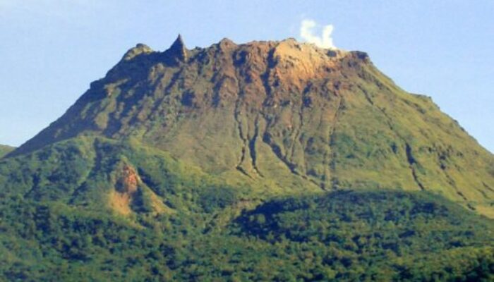
La Soufrière de Guadeloupe is an andesitic stratovolcano located in the southern part of Basse-Terre, within the Guadeloupe archipelago (Eastern Caribbean). It towers over the towns of Sainte-Claude and Basse-Terre. Nearly 50 years ago, this region faced severe consequences from a phreatomagmatic eruption, forcing the evacuation of 80,000 people. Since then, the volcano has been regularly monitored. Today’s blog post will delve into La Soufrière’s eruptive history and provide an update on its current activity.
Basse-Terre is the western of the two main islands in Guadeloupe, with the other being Grande-Terre, ironically the smaller of the two. Basse-Terre consists of seven volcanic complexes that form a 25 km wide and 55 km long volcanic chain, with the highest peak at the dome of La Soufrière de Guadeloupe (La Grande Soufrière – 1476 m). The volcanic activity in this region is driven by the subduction of the Atlantic Ocean tectonic plate beneath the Caribbean plate. La Soufrière complex has been active for 0.3 Ma, and the current dome was formed during the last magmatic eruption dated to 1530. Since then, the dome suffered six phreatic events, major ones in 1797-98 and 1976-77.
A fraction of eruptive history
The 1797-98 phreatic eruption is considered the first well-documented event in La Soufrière’s history. Before the eruption, intermittent clouds were emitting sulfuric fumes, as well as frequency and magnitude increase in felt seismic activity. The eruption began in the early fall of 1797, marked by roars followed by an earthquake felt through the region. In the upcoming hours of grumble, a thick ashy cloud covered the skies towards the west. The next few days after the eruption, a pervasive sulfuric odor spread everywhere, and black ash covered the ground from surrounding towns to the coast, contaminating river canyons. With the subsiding of the clouds, it became clear that the flanks of the dome had collapsed. The phreatic activity lasted until the spring of 1798 culminating in a violent explosion that produced large meter-sized ballistic material and debris. Historical records from French missionary priests provide detailed accounts of the eruption’s effects.
The other significant phreatic event occurred between July of 1976 and March of 1977. At the time, information on the volcanic history of the area was scarce and monitoring was poorly conveyed making this eruption a precedent for the scientific community and governmental bodies. This 8-month-long battle led to increased funding for volcano monitoring at French observatories worldwide and sparked advancements in methodologies and approaches to crisis management and risk mitigation.
Similarly to the last big phreatic eruption, this event was preceded by a gradual increase in recorded volcanic activity over the previous year. The first noted explosion ejected about 0.6 × 10⁶ cubic meters of solid material, while seismic activity caused multiple fractures on the flanks of the dome. Large blocks were thrown several hundred meters from the volcano, and the eruption triggered a rock avalanche that traveled nearly 4 km toward populated areas. The violence of the phreatic eruption, and a dark ashy cloud, caused panic and a sudden evacuation of the residents. In the days following the eruption, active vents ejected water, and additional explosions were recorded over the subsequent weeks. Almost a month after the beginning of the eruption, a contingency plan was sent into place to evacuate 60,000 people from the southern Basse-Terre area. The first phase of the eruption was characterized by numerous explosions and intense seismicity. The second phase was much more tranquil with subsiding seismicity. The crisis period was terminated in March of 1977.
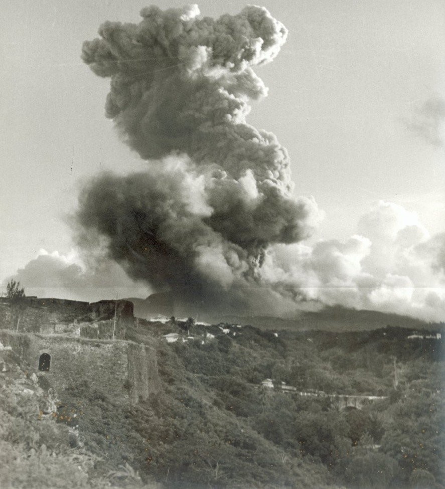
A photo taken in July 1976 from the Sainte-Claude village (source: IPGP records).
Ongoing activity and research
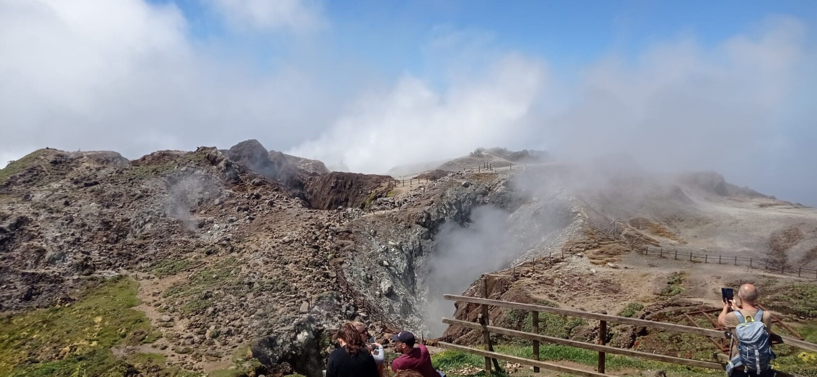
Nowadays, La Soufrière is still active. Significant advancements have been implemented in studying and monitoring the volcano. Thorough research has been done using electrical and muon tomography and seismic imaging, as well as monitoring volcanic gases and temperature. What we currently know is that fumarolic degassing is present from several craters, fissures, and fumaroles on the top of the dome. The temperature in the acid thermal lake on the bottom of the Cratère Tarissan is on the rise (around 104 °C).
The structure of La Soufrière suggests a link between the volcano’s summit and nearby southern thermal springs, that is controlled by a fault system. Geochemical studies have also revealed that the chemical composition of fumaroles, acid ponds, and nearby hot springs are closely related. Testing of spring fluid showed irregular spikes in chlorine levels, which were linked to summit fumarole activity starting in 1998. And historical phreatic events discussed earlier resulted from magmatic fluid and meteoric water mixing, culminating in a pressurized outflow of acid fluid through the fractures on the volcano.
Undoubtedly, La Soufrière is extremely altered. As the volcanic rocks comprising the dome continue to change, they become more susceptible to structural collapse and landslides, which can trigger further volcanic activity or seismic events. The hydrothermal alteration of volcanic rocks poses a significant hazard, making it crucial to identify where altered zones lay. The detected altered zones show significant alteration on the S and SW flanks. They were found using electrical tomography, which detects the areas of increased electric conductivity alerted by fluid-saturated rocks or clay minerals. So, not only does the south part of La Soufrière lie on ‘rotten’ altered rocks, but studies show that even a smaller dome or flank collapse could endanger populated regions of Sainte-Claude and Basse-Terre.
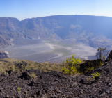
The view from La Grande Soufrière, the highest peak in Guadeloupe and Eastern Caribbean (1467 m). The closer crater is Tarissan – a 100m-deep crater with an acidic lake at the bottom, and the one in the back is Cratère Sud Central.
References:
Komorowski, J.-C., Boudon, G., Semet, M., Beauducel, F., Anténor-Habazac, C., Bazin, S., & Hammmouya, G. (2005). Guadeloupe. In J. Lindsay, R. Robertson, J. Shepherd, & S. Ali (Eds.), Volcanic Atlas of the Lesser Antilles (pp. 65–102). University of the French West Indies, Seismic Research Unit.
Rosas-Carbajal, M., Komorowski, J. C., Nicollin, F., & Gibert, D. (2016). Volcano electrical tomography unveils edifice collapse hazard linked to hydrothermal system structure and dynamics. Scientific Reports, 6, 29899.
Peruzzetto, M., Komorowski, J.-C., Le Friant, A., Rosas-Carbajal, M., Mangeney, A., & Legendre, Y. (2019). Modeling of partial dome collapse of La Soufrière of Guadeloupe volcano: Implications for hazard assessment and monitoring. Scientific Reports, 9(1), 1–15.
Heap, M. J., Baumann, T. S., RosasCarbajal, M., Komorowski, J.-C., Gilg, H. A., Villeneuve, M., et al. (2021). Alteration-induced volcano instability at La Soufrière de Guadeloupe (Eastern Caribbean). Journal of Geophysical Research: Solid Earth, 126.