The mantle makes up the bulk of Earth, extending from near the surface to the edge of the core 2900 km down. It constitutes 84% of Earth’s volume and has roughly 6 times the mass of Mars! Despite its impressive bulk, the mantle is almost everywhere covered by several km of crust. As a result we don’t have a lot of pieces of it that we can look at, hold or study. Those we have (e.g. xenoliths, seafloor serpentinites, ophiolites) are generally affected by alteration, perturbation and/or biases related to their delivery to the surface. Much of what we understand about Earth’s interior is from indirect observations: the chemistry of lavas, seismic tomography, high pressure experiments.

Thin section of a peridotite from the mantle section of the Leka Ophiolite, Norway – the primary mantle rocks here have been infiltrated by melts and fluids in a subduction setting, altering their primary characteristics (Image credit: E. Carter)
Perhaps unsurprisingly therefore, scientists have wanted to drill through the crust to the mantle for a long time. To do this we need to drill a very deep hole, around 6 km deep in oceanic crust and at least 25 km on the continents.
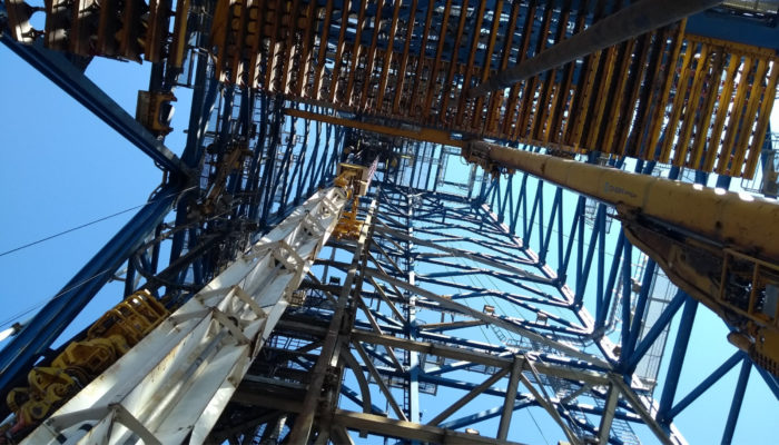
One such attempt to drill an extremely deep hole was the Kola Superdeep Borehole programme undertaken by the USSR. Although it did not reach the mantle and was unlikely to ever do so, the story is a fascinating one. Conceived, in the spirit of cold war competition, as a record breaking attempt to drill as deep as possible into the crust, a site on the NW Kola Peninsula, near the Norwegian border, was chosen to drill into 3 billion year old Baltic continental crust. A. Osadchy’s account (auto-translated from Russian) gives a vivid sense of the setting:
“From Zapolyarnoye to Superglubokaya – 10 km. The road goes past the plant, then along the edge of the quarry and further climbs up the hill. A small hollow opens from the pass, in which the drilling is installed. Its height is about a twenty-story building. […] In total, about 3,000 people worked on the expedition; they lived in the city in two houses. From the drilling rig, the grumbling of some mechanisms was heard around the clock. Silence meant that for some reason there was a break in drilling. In winter, on the long polar night […] the entire rig was lit with lights. Often, the light of the aurora was added to them.”
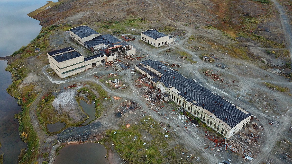
The abandoned site of the Kola superdeep borehole, Russia in 2020 (Image credit: Шелковников Евгений Анатольевич, CC-by-SA 4.0, via Wikimedia Commons)
From 1970 to the eventual abandonment of activity in 1992, drilling at Kola produced the deepest borehole on Earth, reaching 12,262 m into the crust, a record that remains unsurpassed to this day. Progress was painfully slow, averaging only 60 m per month. Drill bits would only typically last 7-10 m of drilling before wearing out. Once this happened, the entire 12 km drill string (weighing around 200 tons!) would have to be lifted from the hole allowing the bit to be changed. Wear on the pipes was such that the final 5 km of drilling required a total of 50 km of pipe!
Along the way the project came across unexpected lithologies, deep water saturated rocks (a discovery western scientists at first simple refused to believe), and unexpectedly high geothermal gradients. These latter contributed to the depth in the base of the hole reaching nearly 200°C at 12 km, meaning the basement behaved more like soft plastic than brittle rock, making further drilling almost impossible and leading to the abandonment of the project in 1992.
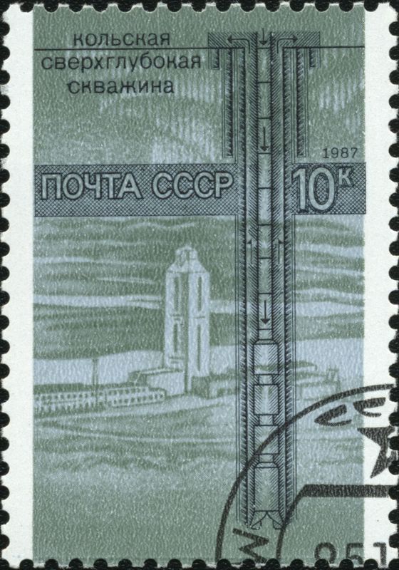
A 1987 USSR stamp commemorating the Kola Superdeep Borehole (Image credit: Scanned and processed by Mariluna, public domain via Wikimedia Commons)
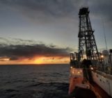
As the experiences of Soviet scientists at Kola show, drilling another 20 km to reach the mantle on land would be nigh on impossible. Instead, it looks like our best bet would be to target the comparatively thinner oceanic crust and drill to the mantle at sea. So, how do they do that? The simple answer is using a drill ship. Another simple answer is with difficulty! Drilling at sea is as nightmarishly complicated at it sounds, with all the problems of continental deep drilling plus a few added extras. As at Kola, a “drill string” – essentially a long series of metal pipes ~ 10-20cm in diameter – is lowered through several km of water to the seafloor and either hammered into soft sediments (advanced piston coring, APC – the mainstay of many oceanic sediment records) or rotated with a drill bit to core into hard rocks. Keeping the boat in position over the hole while floating far above is not an easy matter and requires what’s known as dynamic positioning. In the early days this was achieved by means of 6 submerged buoys which would ping allowing the ship’s operators to determine its correct position, equidistant to each, using sonar. In modern ships sonar and buoys have been replaced by GPS and multiple directional thrusters on the underside of the ship.
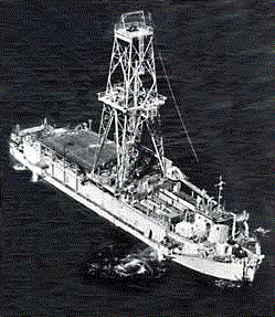
The CUSS I drilling ship used during the original project MOHOLE (Image credit: public domain, via Wikimedia Commons)
The earliest project to drill to the mantle was named Project Mohole and predates the Kola drilling operation. Conceived in the early 1960s as an attempt to drill to the Mohorovičić discontinuity – a marked discontinuity on seismic profiles thought to mark the transition between crust and mantle – in the Pacific Ocean, the project is perhaps more important for its legacy than its direct achievements. Having secured Nation Science Foundation funding, the project scientists adapted a drilling barge named CUSS I for deep sea drilling, including the buoy-based positioning system mentioned above. Drilling commenced in 1961 of the Mexican island of Guadaloupe in 3600 m of water. The whole endeavour had shades of an Earth-bound space race, particularly following rumours of a similar Soviet project – what would become Kola (indeed the US project also spurred the USSR into action). As a case in point of the intense interest and excitement in the project, the great American novelist John Steinbeck was onboard for the first drilling attempts and documented these in a piece for Life Magazine in April of that year. (This is well worth a read here, if only for the strange incongruity of reading John Steinbeck writing about Earth Science, interspersed with Marlboro adverts and appalling looking recipes for party food).
When measured against the hugely ambitious aims of the project in its original conception, the actual achievements in terms of metres may appear somewhat modest. The deepest of the 5 holes drilled reached 183 m beneath the seafloor and penetrated 13 m into basalt of the uppermost oceanic crust. However, although nowhere near the 6000 m of drilling needed to reach the Moho and mantle, the efforts were hugely important in their own right but particularly for their ongoing legacy.
At the time, the notion of drilling in deep water in an unsupported vessel was astounding and only made possible by the ground-breaking dynamic positioning system pioneered on CUSS I. Prior to Mohole, oceanographers had only sampled the very upmost layer of deep sea sediments. Even before the dissolution of the project other branches had begun to organise a program of deep sediment coring, laying the foundations for what the vast majority of our climate records in deep time rest on. Eventually these and other efforts coalesced in the Deep Sea Drilling Project (DSDP) and its descendants the ODP and IODP.
Project MOHOLE and following DSDP expeditions proved that the oceanic basement was young basalt, confirming seismic models and the theory of plate tectonics. They also unearthed pillow basalts intermingled with deep sea sediments, thereby established a genetic link with ophiolites and ultimately leading to the Penrose model for oceanic crustal structure and the subsequent mutual development of understanding through a combination of oceanic drilling, seismic profiles and ophiolite studies.
Today it might seem we are further from reaching the mantle than we were in 1960. However, there have been major strides in the intervening 60 years. We have now drilled deep (>2km) into the oceanic crust, yielding crucial new insights into its chemistry, structure and variability and driving the technical developments necessary for further record breaking depths to be achieved at sea (see Michibayashi et al., 2019 for a good overview). For those of us that dream of seeing a successful new attempt at a MOHOLE, that hope rests ultimately on political and public willingness to fund such an attempt and to accept the inevitable failures along the way. We have recently seen moves towards a new generation of space exploration, it would be fantastic to see that enthusiasm matched for what lies deep beneath our feet.
References
White W. M. (2015) Isotopes, DUPAL, LLSVPs, and Anekantavada. Chem. Geol. 419, 10–28. http://doi.org/10.1016/j.chemgeo.2015.09.026
Emmermann, R., & Lauterjung, J. (1997). The German continental deep drilling program KTB: overview and major results. Journal of Geophysical Research: Solid Earth, 102(B8), 18179-18201. https://doi.org/10.1029/96JB03945
Ganchin, Y. V., Smithson, S. B., Morozov, I. B., Smythe, D. K., Garipov, V. Z., Karaev, N. A., & Kristofferson, Y. (1998). Seismic studies around the Kola superdeep borehole, Russia. Tectonophysics, 288(1-4), 1-16. https://doi.org/10.1016/S0040-1951(97)00280-1
Osadchy, A. (2002). “Legendary Kola Superdeep”. Наука и жизнь (Journal of Science and Life) (in Russian). https://www.nkj.ru/archive/articles/4172/
Alan Bellows (2006) The Most Boring Story Ever Told [Online]. Damn Interesting, 20 June 2006. https://www.damninteresting.com/the-deepest-hole/
Steinbeck, J. 1961. High drama of bold thrust through ocean floor: Earth’s second layer is tapped in prelude to Mohole. Life, April 14, 1961, 110–121. https://books.google.com/books?id=9lEEAAAAMBAJ&pg=PA110
Michibayashi K., Tominaga M., Ildefonse B. and Teagle D. (2019) What Lies Beneath: The Formation and Evolution of Oceanic Lithosphere. Oceanography 32, 138–149. https://doi.org/10.5670/oceanog.2019.136
Pingback: Proyecto Mohole: la loca, loca historia del pozo más profundo de la historia que jamás llegamos a perforar - ISV
Pingback: Proyecto Mohole: la loca, loca historia del pozo más profundo de la historia que jamás llegamos a perforar