This blog post is part of our series: “Highlights” for which we’re accepting contributions! Please contact one of the GM blog editors, Emily (emily.bamber@utexas.edu) or Emma (elodes@asu.edu), if you’d like to contribute on this topic or others.
by Emma Lodes, Postdoctoral Researcher, Arizona State University, USA
Email: elodes@asu.edu
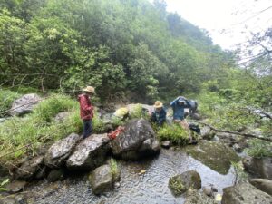
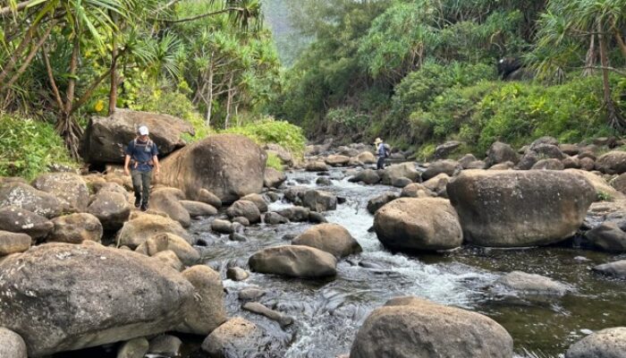
I stood knee-deep in the middle of the stream, sopping wet from head to toe. Thick vegetation drooped under the impact of the rain around me, obscuring the route we had taken bushwhacking down the steep riverbank.
It wouldn’t stop raining. Well, it would stop for a moment, and I would slip the Ziplock bag (an attempt at rain protection) off the laser rangefinder and leap into action, shooting the laser at the reflective target Annie held in channel upstream, one of many length and inclination measurements needed to measure the river’s longitudinal profile. Meanwhile, Nick would rip the waterproof cover off his DSLR and photograph the boulder bar adjacent to the channel for Structure from Motion photogrammetry, while trying not to slip on the boulders’ slippery surfaces. We were on Maui, Hawaii, in Honoloa stream, on the rainy side of the island. That morning, we had woken up in the dry and dusty heat of the dry side of the island, only a 30-minute drive away.
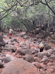
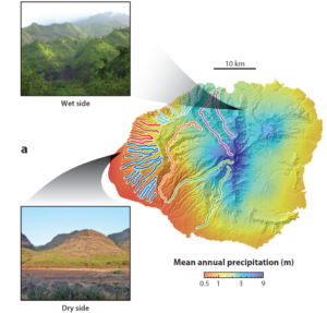
Such is the rainfall gradient on the Hawaiian Islands – the northern side is rainy, with nearly nine meters of rain per year, while the southern side is dry with less than 0.5 meters per year. Built by magma rising from a stationary hotspot below the slowly migrating Pacific oceanic plate, the islands are composed of stacked basaltic volcanic flows and increase in age towards the northwest. Maui is the second-youngest major Hawaiian island at ~1 million years old after the island of Hawaii (which is currently volcanically active) and Kauai, our previous destination, is the oldest island at 4-5 million years old. Relatively homogenous bedrock and a dramatic climate gradient make the Hawaiian Islands an ideal location to study how climate impacts river incision and landscape evolution. Deep canyons, cut radially into the flanks of the islands, are choked with large boulders, some of which appear to be relatively immobile – are these boulders shielding the riverbeds from river incision?
We were in Hawaii for a month last summer as part of an NSF (the U.S. National Science Foundation) – funded project incorporating researchers from Arizona State University, University of Idaho and Purdue University. We visited as many catchments as we could on Kauai and Maui, with a wide variety of mean annual precipitation, with the goal of understanding how precipitation and large boulders have influenced river incision over time. Our hypothesis is that canyon cutting by rivers was initially rapid and slowed down over time. Geologic evidence supports our hypothesis: on Kauai, kilometer-deep canyons contain lava flows that entered the canyons over two million years ago and are still currently at river level, indicating that these canyons were cut during the first half of the island’s history and have not incised further during the last two million years. Very few of these inset lava flows have been dated, so we collected several more for argon-argon geochronology.
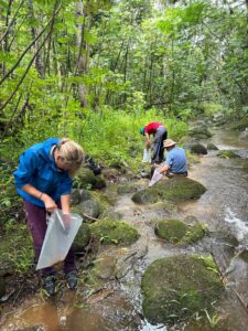
But why did the streams stop incising? Could the large boulders we observe in Hawaii’s modern canyons be acting as thresholds, preventing Hawaii’s streams from incising further? To find out, building a model based on field data is necessary. We measured the size and protrusion of boulders in every stream we visited, and will use these data — together with discharge and channel morphology data — to calculate the shear stress necessary to mobilize the boulders in a flood. We also collected samples of stream sediment to quantify modern catchment average erosion rates and find out if modern erosion rates vary with climate or with volcano age, using a novel cosmogenic nuclide method, chlorine-36 in magnetite.
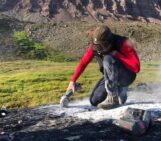
Of course, collecting field data is always messy, and using technology to collect data requires caring for the instruments, which can be tricky in the field. The original plan included flying a drone to collect Structure from Motion data (photographs) for entire channel reaches, but because of connectivity issues we lost the drone on the second day. As the drone flew upstream over our heads, enjoying the last flight of its life, ash rained down on our heads from a nearby wildfire. Without cell reception we hadn’t received the evacuation notice and hiked out after a quick and unsuccessful search for the wayward drone. We returned to the same catchment weeks later only to be stalked by wild bulls hiding in the dry brush, and on our way out were greeted by locked gates at every possible exit, causing us to wait hours for our heroic key-wielding rescuers. At another stream on the rainy side, I managed to lose electronic data simply by walking waist-deep into a river with a caseless iPhone in my pocket! And after spending a full day driving deep into Waimea Canyon, a relatively harrowing trip that included over ten river crossings, it appeared that the lithium battery in our laser rangefinder was dead and I had forgotten to bring a backup.
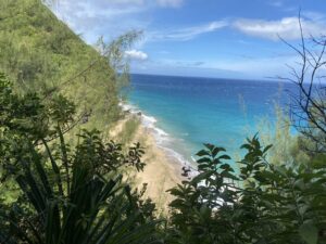
On the other hand, accessing Hanakapiai stream on Kauai’s Na Pali coast was spectacular: sheer, verdant cliffs, accordioned into delicate crenulations and adorned with maroon flowers, drop below the trail to the brilliantly blue ocean, while the wind tries with all its might to toss you off the trail. On Maui, we took a day to hike ten miles through the Mars-like Haleakala crater, and star gazed on the unbearably freezing and windy summit before returning to balmy sea level where we were camped on the beach.
But for now, I’m running around a basement chemistry laboratory, attempting to separate magnetite minerals. Next year we’ll return to the islands with preliminary data in hand, an updated game plan, and better shoes for walking on wet, mossy boulders without falling. If all goes well, this project will lead to new understandings of whether large boulders act as thresholds for river incision on the Hawaiian Islands in different climate zones, which will have implications for other landscapes around the world. Geomorphology is many things, but rarely boring!

