This blog post is part of our series: “A day in the life of a geomorphologist” for which we’re accepting contributions! Please contact one of the GM blog editors, Emily or Emma, if you’d like to contribute on this topic, or others.
by Gerald Raab, Postdoctoral Fellow, Dalhousie University in Halifax, Canada
Twitter: @gr_science | Email: gr.science@gmx.at
Chasing landscape chronometers
Somehow, I feel like I am still a hunter, despite humanity’s long history. And although my prey has changed, it remains exciting and dangerous. To chronologically classify landscape developments using modern geochronological methods, I track rare isotopes and geochemical signatures across mountains. Besides ordinary modern daily office routines, e.g., corresponding to e-mails, my workday typically constitutes a mix of fieldwork, lab work, data processing, writing manuscripts/proposals, reading articles, or just plain thinking. Some of these tasks are very analogous across disciplines (e.g., reading and writing), yet some of these terms can have a very different meaning among geoscientists. In example, “lab-work” is undefined; it can mean working on computational imaging, using sandboxes, building new field equipment, extracting isotopes, calibrating instruments, and so much more.
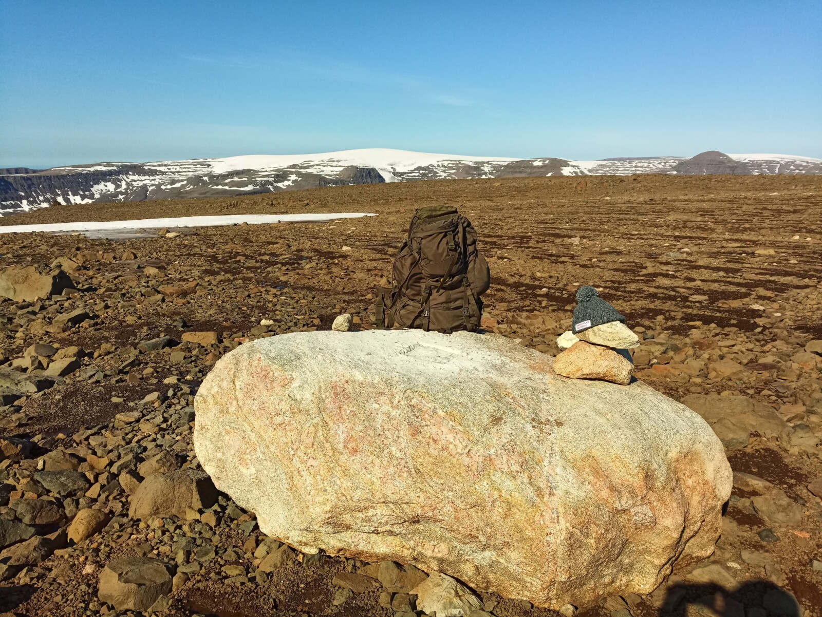
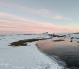
Fig.1: Erratic boulder on a selected mountain top in Greenland.
For perspective, you can imagine one of my last investigations as follows: After traveling for roughly one week to reach our location of interest, we battled the harsh weather conditions of the arctic. Finally, the sky was clear and we could seize the day to explore and gather samples from remote locations with the objective of uncovering their glacial history. Starting from sea level, we climbed the ~850 m high peak and mapped the largest granitic boulders, which heavily contrasted with the mafic bedrock under our feet (Fig.1). These so-called erratic boulders were once transported by ice before being deposited thousands of years ago. Erratic boulders are special because they allow a direct retracing of glacial movements back to their source of origin.
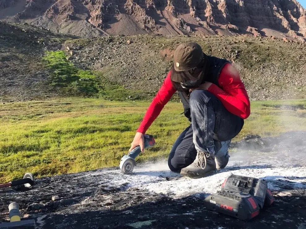
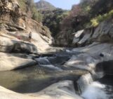
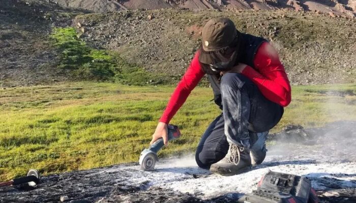
Fig. 2: Hard labor, cutting out the upper few centimeters of the rock surface will allow the determination of the deposition time
Yet, before we could derive any results, we had to first take our samples. With the help of diamond bladed electrical saws, hammers, and chisels, we collected about two kilograms of rock of the upper few centimeters of the erratic boulders’ surfaces (and of course made rigorous field notes) (Fig. 2). After climbing down with our weighty backpacks (+35 kg), we enjoyed the majestic icebergs (Fig. 3) passing along the coastline and prepared for our departure – back to the laboratory!
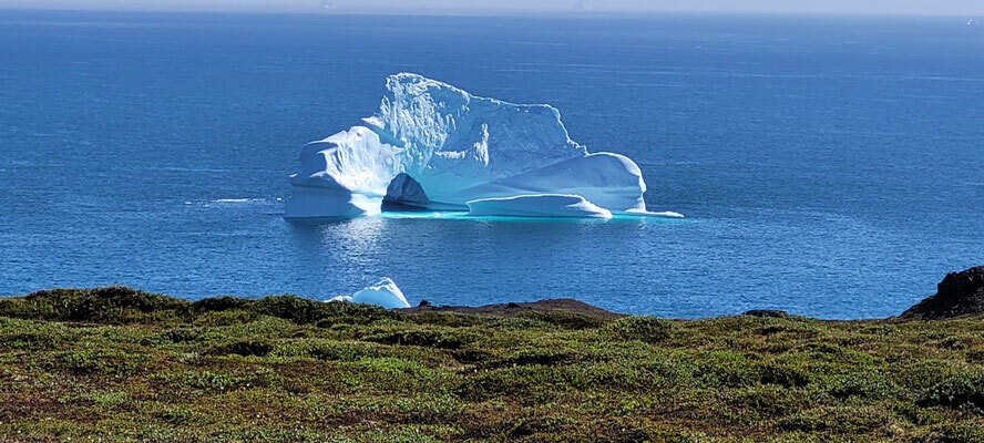
Fig. 3: Iceberg!
I hope you are now as excited as I always am after returning from a sampling campaign. I can’t wait to start working on these samples and to see what stories I can uncover! How valid are our hypotheses? Do we change history books, or can we confirm the known? Be patient, we must wait. Actually, we waited several months, until the samples arrived by sea cargo, a wonderful time to recapture field impressions and get the laboratory ready. Once the samples were in the lab, we followed our strict sample processing protocol to ensure quality results. I don’t want to bother you with the details of target chemistry (Fig. 4) to extract these terrestrial cosmogenic nuclides from our target mineral quartz.
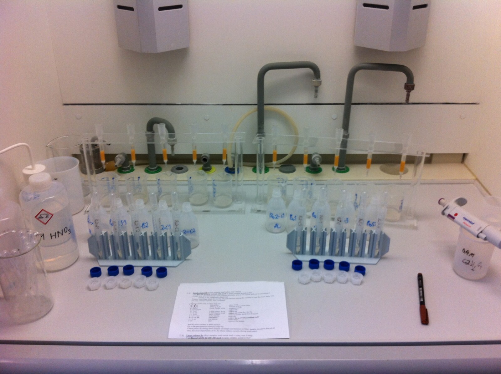
Fig. 4: Impression of one of our target chemistry steps.
However, if you are interest in the method or just to chat about research, join our session (GM 2.4 “What’s new with cosmogenic nuclides? Technique developments and applications of cosmogenic nuclides” – https://meetingorganizer.copernicus.org/EGU24/session/48024) or our short course (SC5.9: “Applications of cosmogenic nuclides to study Earth surface processes and landforms” –https://meetingorganizer.copernicus.org/EGU24/session/49432).
Hurray, after a few months in the laboratory, we did it! We finally extracted one of our isotopes of interest (Fig. 5). Just some final preparations for measurement by the accelerator mass spectrometer (which basically counts atoms), a few computations of the results, and presto – we have a surface exposure age (of some kind). Yet, having numbers is useless unless we can bring them into context. In example, “How well do the erratic boulder ages fit to our current understanding of deglaciation chronology?” and “What other field evidence supports our findings?” I want to stretch how important it is to combine quantitative data with qualitative descriptions to reach a holistic understanding of surface processes. In the case of this arctic field study, we do not have final conclusions yet, as the contextual phase is currently still filling my days before I prepare for another “hunting season”.
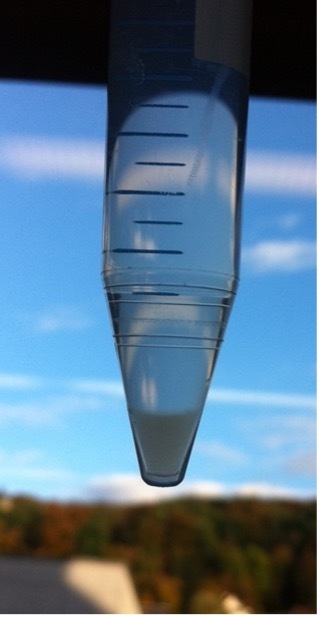
Fig. 5: This tiny little tube tip holds what I am after, – 10-Beryllium.
PS: Where is the danger in my work, you might ask? Well, working in remote areas inherently has a certain risk, and handling very toxic chemicals (e.g., hydrofluoric acid) on a regular basis also keeps you on alert in the lab.
Did you enjoy this blog post? This blog post is part of our series: “A day in the life of a geomorphologist” for which we’re accepting contributions! Please contact one of the GM blog editors, Emily or Emma, if you’d like to contribute.