Sea-level change serves as a direct indicator of climate change with profound implications for coastal areas. Since 1900, the global mean sea level (GMSL) has risen over 20 cm, leading to beach erosion, delta inundation, and increased flooding worldwide. Over glacial cycles spanning tens of thousands of years, interactions between ocean and continental-scale ice sheets can cause GMSL to fluctuate ...[Read More]
Calculating postglacial sea-level change within few seconds: a statistical emulator for GIA
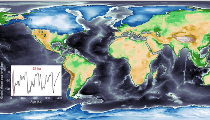
Figure 1. Map of the global ice sheet and topography during the Last Glacial Maximum. Areas with dark green colour indicate land created by sea-level lowering. Figure courtesy of J. Austermann; Dendy et al., 2017.