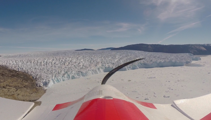
The use of drones or Unmanned Aerial Vehicles (UAVs) is one of the most exciting development in glaciology in recent years. The picture was taken during fieldwork conducted in the summer of 2014 by Johnny Ryan and colleague Nick Toberg. The aim was to survey Store Glacier once a day using a fixed-wing UAV, that was equipped with a digital camera, which took photos every two seconds during its dangerous 40 km sortie over the glacier.
The project was a joint project between Aberystwyth University and the University of Cambridge, and the data provided insights into the process of calving and the interplay between the glacier and sea-ice mélange that forms during the winter and breaks up in late spring.
Read Johnny’s exciting blog post about the whole field season here.
Results from the study has been published in the The Cryosphere earlier this year.

Pingback: Cryospheric Sciences | Image of the Week — Looking for ice inside a volcano !