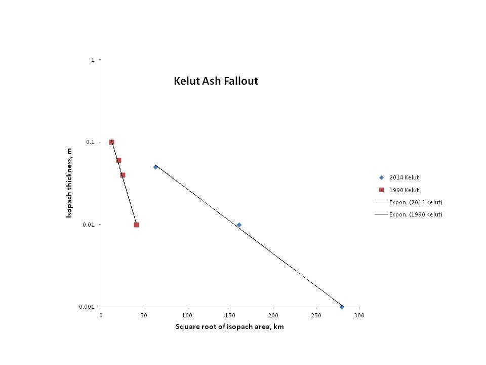
Preliminary ash thickness – isopach area plot for the February 2014 Kelut eruption. 1990 data from Bourdier et al., 1997 (not all proximal data are plotted).
The dramatic eruption of Gunung Kelud, or Kelut, led to a flurry of images of ash appearing on many social media platforms, including Flickr, Instagram and Twitter. As an experiment in a volcanology class, we sought out images that we could locate on a map, and by classifying the ash deposits as ‘light’, ‘moderate’ or ‘heavy’, generated a very rough contour map of the ash fallout from the eruption. The data show, very crudely, an exponential decay of ash thickness away from the volcano, and allows us to estimate the amount of ash deposited across Java during the eruption. Our current estimate is that the eruption may have deposited the equivalent of 0.2 – 0.3 cubic km of magma across the region. There are considerable uncertainties in this value, but it does confirm that the 2014 eruption was indeed substantial, rating as a Magnitude 4 (VEI 4) event.
Fuller details can be found in a preliminary report: Ash fallout from the 2014 Kelut eruption.


asamuratpenyakit315
Terimakasih infonya gan … http://goo.gl/NcaM1B
Pingback: Kelud, Before and After the EruptionAny News from Everywhere