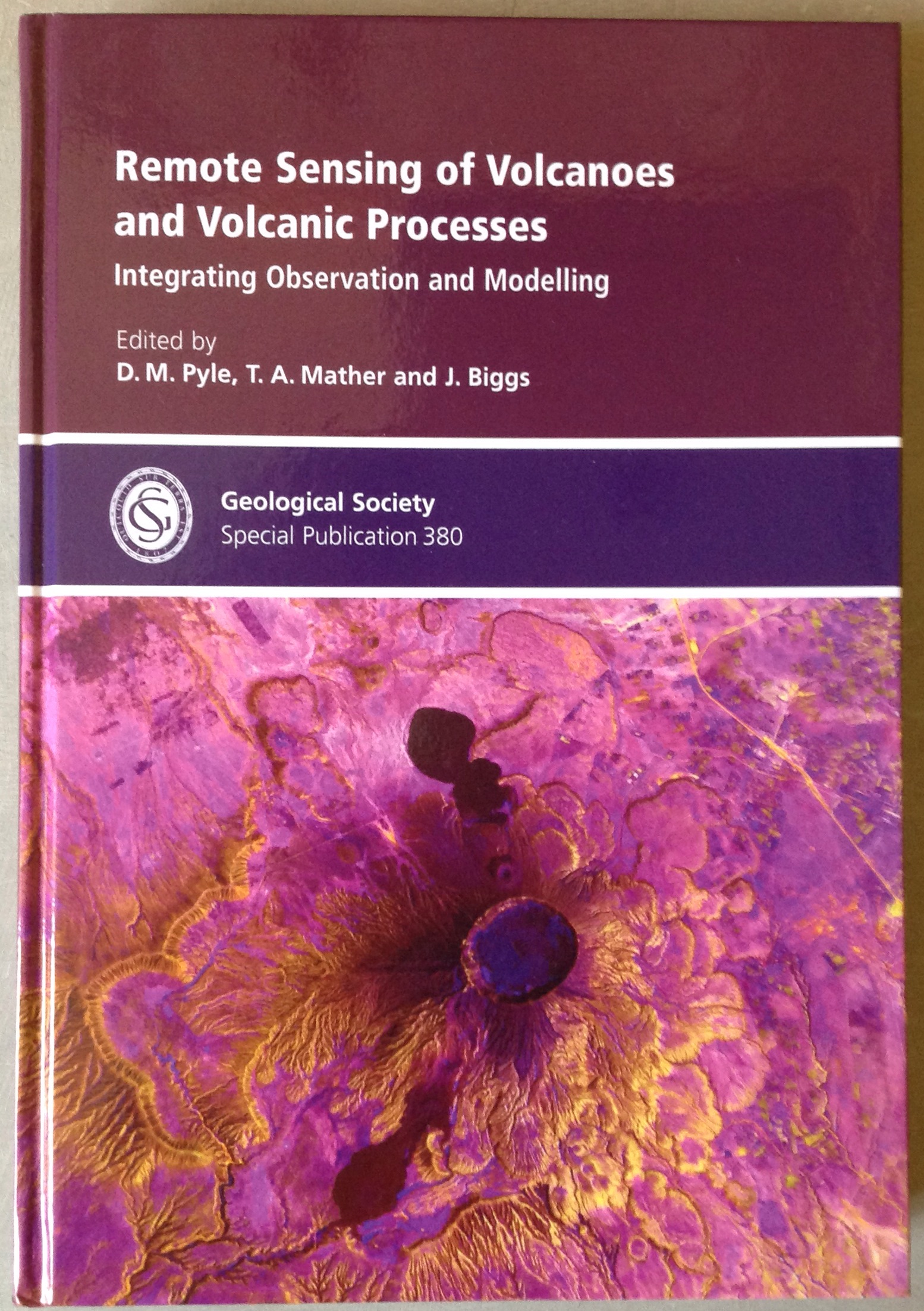
The spectacular front cover of the Geological Society of London Special Publication 380 – with many thanks to Elspeth Robertson and ESA for this SPOT5 image of Longonot volcano, Kenya.
A major goal of volcanological science is understand the processes that underlie volcanic activity, and to use this understanding to help to reduce volcanic risk. Advances in instruments and techniques mean that scientists can now measure many different aspects of the behaviour of restless or active volcanoes, including seismicity (to detect magma movement at depth, for example); deformation (often reflecting pressure changes at depth); and emissions of heat and gas. With the exception of seismicity, which requires sensitive instruments placed close to the volcano, many of these measurements can now be made remotely using instruments on board satellites or aircraft.
Remote-sensing techniques have transformed our capacity to detect, monitor and measure volcanic activity worldwide. In the past 35 years, applications have moved from the first satellite remote-sensing observations of the rise and spread of a volcanic plume and volcanic gases from an explosive volcanic eruption (the April 1979 eruption of the Soufriere of St Vincent in the Caribbean); to the current situation where constellations of satellites are used to provide routine monitoring of volcanic gas emissions, volcanic hotspots and volcano deformation. As well as dramatically improving our ability to monitor the progress of volcanic eruptions, these techniques also help us to understand better how volcanoes work by providing long-term data on what happens at volcanoes when they are not erupting; and by making it possible to compare the behaviour of different volcanoes in ways that are simply not possible from the ground, or with ground-based observations.
In a new Geological Society of London Special Publication, we have brought together a selection of papers that give a broad perspective of the current state of the art in the remote sensing of volcanoes and volcanic processes. The 14 papers in the volume focus on the observation, modelling and interpretation of satellite-remote sensing of volcanoes: from surface deformation, to thermal anomalies, gas fluxes and eruptive plumes. Many of the papers take a broad perspective, reviewing current techniques and applications, or demonstrating the potential to investigate volcano behaviour and volcanic activity at regional to global scales. Papers in the volume also show the ways in which people are now trying to go from these observations to a deeper understanding of underlying processes, by integrating observations with theoretical models and computer simulations of volcano behaviour; and then to use these insights to advance the potential for eruption forecasting. We hope that this Special Publication will find a wide and appreciative audience out there!

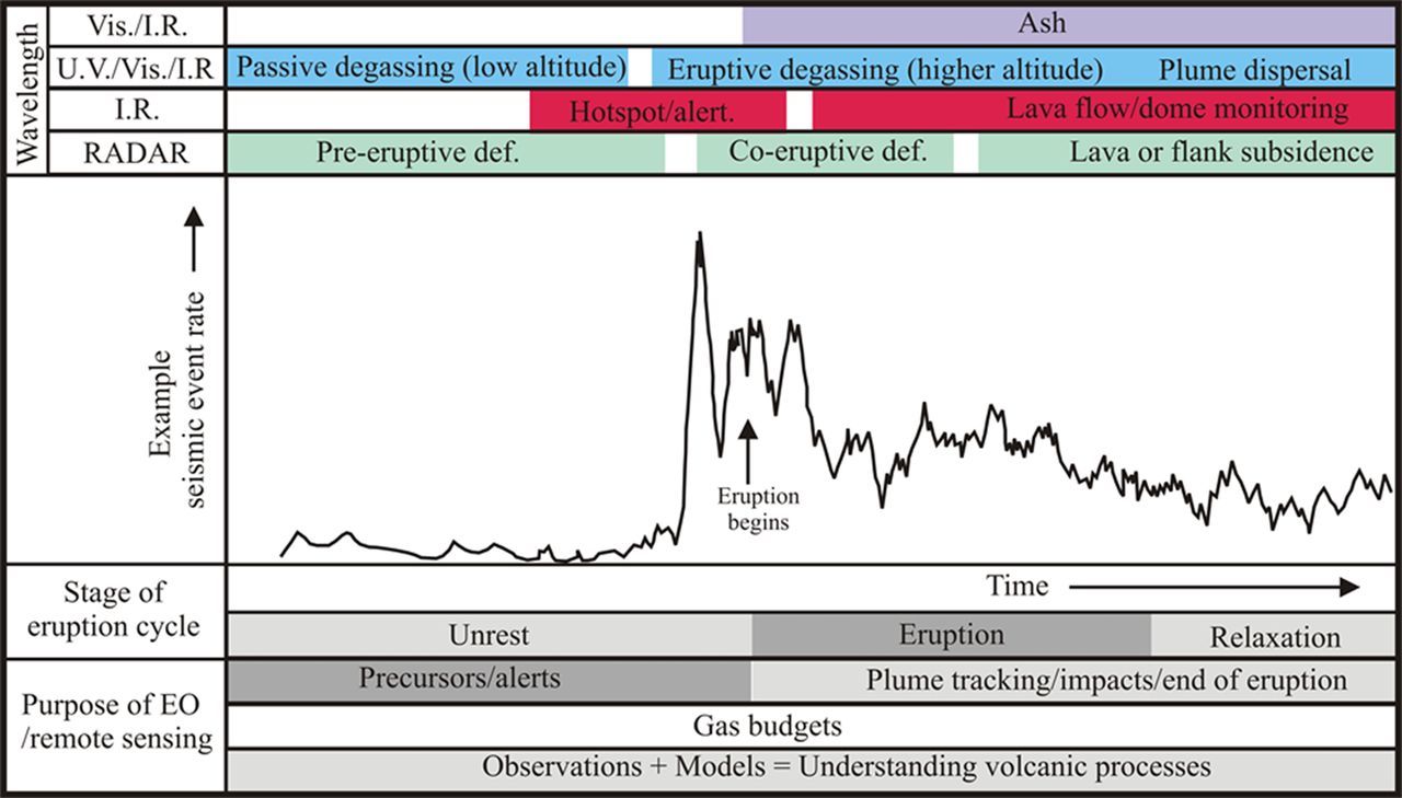
An illustration of some of the applications of remote-sensing techniques to a volcano through a hypothetical eruption cycle, across wavelengths ranging from the Infrared (I.R.), through the Visible (Vis.) and Ultraviolet (U.V.), to radar (ca. 2.5 – 30 cm in volcanic applications). Earth Observation (EO) techniques now allow the detection and analysis of a spectrum of different aspects of volcano behaviour at both non-erupting and erupting volcanoes. From the introduction to the Geological Society Special Publication 380 (Pyle et al., 2013). The seismic event rate trace is schematic, but based on observations at Mt St Helens in March – May 1980.
Editing a volume of this scale requires a lot of support from a lot of people. On behalf of the editors (Tamsin Mather, Juliet Biggs and myself), we would like to thank the authors of all of the contributions for their hard work and for entrusting their manuscripts with us; we would like to thank the very many reviewers who selflessly gave up their time to provide the feedback and constructive criticism of the papers that is the key part of the peer-review process; and we would also like to thank the staff of the Geological Society’s Publishing House, and in particular Angharad Hills, Tamzin Anderson and Hannah Sime, who shepherded this v0lume from start to finish, and who have turned our initial idea into such a wonderful physical volume. Finally, and on behalf of all of the authors, we would like to acknowledge the many individuals, institutions and agencies who have provided the facilities, funding, imagery and datasets which have underpinned all of this work.
Reference
Pyle DM, Mather TA, Biggs J (eds) 2013. Remote sensing of Volcanoes and Volcanic Processes: Integrating Observation and Modelling. Geological Society, London, Special Publications, 380. ISBN 978-1-86239-362-2.
The volume is available to subscribers through the Geological Society’s Lyell Collection, and can be purchased via the Geological Society’s online Bookshop.
Abbreviated contents list (the full list is available via the Lyell collection):
Pyle, DM et al. – Remote sensing of volcanoes and volcanic processes: integrating observation and modelling – introduction (Free content)
Ebmeier, SK et al. – Applicability of InSAR to tropical volcanoes
Wauthier, C et al. – Nyamulagira’s magma plumbing system inferred from 15 years of InSAR
Aoki, Y et al. – Magma pathway and its structural controls at Asama volcano, Japan
Segall, P – Volcano deformation and eruption forecasting
Blackett, M – Review of the utility of infrared remote sensing for detecting and monitoring volcanic activity
Zaksek, K et al. – Constraining the uncertainties of volcano thermal anomaly monitoring using a Kalman filter technique
Jay, JA et al. – Volcanic hotspots of the central and southern Andes as seen from space by ASTER and MODVOLC, 2000 – 2010
van Manen, S et al. – Forecasting large explosions at Bezymianny volcano using thermal satellite data.
Hutchison, W et al. – Airborne thermal remote sensing of the Volcan de Colima lava dome from 2007-2010
Carn, SA et al. – Measuring global volcanic degassing with the Ozone Monitoring Instrument
McCormick, BT et al. – Volcano monitoring applications of the Ozone Monitoring Instrument
Grainger, RG et al. – Measuring volcanic plume and ash properties from space
Pieri, D et al. – In situ observations and sampling of volcanic emissions with NASA and UCR unmanned aircraft


