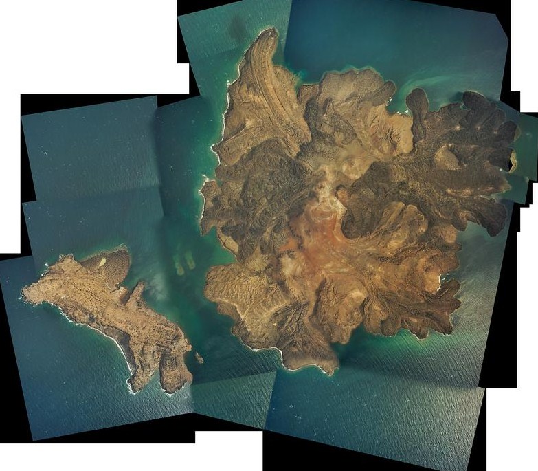
A glimpse of the spectacular Kameni or ‘burnt’ islands of Santorini, Greece from the air reveals in intricate detail the overlapping lava flows, explosion craters and fields of volcanic ash from which the islands have been built in successive eruptions over the past 2000 years, and more.

Air photo mosaic of the Kameni island of Santorini, based on images taken during a NERC Airborne Research and Survey Facility campaign in 2004, and published later in an open access paper (Pyle and Elliott, 2006). A high resolution (340 Mb) version of this image is now available from figshare.
Of course, what we can see from the air is just the literal ‘tip’ of the present-day volcano which has grown up within the flooded caldera of Santorini since the last major explosive eruption, the Minoan eruption of ca. 1600 BC. Historical records and accounts from as far back as the Greek geographer Strabo, suggest that there have been at least ten eruptions in and around the Kameni islands since 197 BC. It is quite likely that there have been more that either weren’t noticed (because they were underwater), or that have been forgotten about with the passage of time. The present day the Kameni islands have a volume of about 3 cubic kilometres (of lava), measured from the sea-floor, and must have grown up at an average rate of about 1 million cubic metres per year since the Minoan eruption.
Data sources.
The high resolution version of the composite aerial photograph of the Kameni islands is available to download from figshare,
http://dx.doi.org/10.6084/m9.figshare.928563
Link to the original paper: DM Pyle and JR Elliott, 2006, Quantitative morphology, recent evolution and future activity of the Kameni islands volcano, Santorini, Greece, Geosphere 2 (5), 253-268 [Open Access]
Related web pages and posts.
A blog post from August 2013 – ‘Santorini: a volcano in remission‘
Some web pages introducing the volcanic history of the Kameni islands.

Pingback: Growth of the Kameni Islands Volcano, Santorini, Greece | volcanicdegassing