If you are ever in Chile and have the chance to take a mid-morning flight south from Santiago towards Puerto Montt or Concepcion, make sure you try and book a window seat on the left hand side of the plane. Once the early morning cloud has cleared, you could be in for a treat as you fly along the ‘volcanic front’, with spectacular views of Chile’s brooding volcanoes popping up from the landscape. Be sure to take a map, too, so that you can work out which one is which. The pictures below are roughly in order, flying from north to south – and several major volcanoes of the chain aren’t included.
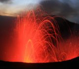
There are several things to notice about these volcanoes – they are often in pairs, either as distinct but closely spaced mountains (Tolhauca and Lonquimay), or as ‘twin peaks’ forming the summit of an elongated massif (e.g. Llaima, Mocho Choshuenco). Many of the volcanoes are also clearly very young structures – forming wonderfully characteristic conical shapes (e.g. Antuco, Villarrica, Osorno). These cones must be younger than 15 – 20,000 years (and perhaps much younger than this), based on what we know about when the last major glaciation in the region ended. These cones sit on top of the lower-relief and older parts of the volcanoes, many of which have been reshaped by caldera-collapse, perhaps shortly after the ice retreated during deglaciation. The accessibility of the volcanoes of the Southern Volcanic Zone of the Andes makes this a wonderful place to study volcanic processes and volcano behaviour, both at the scale of individual eruptions, as well on the regional scale.
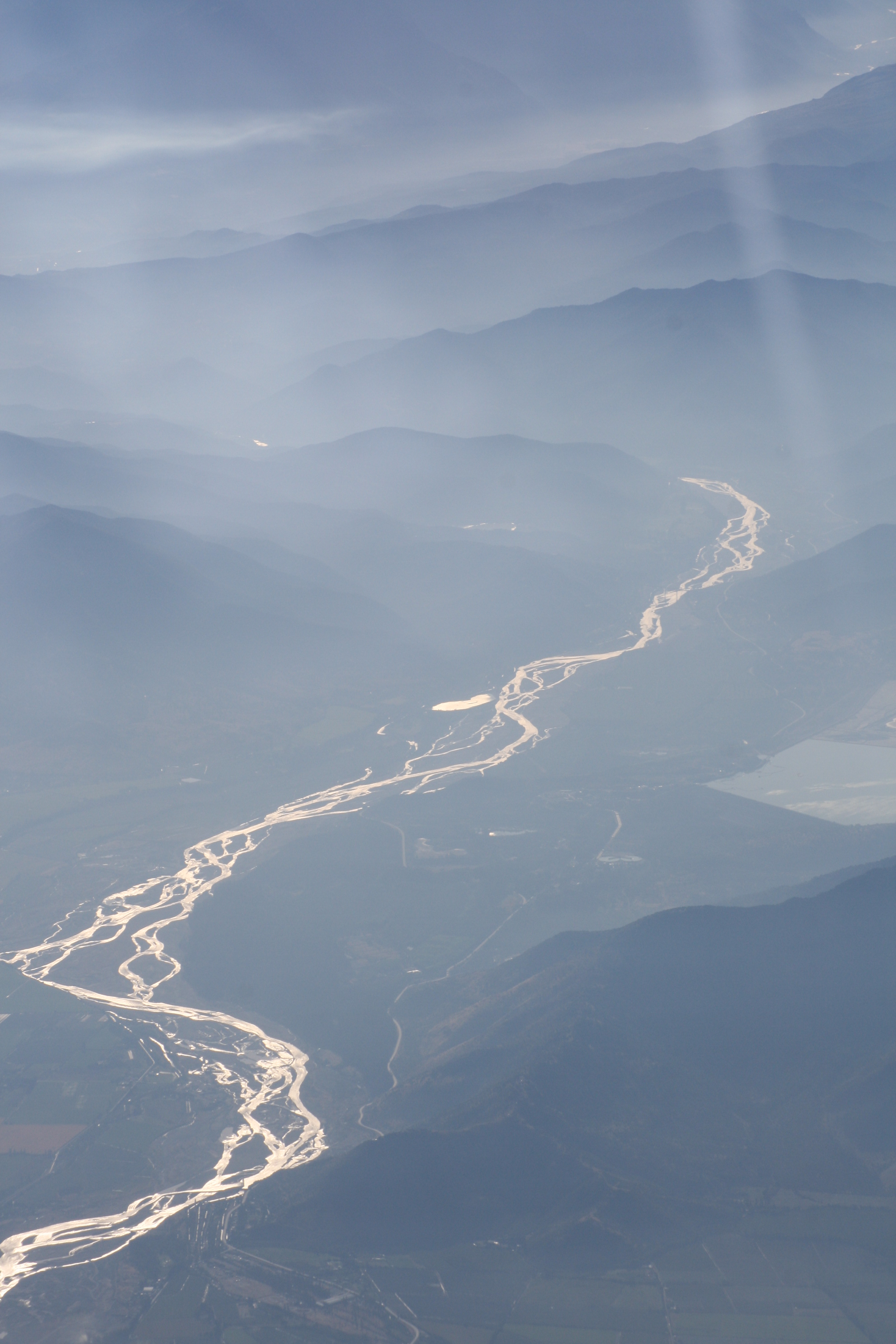
The river Cachapoal runs out of the Andes mountains, past the city of Rancagua
The saddle-shaped volcanic complex of Planchon-Peteroa (35.2 S), which last erupted in 2011.
The spectacular ice-filled summit crater of Descabezado Grande volcano, Chile, at 35.6 S. The last eruption from this complex was in 1932, shortly after an eruption of the nearby volcano Cerro Azul (or Quizapu).
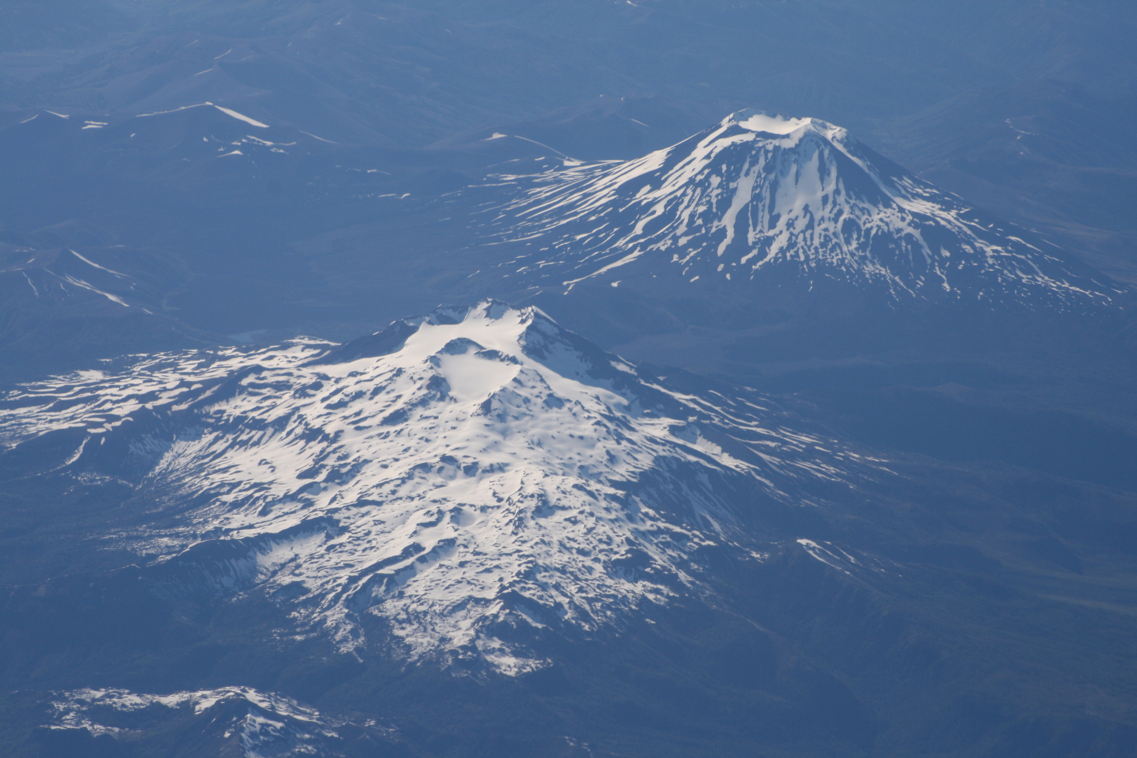
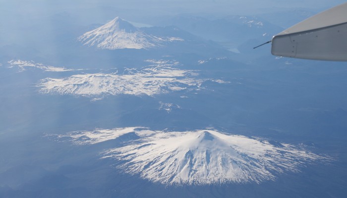
View across the volcanoes of Tolhuaca (or Tolguaca, near ground) and Lonquimay (38.3 S). Both volcanoes are young, but it is not known when Tolhuaca last erupted. Lonquimay last erupted from 1988-1990.
The young cone of Volcan Antuco, 37.4 S. Its last known eruption was in 1869.

Twin-peaked Llaima (38.7 S) is one of the most active volcanoes of southern Chile, and last erupted in 2009.

Volcan Sollipulli (39 S) has a spectacular ice-filled summit caldera, but is not thought to have erupted since the 18th Century
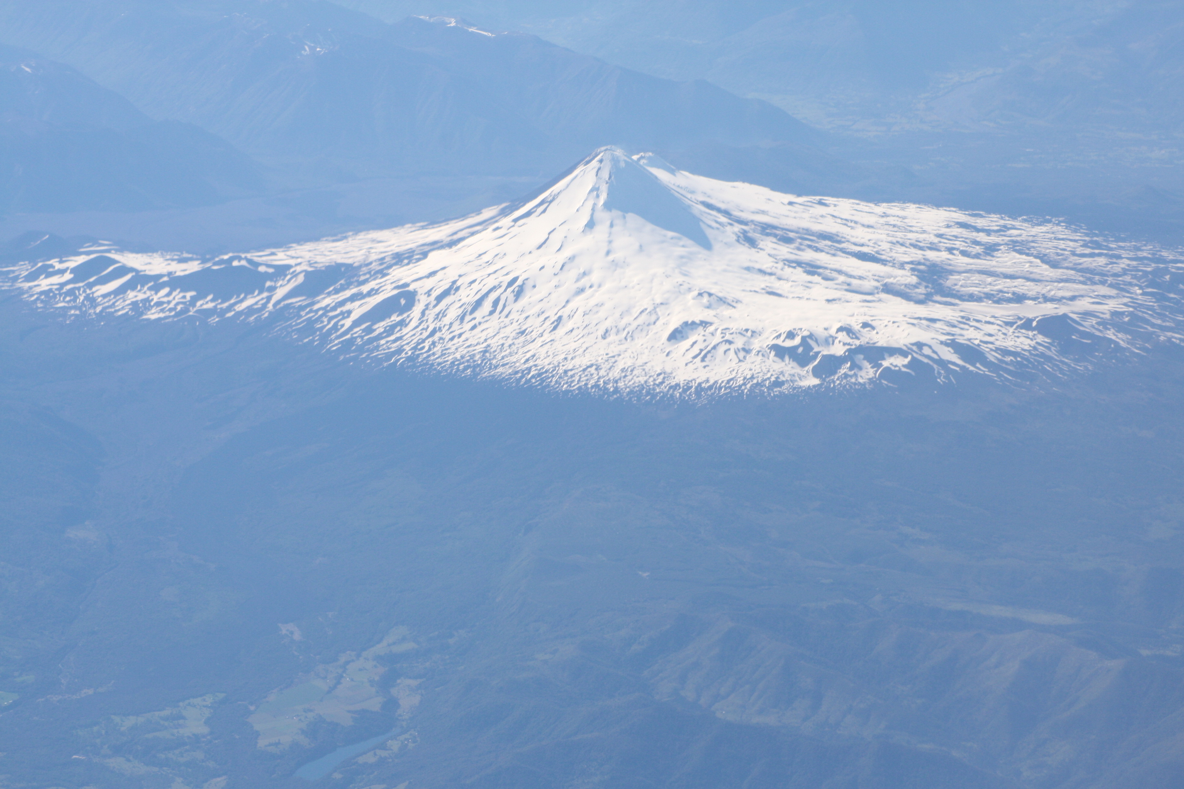
Panorama across three young volcanoes, looking east: Villarrica (39.4 S) in front; the snow-covered sprawl of Quetrupillan in the middle ground; and the peak of volcan Lanin, on the Chile – Argentina border, in the distance.

Villarrica, with a characteristic thin gas and aerosol plume rising from the open crater at the summit.
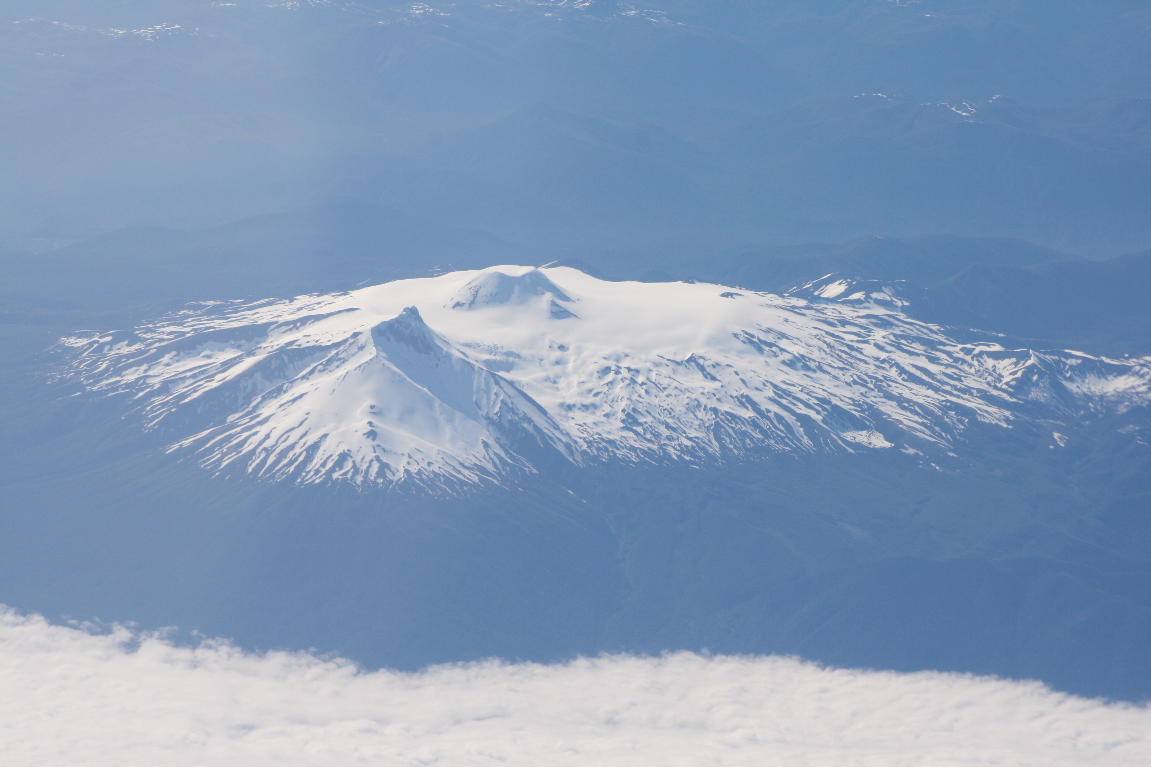
The twin-peaked volcanoes Mocho Choshuenco (39.7 S). Choshuenco, thought to be the older vent, is the angular crag nearer the camera; Mocho is the small cone in the middle of the summit plateau. Mocho last erupted in 1937.
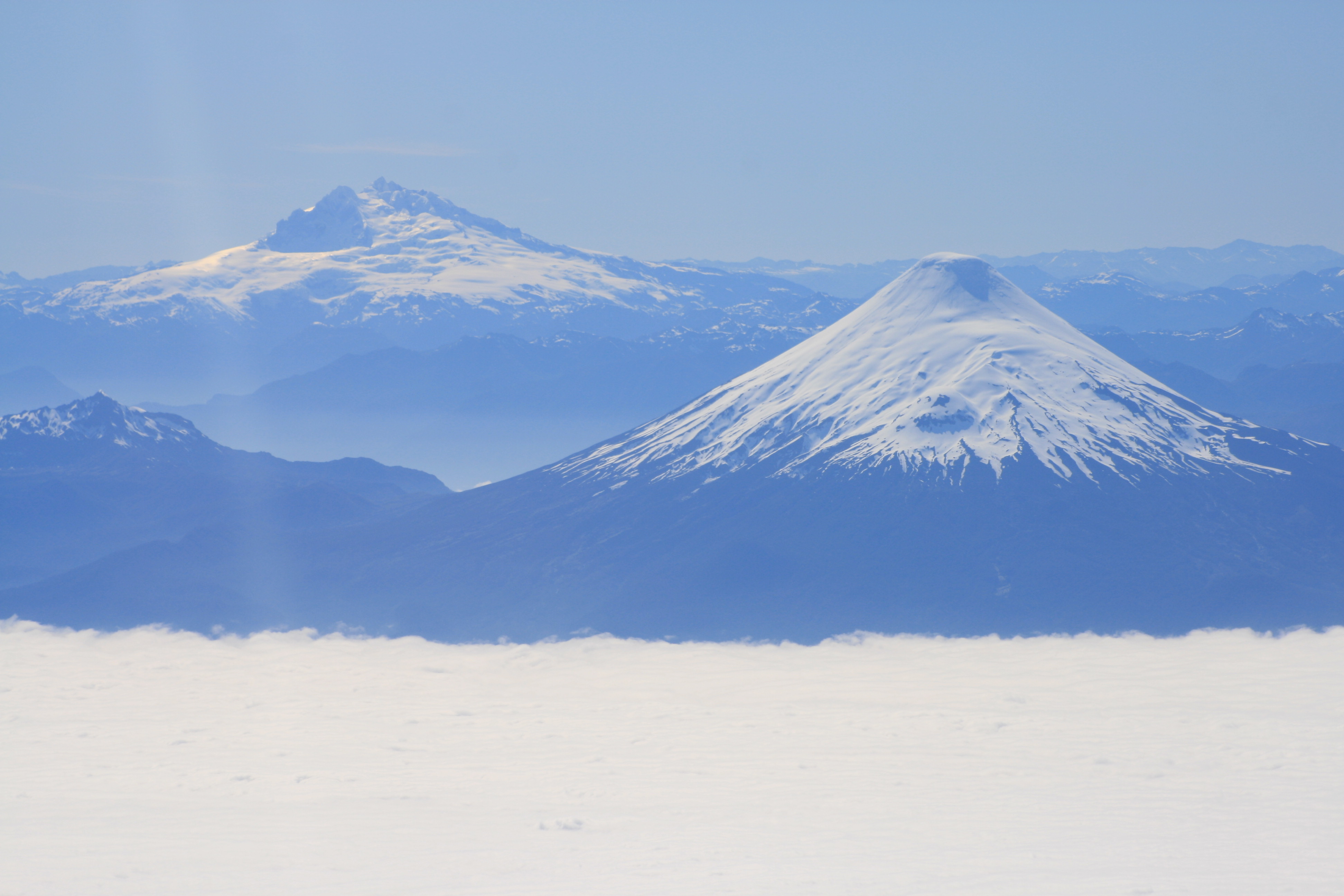
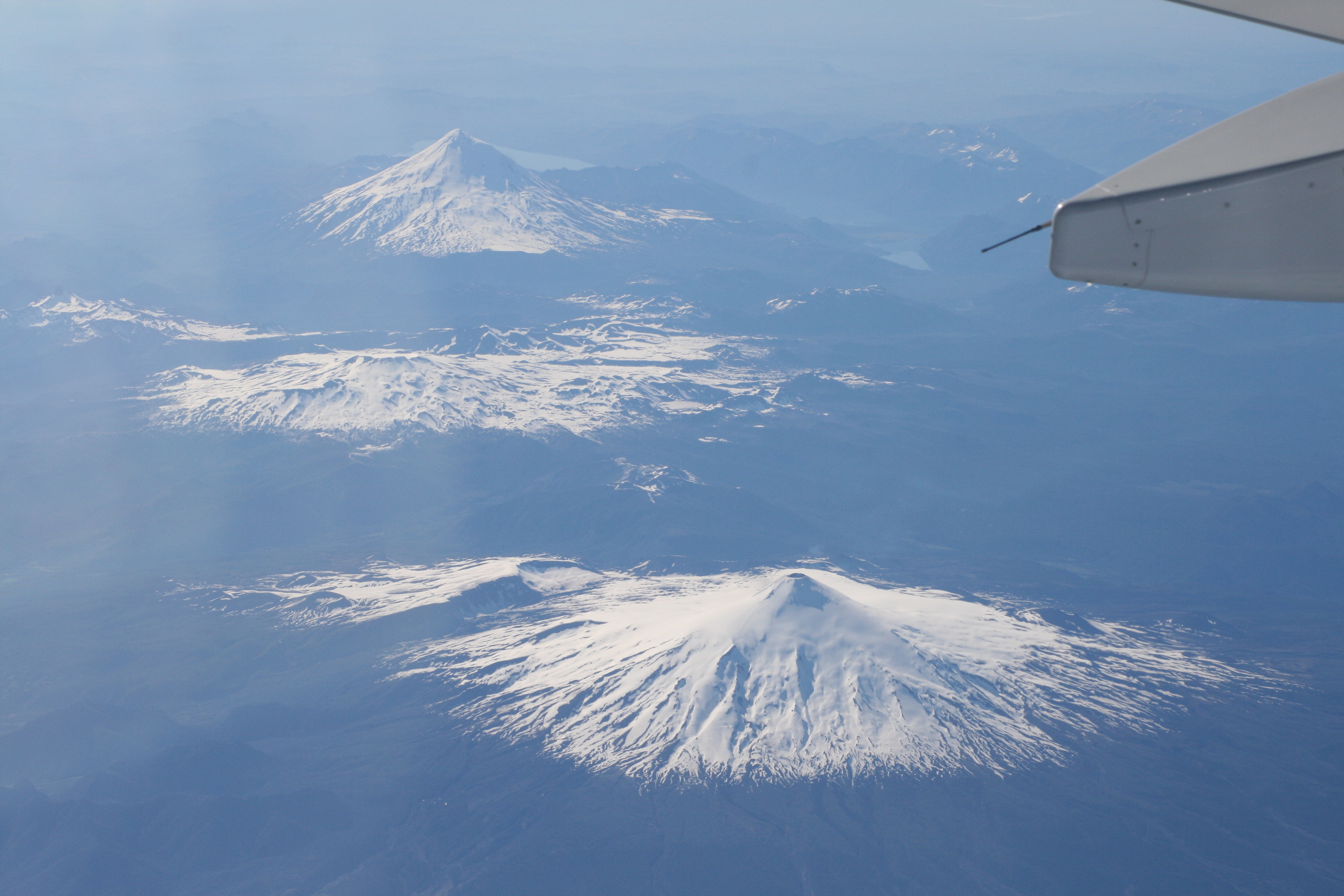
Looking across a bank of cloud towards volcan Osorno (front, 41.1 S), and volcan Tromen, in the background. Osorno last erupted in 1869; Tromen is thought to have last erupted in 1822.

Volcan Calbuco (41.3 S), which last erupted in 1972.
Data source: information on the recent eruptions of these volcanoes is all from the Smithsonian Institution Global Volcanism Project.
Further reading:
CR Stern, 2004, Active Andean volcanism: its geologic and tectonic setting. Revista geologica de Chile 31, 161-206 [Open Access].
SFL Watt et al., 2009, The influence of great earthquakes on volcanic eruption rate along the Chilean subduction zone. Earth and Planetary Science Letters, 277 (3-4), 399-407.
SFL Watt et al., 2013,The volcanic response to deglaciation: evidence from glaciated arcs and a reassessment of global eruption records, Earth-Science Reviews 122, 77-102.
Acknowledgements: my fieldwork in Chile over the past 10 years has been funded by NERC, IAVCEI and the British Council. Many thanks to my parents for introducing me to Chile and its volcanoes at the age of 7; and to Jose Antonio Naranjo and many others at SERNAGEOMIN for facilitating our continuing work in the region.

Pingback: Lanin and the Huanquihue Volcanic Group, Argentina |