EGU Blogs

Radiocarbon

From mud to moai statue: lake sediments reveal new insights into Easter Island colonization

The small landmass of Easter Island (164 km2), the southeasterly point of Polynesia in the Pacific Ocean, has achieved iconic status in the world today as people wonder how its colonisation was physically possible by settlers journeying through the vast ocean in tiny boats, how and why the enormous moai s were constructed and, most infamously, to what extent they contributed to their own downfall through severe environmental degradation. This story has received a lot of attention, featuring in Jared Diamond’s eye-opening book ‘Collapse’ as well as National Geographic. (Check out the neat video embedded in the National Geographic article in which researchers replicate their theory on ‘walking’ the s).
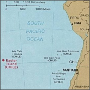
The location of Easter Island related to South America. Used by permission of the University of Texas Libraries, The University of Texas at Austin.

The location of Easter Island related to South America. Used by permission of the University of Texas Libraries, The University of Texas at Austin.

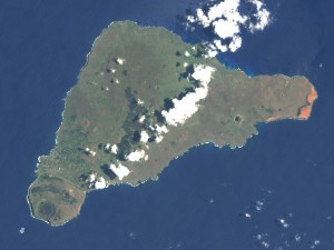
Image of Easter Island from the Earth Observatory, NASA.

Image of Easter Island from the Earth Observatory, NASA.

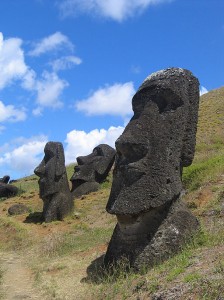
Moai s at Rano Raraku, Easter Island. Source: WikiCommons

Statues at Rano Raraku, Easter Island. Source: WikiCommons

Substantial research efforts have tried to build up a detailed picture of the timing and rate of human settlement and changes in vegetation cover on the island, and most importantly whether there is a clear causal link between the two. Much of the evidence for environmental changes on Easter Island come from lake sediment sequences, a subject close to my heart (having invested 3 years and counting looking at lake sediments for my PhD).
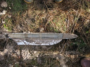
An example of a sediment core extracted from a lake bed. Photo from WikiCommons, courtesy of Gary Rogers.

An example of a sediment core extracted from a lake bed. Photo from WikiCommons, courtesy of Gary Rogers.

In particular, identifying pollen grains at different depths in lake sediment cores can be used to reconstruct what types of plants were growing on the island through time and identify the timing of shifts from a tree-dominated landscape to a more open grassland, for example. I recently found a paper in the journal Quaternary Science Reviews (Cañellas-Bolta et al. 2013, QSR; I apologise that it is not open-access) that I was immediately drawn to as it applied a multi-proxy (integrating different, independent techniques) analytical approach to a new sediment core from a lake on Easter Island. Now, I have thoroughly enjoyed my PhD (so far!); it has been exciting, interesting and the fieldwork has been in the picturesque landscapes of the English Lake District and southern Scotland. Nevertheless, reading this paper set me off on a series of day-dreams because, as lakes are pretty much ubiquitous around the world, maybe one day in the future as part of a successful academic career, I could drill a lake somewhere REALLY cool?!?

A number of hypotheses have been set out to try and explain when settlers first arrived on Easter Island and what triggered the demise of their undoubtedly complex civilisation. One common story is that increased demand for firewood and space for agriculture led to rapid deforestation, severe soil degradation and ultimately cultural collapse. Climatic fluctuations, the introduction of rats, contact with European explorers or simply living in such isolation have also been proposed as drivers of this collapse.
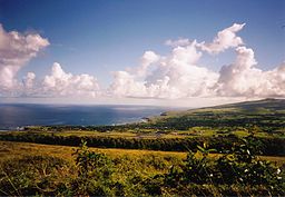
Panoramic view across Hanga Roa, Easter Island. The modern-day 'natural' landscape dominated by open grassland and largely devoid of palm trees is clear to see. Photo from WikiCommons courtesy of Makemake.

Panoramic view across Hanga Roa, Easter Island. The modern-day ‘natural’ landscape dominated by open grassland and largely devoid of palm trees is clear to see. Photo from WikiCommons courtesy of Makemake.

The new data from Cañellas-Bolta et al. include identification of a new pollen type Verbena litoralis and a more refined chronology for their sediment core based on radiocarbon dating. Using radiocarbon dates to identify the timing of events on Easter Island has been problematic due to inverted ages (i.e., a radiocarbon age higher in the sediment sequence returns an older date than samples lower down the core) and hiatuses, or gaps, in the sediment record. The hiatuses are particularly problematic here because sediment accumulation rates are very slow (100 years per cm), thus any gap in the record sadly means a significant chunk of the story has been lost. The authors use the BACON age-depth modelling software package to construct a more robust chronology, as the model incorporates known prior information on sediment accumulation rates and the identification of hiatuses within a Monte Carlo Markov Chain framework (Systematically running many millions of slightly-different simulations based on the same radiocarbon ages) in order to incorporate all possible age distributions, thus doing a better job of accounting for chronological uncertainties.

Verbena litoralis. Photo from WikiCommons, courtesy of Forest & Kim Starr.

Verbena litoralis. Photo from WikiCommons, courtesy of Forest & Kim Starr.

Their vegetation reconstruction suggests Easter Island was dominated by palm trees until ~450 B.C., where the first evidence for a shift in vegetation cover is observed. At this time, grassland and the marker weed species V. litoralis increase in abundance while palm pollen numbers decline, likely suggesting a clearance episode. The replacement of palm-dominated vegetation by herbaceous taxa then continues in a stepped manner, with another major palm decline at ~1200 A.D. This is the most-commonly accepted date for the first Polynesian settlers to the island (~A.D. 800 – 1200) so fits in well with previous work. But the suggestion that human-induced changes in vegetation cover began ~450 B.C., approximately 1500 years earlier, has enormous implications for our understanding of the history of not only Easter Island but also the pattern of settlement across much of Polynesia.

The history of Easter Island has been a topic of intense debate and this paper is another entry into the story. One part of their paper I found particularly neat is that V. litoralis is a weed species native to North America; how then did it arrive on Easter Island nearly 2500 years ago? The authors, after careful consideration of natural dispersal mechanisms, strongly support an interpretation of human-driven spread. They mention other interesting examples such as evidence that sweet potato and bottle gourd, crops native to South America, arrived in Polynesia in prehistoric times and a contemporaneous introduction of Polynesian chickens to Chile.

The authors refrain from making sweeping statements about their findings in terms of re-thinking local and regional history, instead emphasising that many hypotheses remain plausible and there is tremendous scope for future work. I am now mentally planning my mud-extraction expedition as I type…

As a final point, I read Collapse several years ago and was quite taken by the author’s arguments but having read the paper and put together this blog post, I am inspired to conduct a more critical examination of all the information pertaining to Easter Island, especially as I am extremely concerned by the current state of natural environments around the globe and our role in their rapid degradation.

Reporting on a recent visit to the NERC Radiocarbon Facility (East Kilbride, Scotland)

I (Daniel) recently had the opportunity to visit the Natural Environment Research Council (NERC) Radiocarbon Facility – Environment (NRCF-EK), hosted at the Scottish Universities Environmental Research Centre (SUERC), a collaborative facility between the Universities of Glasgow and Edinburgh. The lab is located in East Kilbride, a 30-minute train ride south of Glasgow city centre.

The opportunity arose via an application I submitted with my Supervisor (Dr Richard Chiverrell) to the NCRF-Steering Committee for funding towards a series of radiocarbon (14C) dates for our lake sediment sequence at Brotherswater, northwest England. The dating rationale was to augment our current chronology in order to confirm the local mining history recorded in the lake sediment sequence (EGU abstract) as well as more confidently temporally correlate individual palaeoflood laminations with known historical floods (EGU abstract). I was delighted to be awarded 14 radiocarbon dates in total and being invited to bring my samples to their lab and observe the preparation procedures and analytical equipment they use seemed an excellent opportunity.

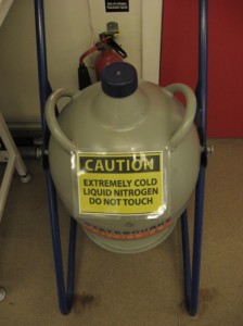
Pauline Gulliver, a Research Associate at the NRCF-EK lab and the manager of our project, kindly picked me up from the train station on Monday morning (Aug 19th). My first morning involved reading detailed Health and Safety briefings, which were by some margin the most interesting paperwork I have ever completed. The repeated mentions of liquid nitrogen, for example, were intriguing as my prior knowledge of its properties was only from movies.

GasLines

LiqNitrog
Photos: Daniel Schillereff

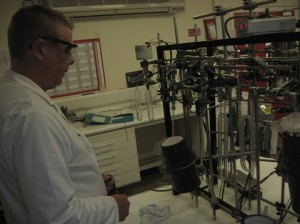
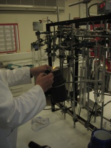
Monday afternoon was more ‘hands-on’ and in fact, by the end of my three-day visit, I had been lucky enough to observe and attempt first-hand each different stage of sample pre-treatment. Callum Murray, the lab technician with whom I was working, was brilliant throughout, explaining each step in detail and with admirable patience. The gas lines (see photo) used for extracting various gases and cryogenically capturing the CO2 were visually impressive (and initially daunting when Callum suggested I attempt a sample myself). But he clearly explained the order in which each valve is turned in order to check for leaks, move gases through the liquid nitrogen and water traps, and measure the total CO2 captured so, in the end, it was great fun and I spent much of Tuesday doing this procedure. Once the sample CO2 is captured it is turned into a form of elemental carbon called graphite and I also watched this being compressed into a graphite pellet. It is this pellet that is subsequently placed on a large diameter tray and inserted into the AMS, enabling the 14C to be measured. I also had the opportunity to put some of my own samples in their Mass Spectrometer, with the help of technician Josanne Newton, in order to measure the ratio of 12C to 13C isotopes, which is used to correct the radiocarbon data for isotopic fractionation.

Torch

An important ‘known unknown’ within my knowledge of radiocarbon sample preparation prior to visiting the lab was how the glass vials containing CO2 are kept absolutely sealed from surrounding air and the possibility of mixing is minimised. Their method is extremely effective: using a butane torch, the narrow stem of the silicon glass vial is made molten and sealed shut (see photo). I had a few attempts with mixed results; another fun yet effective task.

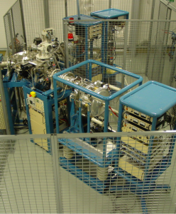
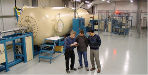
Wednesday lunchtime Pauline and I visited the SUERC AMS lab where their enormous, powerful Accelorator Mass Spectrometer for measuring the carbon isotopes (as well as other selected cosmogenic isotopes) is housed in a purpose-built facility. Upon arrival, Philippa Ascough kindly volunteered her time to provide me with a fascinating guided tour. (On a side note, this demonstrates the power of Twitter as I’ve had one or two Twitter conversations with Philippa in recent months). I honestly cannot recall which aspect was most impressive; the size of the accelerator or the complexity of wiring visible through the casing perhaps. The fact such a large machine is needed when the particles sought to be measured are so small seemed astounding but Philippa’s explanations made this very clear. Truly one of the most impressive machines I’ve ever seen.

AMS

Accelorator

The SUERC Accelorator Mass Spectrometer. Photos used with the kind permission of Philippa Ascough, SUERC AMS Laboratory

I am very grateful to the NRCF-E staff and Philippa Ascough for taking the time out of their undoubtedly busy schedules to provide such an educational experience. I’ve taken a number of lessons from my visit to the NRFC-E lab; for one, it has inspired me to greatly improve my knowledge base of standard chemistry and physics. While the staff provided helpful explanations of the various reactions taking place and equipment being used, a solid understanding of the underlying mechanics can only be acquired through a better personal understanding. My visit confirmed yet again that hands-on, visual experience is undoubtedly the most effective learning tool; I don’t think reading every issue of Radiocarbon plus relevant textbooks could replace the knowledge I acquired during my visit (ignoring the time needed for all that reading!). Most importantly, I feel much more confident to discuss the radiocarbon dating technique in published papers or my viva, when the time comes.

Visiting the NRCF-EK lab was an invaluable experience that I’d recommend to any Early Career Researcher who has successfully been awarded funding from the Steering Committee towards 14C dates.