EGU Blogs

Environmental Change

Anthropocene featuring heavily at the EGU

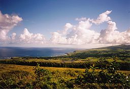
Among other sessions on Tuesday (Day 2 at EGU2014), I (Daniel) ventured to the EGU Press Conference featuring four experts from different scientific disciplines debating the Anthropocene concept. This term is fast becoming well-known in the popular media, politics and a vast spectrum of scientific disciplines and refers to the possibility that we, humanity, are living in a new geological time period in which our activities are the driving force behind present-day landscape evolution and surpass natural processes. As my own research spans geomorphology, Quaternary environmental and climatic change and past landscape evolution in general, I’m keen to keep abreast of the latest developments pertaining to the Anthropocene so it seemed like an opportune session to attend.

First up was Professor John Burrows, an atmospheric chemist who briefly presented data obtained from satellites of atmospheric emissions driven by human activity, particularly around urbanised regions, and likely future trends. Tony Brown, a Professor of Physical Geography at Southampton, and the chair of the British Society of Geomorphology Working Group on the Anthropocene then spent some time outlining the stratigraphic signature of the Anthropocene we can seek within alluvial sediments. Brown re-emphasised that a depositional feature or an erosional hiatus that is laterally extensive is required for any Anthropocene ‘boundary’ to be considered. His case study of the River Severn basin and its sub-basins showed a tremendous increase in sediment load after around 3000 years ago, directly driven by the introduction of agricultural practices in late-Neolithic and early-Bronze Age times. The removal of forest cover left a hilly landscape highly susceptible to erosion and a dramatic spike in sediment flux is thus recorded. Such a signal is found in different sedimentary environments in many areas of the world, including river systems and lake sediment cores, and is well-supported by archaeological data. The difficulty arises from the time-transgressive nature of such deposits because the agricultural revolution arrived in different regions of the world at very different periods. One interesting point Brown made relates to the need for any signature to persist through time preserved within the rock record. His calculated sediment load stored within floodplains is so large that, based on contemporary erosion rates, will not be removed until at least the next interglacial, thereby meeting that specific criteria. We also heard from Dr Pöppl, a geomorphologist from the University of Vienna, who showed some striking examples of the magnitude of impacts on sedimentary systems through the installation and removal of large dams.

Finally, Dr Jan Zalasiewicz, a palaeobiologist from the University of Leicester who has published some seminal papers on the Anthropocene concept, outlined the on-going work of the ‘Anthropocene Working Group’ of the International Commission on Stratigraphy examining whether it merits becoming a formal geological unit of time. One important revelation from Dr Zalasiewicz was that, while decisions taken by the ICS are lengthy processes, an interim report may appear sometime in 2016 addressing whether the Anthropocene is worthy of being designated as its own geological unit and, secondly, the date to be assigned as its onset. Dr Zalasiewicz also stated that, at present, the commission are leaning towards adapting 1950 as the ‘golden spike’, the so-called Great Acceleration as coined by Steffen et al. (2007), although he emphasised this is very much still under debate. He also highlighted that the Anthropocene Commission is unique at the ICS in that non-geologists and noted sceptics of the idea are sitting on the panel to ensure that the decision taken considers all view-points and stands up to scrutiny.

There was limited time at the end of questions from the press but one that sticks me is the relevance of the concept and whether it really matters that the Anthropocene is ratified by the ICS (or not). Burrows made the valid point that it’s imperative, in fact, that the Anthropocene be formalised as a geological entity to drive political action towards adapting a more sustainable future for the planet. That is certainly a view I share!

A couple of final points I’d like to highlight is that EGU is running a live-stream of all press conferences this week – check them out here – and the Anthropocene session taking place on Thursday: Orals in room G10, posters in Blue Room 243-279 (GM4.1/HS9.12/SSS9.18
Human-Earth interaction from the Pleistocene to the Anthropocene: state of the science and future direction).

Steffen, W., Crutzen, P. and McNeill, J. (2007) The Anthropocene: Are humans now overwhelming the great forces of nature? AMBIO 36 (8), 614-621.

Geology makes a difference to Society

The Geological Society of London have just today released a great report highlighting how geology contributes to our society.

All too often the impression is that all geologists do is study rocks. Whilst in essence, this is what we do, the implications of geological research are far reaching and not always understood by the wider public. I think this report is a fantastic piece of science communication (yes, I’m off again!) but more importantly, a great tool for all to appreciate just how important to our every day lives the study of Earth Sciences actually is.

In total, the report covers 12 areas  in which our understanding of geology shapes our daily lives. A maximum of 2 pages are dedicated to each topic, which makes for very clear, quick and easy reading. Topics covered include: Geoengineering, Energy, Geohazards, Climate Change and some unexpected ones: The Anthropocene and Valuing and protecting our environment. Of course, I have a favourite and you won’t be surprised, I’m sure, that it is the pages on Communicating geology: time, uncertainty and risk.

The Societies pages on how geology impacts on society can be found here and can be downloaded as a PDF too.

Credit: Wikimedia Commons, Author:  Alpsdake

Credit: Wikimedia Commons,
Author: Alpsdake

Credit: Wikimedia Commons. Author: R. Clucas. This image is in the public domain because it contains materials that originally came from the United States Geological Survey, an agency of the United States Department of the Interior.

Credit: Wikimedia Commons. Author: R. Clucas. This image is in the public domain because it contains materials that originally came from the United States Geological Survey, an agency of the United States Department of the Interior.

Credit: Wikimedia Commons. Author: de:Benutzer:Alex Anlicker

Credit: Wikimedia Commons. Author: de:Benutzer:Alex Anlicker

From mud to moai statue: lake sediments reveal new insights into Easter Island colonization

The small landmass of Easter Island (164 km2), the southeasterly point of Polynesia in the Pacific Ocean, has achieved iconic status in the world today as people wonder how its colonisation was physically possible by settlers journeying through the vast ocean in tiny boats, how and why the enormous moai s were constructed and, most infamously, to what extent they contributed to their own downfall through severe environmental degradation. This story has received a lot of attention, featuring in Jared Diamond’s eye-opening book ‘Collapse’ as well as National Geographic. (Check out the neat video embedded in the National Geographic article in which researchers replicate their theory on ‘walking’ the s).

The location of Easter Island related to South America. Used by permission of the University of Texas Libraries, The University of Texas at Austin.

The location of Easter Island related to South America. Used by permission of the University of Texas Libraries, The University of Texas at Austin.

Image of Easter Island from the Earth Observatory, NASA.

Image of Easter Island from the Earth Observatory, NASA.

Moai s at Rano Raraku, Easter Island. Source: WikiCommons

Statues at Rano Raraku, Easter Island. Source: WikiCommons

Substantial research efforts have tried to build up a detailed picture of the timing and rate of human settlement and changes in vegetation cover on the island, and most importantly whether there is a clear causal link between the two. Much of the evidence for environmental changes on Easter Island come from lake sediment sequences, a subject close to my heart (having invested 3 years and counting looking at lake sediments for my PhD).

An example of a sediment core extracted from a lake bed. Photo from WikiCommons, courtesy of Gary Rogers.

An example of a sediment core extracted from a lake bed. Photo from WikiCommons, courtesy of Gary Rogers.

In particular, identifying pollen grains at different depths in lake sediment cores can be used to reconstruct what types of plants were growing on the island through time and identify the timing of shifts from a tree-dominated landscape to a more open grassland, for example. I recently found a paper in the journal Quaternary Science Reviews (Cañellas-Bolta et al. 2013, QSR; I apologise that it is not open-access) that I was immediately drawn to as it applied a multi-proxy (integrating different, independent techniques) analytical approach to a new sediment core from a lake on Easter Island. Now, I have thoroughly enjoyed my PhD (so far!); it has been exciting, interesting and the fieldwork has been in the picturesque landscapes of the English Lake District and southern Scotland. Nevertheless, reading this paper set me off on a series of day-dreams because, as lakes are pretty much ubiquitous around the world, maybe one day in the future as part of a successful academic career, I could drill a lake somewhere REALLY cool?!?

A number of hypotheses have been set out to try and explain when settlers first arrived on Easter Island and what triggered the demise of their undoubtedly complex civilisation. One common story is that increased demand for firewood and space for agriculture led to rapid deforestation, severe soil degradation and ultimately cultural collapse. Climatic fluctuations, the introduction of rats, contact with European explorers or simply living in such isolation have also been proposed as drivers of this collapse.

Panoramic view across Hanga Roa, Easter Island. The modern-day 'natural' landscape dominated by open grassland and largely devoid of palm trees is clear to see. Photo from WikiCommons courtesy of Makemake.

Panoramic view across Hanga Roa, Easter Island. The modern-day ‘natural’ landscape dominated by open grassland and largely devoid of palm trees is clear to see. Photo from WikiCommons courtesy of Makemake.

The new data from Cañellas-Bolta et al. include identification of a new pollen type Verbena litoralis and a more refined chronology for their sediment core based on radiocarbon dating. Using radiocarbon dates to identify the timing of events on Easter Island has been problematic due to inverted ages (i.e., a radiocarbon age higher in the sediment sequence returns an older date than samples lower down the core) and hiatuses, or gaps, in the sediment record. The hiatuses are particularly problematic here because sediment accumulation rates are very slow (100 years per cm), thus any gap in the record sadly means a significant chunk of the story has been lost. The authors use the BACON age-depth modelling software package to construct a more robust chronology, as the model incorporates known prior information on sediment accumulation rates and the identification of hiatuses within a Monte Carlo Markov Chain framework (Systematically running many millions of slightly-different simulations based on the same radiocarbon ages) in order to incorporate all possible age distributions, thus doing a better job of accounting for chronological uncertainties.

Verbena litoralis. Photo from WikiCommons, courtesy of Forest & Kim Starr.

Verbena litoralis. Photo from WikiCommons, courtesy of Forest & Kim Starr.

Their vegetation reconstruction suggests Easter Island was dominated by palm trees until ~450 B.C., where the first evidence for a shift in vegetation cover is observed. At this time, grassland and the marker weed species V. litoralis increase in abundance while palm pollen numbers decline, likely suggesting a clearance episode. The replacement of palm-dominated vegetation by herbaceous taxa then continues in a stepped manner, with another major palm decline at ~1200 A.D. This is the most-commonly accepted date for the first Polynesian settlers to the island (~A.D. 800 – 1200) so fits in well with previous work. But the suggestion that human-induced changes in vegetation cover began ~450 B.C., approximately 1500 years earlier, has enormous implications for our understanding of the history of not only Easter Island but also the pattern of settlement across much of Polynesia.

The history of Easter Island has been a topic of intense debate and this paper is another entry into the story. One part of their paper I found particularly neat is that V. litoralis is a weed species native to North America; how then did it arrive on Easter Island nearly 2500 years ago? The authors, after careful consideration of natural dispersal mechanisms, strongly support an interpretation of human-driven spread. They mention other interesting examples such as evidence that sweet potato and bottle gourd, crops native to South America, arrived in Polynesia in prehistoric times and a contemporaneous introduction of Polynesian chickens to Chile.

The authors refrain from making sweeping statements about their findings in terms of re-thinking local and regional history, instead emphasising that many hypotheses remain plausible and there is tremendous scope for future work. I am now mentally planning my mud-extraction expedition as I type…

As a final point, I read Collapse several years ago and was quite taken by the author’s arguments but having read the paper and put together this blog post, I am inspired to conduct a more critical examination of all the information pertaining to Easter Island, especially as I am extremely concerned by the current state of natural environments around the globe and our role in their rapid degradation.