EGU Blogs

Geology

What’s Geology got to do with it? 3 – Christmas! Part 1

What’s Geology got to do with it? 3 – Christmas! Part 1

Dear Readers!

Christmas is almost upon us and so at Four Degrees we decided to devote our next post in the ‘What’s Geology got to do with it?’ series to Christmas! Marion and I have selected varying aspects of the festive season from trees to biblical stories and common Christmas presents, and linked them to geology (some tenuous, some not so tenuous…). We hope you enjoy!

The Journey to Bethlehem

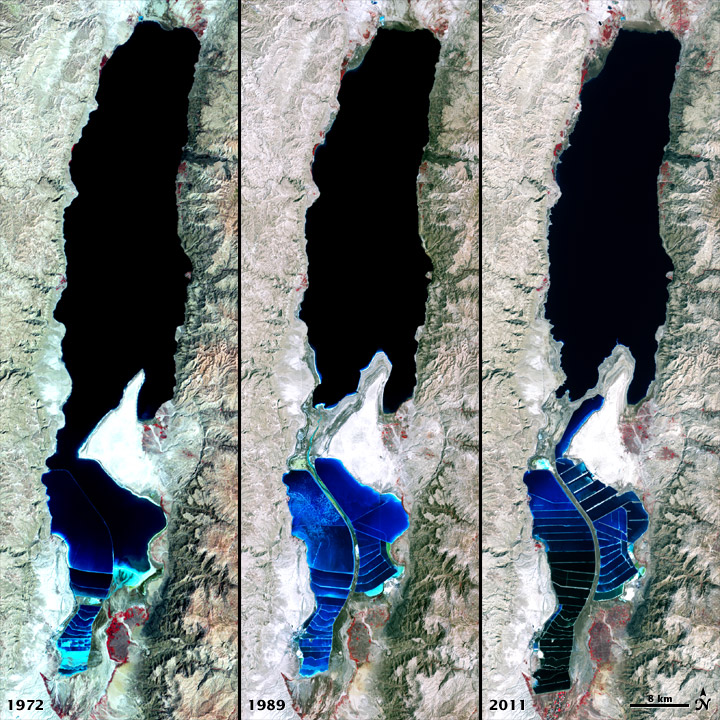
The story of Joseph and Mary’s hallowed journey from Nazareth to Bethlehem is an intrinsic part of christmas festivities. But what route did they take and what landscapes would they have seen?

715px-1759_map_Holy_Land_and_12_Tribes

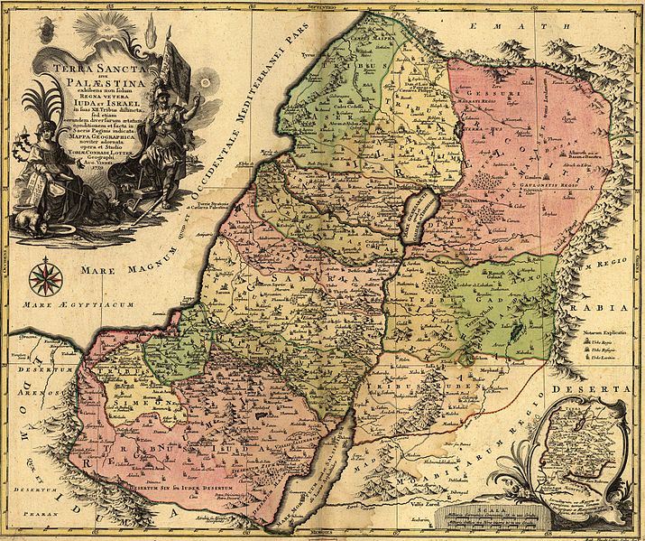
Map of the Holy Land showing the Old Kingdoms of Judea and Israel drawn in 1759. Source – Wikimedia Commons

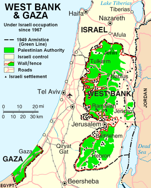
As a distinct geographic area, the description “Holy Land” encompasses modern-day Israel, the Palestinian territories, Jordan and sometimes Syria. The geology of the Holy Land is characterised by the Judean Hills which run North to South through the centre of the region exposing Cretaceous age limestones and sandstones. The rocks reach down to the western banks of the Dead Sea and the Jordan Valley Rift valley which marks the modern border between Palestine and Jordan. The Judean Hills mark the highest area in the region (an area Joseph and Mary may have been trying to avoid!) and the topography then lowers to the Mediterranean coast to the west and the Dead Sea to the east.

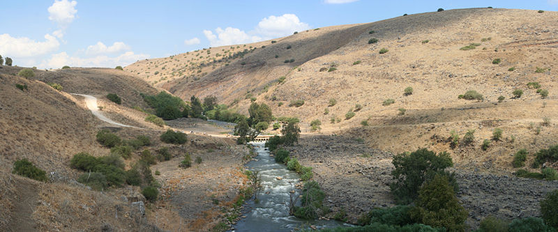
Joseph and Mary’s journey to Bethlehem began in Nazareth in modern day Israel and ended in a manger in Bethlehem, which is in modern day Palestine. The route taken between the two, and indeed the time it took them is oft disputed. Given the mountainous nature of the central Holyland which is dominated by the Judean Hills and the reality of transporting a pregnant woman on a donkey, it is possible they would have avoided the mountains and travelled southeast across the Jezreel Valley, connecting with the Jordan Valley to the East, down to Jericho and then across to Bethlehem. This route would have looked something like this.

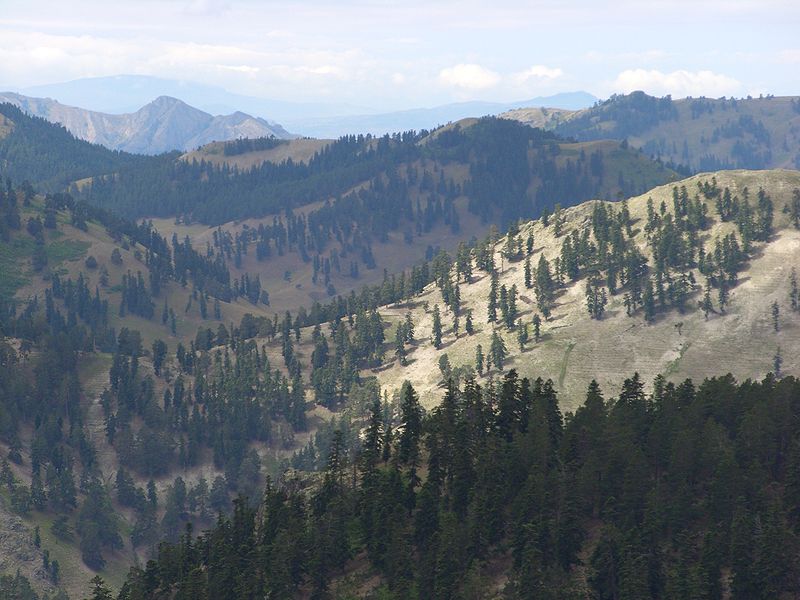
Image of the Judean Hill taken in 1917. Source – Wikimedia Commons

The area they may have wanted to avoid, the Judean Hills, is formed from monoclinic folds and relates to the Syrian Arc belt of anticlinal folding in the region that began in the Late Cretaceous.  These are the same hills that include the famous Mount of Olives, and the location of the story of David and Goliath which occurred in the Ella Valley in the Judean Hills’. It is also home to Bethlehem which stands at an elevation of about 775 meters and is situated on the southern portion in the Judean Hills.

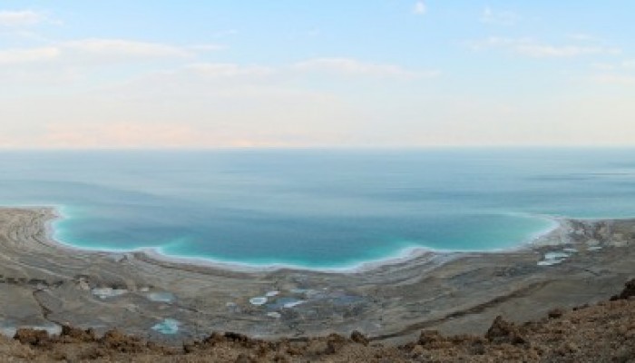
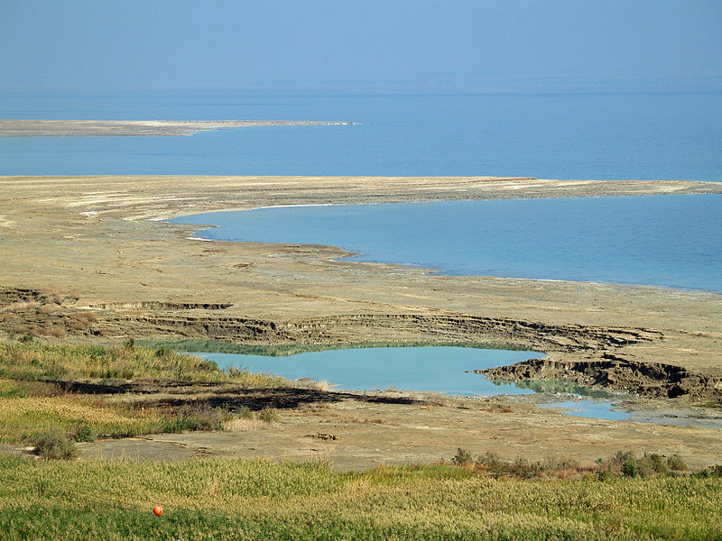
By contrast, the Jordan valley encompasses the lowest point in the world, the Dead Sea (sitting at 420 below sea level). The valley was formed in the Miocene (23.8 – 5.3 Myr) when the Arabian tectonic plate moved away from Africa.  The plate boundary which extends through the valley (and houses the Dead Sea!) is called the Dead Sea Transform. This boundary separates the Arabian plate from the African plate. For more on the geology of the Dead Sea region see this earlier Four Degrees post.


Lego

398px-Lego_Christmas_Tree_at_St_Pancras_International

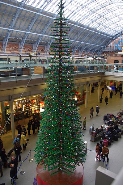
Christmas tree made of Lego at St Pancras Station! Source – Wikimedia Commons

As children (or adults!) many of us will have experienced unwrapping various Lego sets on Christmas Day. Its popularity has been sustained over the last 50-60 years whilst the company has continued to grow; Lego never goes out of style! But did you know that Lego has been manufacturing its hugely successful interlocking toy bricks since 1949 and as of 2013, 560 billion Lego parts have been produced! But what does any of this have to do with geology?

220px-Lego_Color_Bricks

Lego blocks! Source – Wikimedia Commons

Well, Lego started off as wooden blocks and toys in the workshop of inventor Ole Kirk Christiansen, before moving onto manufacuring the blocks out of cellulose acetate. But since 1963 the blocks have been made from a resilient plastic called acrylonitrile butadiene styrene (ABS).  As with many plastics, the Butadiene and Styrene components of ABS are formed from a process that begins with the extraction and cracking of crude oil. Oil consists of a mixture of hundreds of different hydrocarbons containing any number of carbon atoms from 1-100. Butadiene is a petroleum hydrocarbon that is obtained from the C4 fraction of steam cracking (more on steam cracking here ) and styrene is made by the dehydrogenation of ethylbenzene, a hydrocarbon obtained in the reaction of ethylene and benzene. Lego is just another manufactured product who’s journey began in the rocks!

Wrapping Paper

Christmas_wrapping_paper_display

Christmas wrapping paper! Source – Wikimedia Commons

The use of wrapping paper was first documented in ancient China where it was invented in 2nd century BC but it was the innovations of Rollie and Joyce Hall, the founders of Hallmark Cards that helped popularise the idea of wrapping in the 20th Century. Wrapping paper is made using specially milled wood pulp, this pulp is made from a special class of trees called softwoods. The paper is then bleached and decoration and colours are printed onto the paper using dyes and pigments.

Whilst many dyes that are used in the modern day are synthetic, originally all dye materials were sourced from natural materials. Here we focus on how to make the dyes and pigments for christmassy colours!

800px-Alizarin-sample

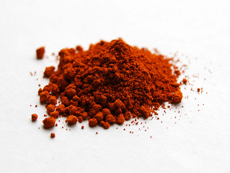
Powdered Alizarin dye. Source – Wikimedia Commons

There are a variety of natural materials that can be used to make red dyes including lichen, henna and Madder. Madder, made from the dye plant Rubia tinctorum, has been used as a dye as far back as 1500BC it was even found in the tomb of Tutankhamun. Madder was also used to make Alizarin, the compound 1,2-dihydroxy-9,10-anthracenedione. Alizarin was a prominent red dye until synthetic Alizarin was successfully duplicated in 1869 when German chemists Carl Graebe and Carl Liebermann found a way to produce alizarin from anthracene. A later discovery that anthracene could be abstracted from coal tar further advanced the importance and affordability of alizarin as a synthetic dye. This reduced cost caused the market for madder to collapse almost overnight. While alizarin has been largely replaced by more light-resistant pigmens it is still used in some printing.  (QI – it is also used in classrooms as a stain to indicate the calcium carbonate minerals, calcite and aragonite!)

Other more exotic inks and pigments used in wrapping paper such as metallic pigments are also made through mined raw materials. To produce metallic pigments, materials such as Aluminium powder (aluminium bronze) and copper-zinc alloy powder (gold bronze) are used to produce novel silver and gold inks!


Christmas Trees

800px-Julgransförsäljning_utanför_Lunds_domkyrka

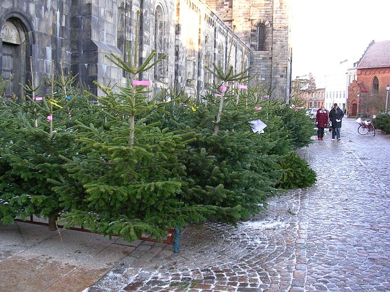
Abies Nordmanniana on sale as christmas trees. Source – Wikimedia Commons

Christmas trees are an iconic part of Christmas, whether at home or in your local area its hard to go far in December without seeing one most days! In fact they are so popular now that Christmas trees are farmed specifically for this purpose. While the best selling trees in North America are Scots Pine, Douglas-fir and noble fir, in the UK, Nordmann fir is the most popular species due to its low needle drop feature.

As with all crops, Christmas trees require a specific set of nutrients to thrive and these are provided by fertile soil which is controlled by the underlying geology. Elements that are required for health growth include Nitrogen, Phosphorus, Potassium, Calcium, Magnesium, Sulphur, Boron, Copper, Manganese, Molybdenum, Iron and Zinc which are all obtained from the soil.

Where this isn’t available or in areas of intensive farming these elements are derived through the use of fertiliser which relies on mined phosphate for mass production (more on the link between fertiliser and mined phosphate reserves here). In terms of soil types, pine trees are usually better adapted to a sandy or sandy loam soil, while White Spruce trees and fir trees,  prefer fine-texture loams and clay loam soils.

800px-Abies_nordmanniana_@Kurtbeli-Alucra-Giresun

Abies nordmanniana trees located in the Black Sea region of Turkey. Source – Wikimedia Commons

The popular Nordmann fir used in the UK, or ‘Abies nordmanniana’ is native to the mountains to the east and west of the Black Sea in an area which covers Turkey, Georgia, Russian Caucasus and Armenia. They grow at high altitudes of 900-2200 m on mountains and require plenty of rainfall (~1000mm).

The distribution of the species around the Black Sea and its absence in other local areas of similar, suitable climate is thought to be due to the forest refugia that formed during the ice age. Refugia is the term used to describe a location of an isolated or relict species population. This can be due to climatic changes, as with Nordmann Fir, geography (and therefore geology) or human activities such as deforestation. The forest refugia that caused the limited spread of the Nordmann Fir was caused by the glacial coverage during the Ice Age in the eastern and southern black sea which cut off many areas restricting the spread of the species. Indeed the presence of these refugia is the reason many forest tree populations survived at all!


Stay tuned for Marion’s Part 2 of the Christmas Post next week…

Flo

Raising the Dead Sea

Raising the Dead Sea


The Dead Sea is one of the planet’s truly otherworldly places: a peculiarity of water distribution, climate and altitude, it is even more extroadinary in that it is a site of religious, cultural and political significance. Viewed by many as a natural wonder, its characteristics and location within one of the most entrenched political situations in modern history makes it intriguing and troubled in equal measure.

The Dead Sea is the deepest hypersaline lake in the world, situated at the lowest point on earth. It has a salinity of 33.7% due to high concentrations of NaCl and other mineral salts.  The Dead Sea, aside from being a misnomer (it is actually an inland lake) is so-called because of the harsh living conditions that the salinity engenders. Many organisms such as fish cannot live there, in fact only populations of bacteria and microbial fungi can thrive.

800px-Yarden_034PAN2

The Jordan River. Source

Located in the Jordan rift valley bordering Jordan to the east, and Israel and Palestine to the west, it is served only by the Jordan River to the North. A combination of the mineral content of the water, low content of pollens, the reduced ultraviolet component of solar radiation and the higher atmospheric pressure at this depth have specific health effects which have borne a booming spa-tourism economy. This along with the dramatic scenery and tranquil waters is why it has long been a site of tourism and refuge; King David used it as such and it was one of the world’s first health resorts for Herod the Great.

There are two schools of thought as to how it formed; one is that the depression forms part of the East African rift valley complex and, another more recent hypothesis describes the formation as a ‘step over’ discontinuity along the Dead Sea Transform creating an extension of the crust. The sea was once connected to the Mediterranean and experienced regular flooding, resulting in thick layers of salt deposition. The land between the Mediterranean and the Dead Sea subsequently rose to cut the basin off and create a lake.

What’s the status now? 

The dwindling water level of the Dead Sea. Source

The dwindling water level of the Dead Sea. Source

The Dead Sea in more recent years has been characterised by a decline in water levels, a drop of ~30m since 1960 alone and is currently shrinking by around 1m/year. This is in part due to a drop in rainfall and the use of water upstream of the Jordan river for irrigation projects. Declining water levels have resulted in a wide variety of environmental issues for the Dead Sea ecosystems and surrounding region. One such issue is the ever-feared rumble that precedes the formation of sinkholes; these can be unpredictable and can occur suddenly almost anywhere in the Dead Sea region. Indeed, the level of uncertainty and rapidity of sinkhole formation is such that around 10 years ago, renowned geographer-geologist and expert on sinkhole phenomena Eli Raz was swallowed up by one and waited 14 hours for rescue!

Sinkholes in the Dead Sea area are caused by the interaction of incoming freshwater with subterranean salt layers.  As the sea level drops, high levels of salt are left behind in the soil and when freshwater washes in from the Jordan River it dissolves the salts and cavities are created. This process continues until the subterranean structure loses integrity and sinkholes are formed.  It is estimated there are now about 3000 in the region of the dead sea with an opening up of around 1 a day.


800px-Dead_Sea_sinkhole_by_David_Shankbone

Sinkholes along the shore of the Dead Sea. Source.

Why is the water level dropping?

Jordan, Syria, Palestine and Lebanon have all tapped the Jordan river for water over the last few decades for irrigation purposes resulting in a reduced flow into the Dead Sea.  An area with historically low rainfall, ~ 2 inches a year, enormous amounts of water is also piped off to fill evaporation pools for the potash and magnesium industries which sit at the very southern end of the sea. This alone is thought to result in a 30-40% reduction in water.

In the last 50 years, the population in the surrounding countries of Israel, Palestine and Jordan has increased from 5.3 million to over 20 million with an increase in the settled population in the Dead Sea region. Currently, tens of thousands of tourists visit every year to bathe in the sea and use the many resorts and spas found along the shores and visit the mighty ruin of Masada (including me!) that overlooks the Dead Sea. Tourism is growing in this area and makes up about 40 percent of the income of local residents and this is putting further pressure on diminishing water resources.

The_Dead_Sea_1972-2011_-_NASA_Earth_Observatory

Views of the Dead Sea in 1972, 1989, and 2011 compared. Source.


How can environmental catastrophe be avoided?

The delicate balance of inflows, outflows, evaporation and rainfall has been severely disturbed in the last 50 years, and this hasn’t gone unnoticed. A highly ambitious project is underway to replenish the Dead Sea and ameliorate some of the water and energy shortage issues in the region. The World Bank, together with the local governments is planning to create a canal linking the Red Sea to the Dead sea.  The project includes a series of studies including feasibility, environmental and social assessment with the aim of generating a trilateral agreement between Palestine, Jordan and Israel. If the plan goes ahead as detailed, the pipeline will deliver 2 billion cubic metres of sea water per year from the Gulf of Aqaba through Jordanian territory and to the Dead Sea. The plan is to also use the downwards flow between the Red Sea and the Dead sea to incorporate a hydroelectric plant. This is in turn will power a desalination plant which would provide up to 850 million m3 of fresh water per year to a water parched region. The briny discharge from the desalination plant would then be discharged into an already-saline Dead Sea. The project is likely to cost at least US $10 billion, a significant proportion of this is taken up by the cost to pump the desalinated water 200km over an altitude change of 1000m from the Dead sea towards Amman, an extremely parched area.

782px-ArabianSea_AMO_2005053_crop

Algal Blooms in the Arabian Sea. Source.

So, it sounds good but is it really that simple? Many studies find that if more than 400 million m3 of sea water is added to the Dead Sea, this could result in the formation of algal bloom and unsightly gypsum crystals, the effects of which have effects that are difficult to predict, this will impact on the image and chemistry of the Dead Sea. Although the ecological effects of these chemical changes are still unclear, they would likely diminish the sea’s tourist appeal. This is in addition to the fact that the amount of water supplied would not be enough to stabilise or increase the level of the Dead Sea. There is also concern about the effects of mixing Red Sea water with Dead Sea water. Many other alternatives have been mooted by environmental groups, such as water recycling and conservation by Israel and Jordan, importing water from Turkey and desalinating sea water on the Mediterranean coast. Whilst pumping desalinated sea water from the Mediterranean to Ammam would be easier and cheaper, the geopolitics are concerning. Many worry that Israel would control the supply to Ammam.  Another very real concern is the high frequency of earthquakes in the region, seismic activity could cause salt water to leak into underground fresh water aquifers. Others would prefer to see the rehabilitation of the Jordan River with a greater utilisation of desalination to provide water to the Mediterranean coast.  All of these alternatives however require cooperation and a regional approach to water sharing which is difficult in this part of the world to say the least.

Regional Water Security

This issue sits within a wider problem. This is a region with extremely low levels of rainfall and a booming population. Jordan are well behind the Red-Sea-Dead-Sea project largely because the country’s access to fresh water is extremely restricted, which has been exacerbated by the arrival of more than a quarter of a million Syrian refugees since the outbreak of the civil war.

800px-Nitzana_desalination_(2)

Nitzana desalination plant in Israel. Source.

Israel has long had issues with water scarcity. Due to low rainfall and a booming industry, the demand on water outstrips conventional water resources. This is put under further strain from the water-intensive agricultural practices used throughout the country.This is in part alleviated by their technologically advanced desalination plants dotted along the Mediterranean coast.

Gaza, on the Mediterranean coast is thought to be heading for a serious water crisis in the coming decade with 90-95% of the main aquifer contaminated, the UN suggest the water might be unusable by 2016. Meanwhile water shortages in the West Bank affect the provision of drinking water, water used for farming and agriculture in addition to that required for basic sanitation.

Regional Geopolitics

The regional geopolitics is intensely complex with many historic and current political factors at play. Others can write much more authoritatively on the area but it is worth mentioning here because, as with many geological issues, the interplay between the two is important.

The main regional players are Israel, Palestine and Jordan. Jordan, with few freshwater resources and no oil to power desalination plants, has long been considering an engineered solution to alleviate the water issue in Jordan. At peace with Israel since the signing of a treaty in 1994, the Jordanian government is hoping the plan goes ahead in full.

Israel and Palestine are significantly more complicated. The current de facto borders of Israel and Palestine are broadly along the lines drawn following the ‘Six Day War’ in 1967, as seen in the image, where Israel extended its borders and captured, among other territories, the West Bank.

West_Bank_&_Gaza_Map_2007_(Settlements)

Map of the West Bank and Gaza Strip. Source.

Contemporary Palestine now exists as two non-coterminous territories: the Gaza strip, which is on the Mediterranean coast (run by Hamas) and whose borders are controlled by Israel and Egypt, and the West Bank (the name of which refers to the Jordan River) which borders Israel to the north, south and west, and Jordan to the east. Civil and military authority in the West Bank is a mixture of the Fatah-led Palestinian Authority and the Israeli state. The Dead Sea spans the south east corner of the West Bank, as well as parts of Israel and Jordan. Whilst the West Bank shares a geographical border with Jordan, this is controlled by Israel, and the West Bank remains under Israeli occupation under international law.

In a region with scarce water resources, distribution can be controversial – and Israel’s monopoly over a shared aquifer and access to the Jordan River has resulted in the state being accused of restricting access to water for Palestinians.

Palestine (despite divisions in governance across the two territories) is still seeking independent statehood, and in 2012 was recognised at the United Nations as a ‘Non-member observer state’. As such, negotiations over multilateral initiatives such as the Red Sea-Dead Sea project have enormous geopolitical implications. 

Other Cross-boundary Water Conflicts

There are many examples of delicate border regions which cut across natural river systems, such is the nature of modern national borders, they very rarely follow catchment areas and as such control over and use of water bodies can be highly contested.

Cross boundary water engineering negotiation goes on in many areas around the world and these often intersect with political and environmental issues. In addition to the Dead sea and Jordan river the Nile is subject to boundary issues, running through Egypt, Sudan and Ethiopia. Egypt and Ethiopia are currently negotiating over a billion dollar dam project being built in Ethiopia. Egypt are looking to help with the construction of the dam project.

The Caspian Sea has also had more than its fare share of water-rights disputes. A massive sea in Central Asia, its issues descend from the break up of the Soviet Union in 1991 and thus increasing the number of countries with an interest. As such a number of plans have been proposed and rejected due to lack of unanimity leaving the legality and governance of the area up in the air and resulting in resource grabs and export of resources struck without agency.

As with the Dead Sea, these examples show the great complexity in dealing with cross-boundary water management and no situation is the same, and must be dealt with carefully and on a case by case basis.

Flo

Further Reading

BBC News – Project to replenish Dead Sea water levels confirmed

Phys Org – Dead Sea, Red Sea plan raises environmental hackles

Nature – Environmental concerns reach fever pitch over plan to link Red Sea to Dead Sea

Slate – The Dead Sea is Dying


What’s Geology got to do with it? 2 – Coffee

We should start this post with a declaration of interest. We absolutely love coffee. Whether it’s  latte, macchiato, flat white (or cafe au lait for Marion!) we drink it everyday! So for our second installation of “What’s geology got to do with it?’ we’re going to highlight the connections between coffee and geology!

fpVcA2_imgur

Coop loves his coffee! Source

As well as being absolutely delicious (and often powering an entire community of researchers, PhD Students, lawyers etc through work on a daily basis!) coffee is the 2nd most traded commodity in the world, sitting in a list dominated by other commodities important to geoscience!

  1. Crude Oil
  2. Coffee
  3. Cotton
  4. Wheat
  5. Corn
  6. Sugar
  7. Silver
  8. Copper
  9. Gold
  10. Natural Gas

Coffee and Soils!

800px-CoffeeCatucai

Coffee berries, a variety of Coffeea Arabica. Source – Marcelo Corrêa, Wikimedia Commons.

In order to supply the international demand for coffee, coffee trees require a large supply of nutrients. These nutrients are delivered through soils which are ultimately formed from the breakdown and erosion of rocks. In addition to allowing coffee trees to grow, the soil makeup will also contribute to a coffee’s unique flavour profile. Having said that, the combination of factors affecting taste is so complex, that even from a single plantation you can find variation in quality and taste.

What does coffee need to grow?

Aside from cool-ish temperatures (~20 degrees) and high altitude (1000-2000 metres above sea level), Coffee requires a wide variety of essential elements in order to grow and deliver the delicious stuff we drink. These elements are delivered through the soil profile. The usual suspects like Phosphorus, nitrogen, potassium, calcium, zinc and boron are all very important. The level of potassium influences total sugar and citric acid content while nitrogen is important for amino acid and protein buildup and can influence caffeine build up. Boron is important for cell division, cell walls and involved in several enzyme activities. It also influences flowering and fruit set and affects the yield. In addition to soil type and content, factors such as slope angle (15% is optimal), water supply (good supply with interspersed dry periods are essential) and altitude exert strong influence on the success of coffee growth.

What soils are best?

Coffee can be grown on lots of soils but the ideal types are fertile volcanic red earth or deep sandy loam. For coffee trees to grow it is important that the soil is well draining which makes heavy clay or heavy sandy soils inadequate. Some of the most longstanding and famous coffees are grown on the slopes of volcanoes or in volcanic soil, also known as ‘Andisols’.

Definition of Andisol (USDA soil taxonomy) – ‘Andisols are soils formed in volcanic ash and defined as soils containing high proportions of glass and amorphous colloidal materials, including allophane, imogolite and ferrihydrite.’

102 SSC2_No_Folder _33R

Coffee grows on the slopes of these volcanoes in El Salvador. Source – NASA, Wikimedia Commons

But why are they so fertile? This is due to how young, or immature they are as soils. They still retain many of the elements that were present during the formation of the rock, they haven’t been plundered over hundreds of years of agriculture, they haven’t undergone extensive leaching and are relatively unweathered. This means they often include basic cations such as Mg, Ca or K (which can be easily leached out) and often retain a healthy supply of trace elements. Whilst these soils are very fertile, they only cover around 1% of the ice-free surface area of the earth. They can usually support intensive use for growing coffee and other mass crops such as maize, tea and tobacco. Despite the high fertility of volcanic soils, many do need a nutrient top-up during the growth cycle that comes from natural manure or fertilisers, which are themselves in diminishing supply.

Volcanic soils also have a good structure and texture for coffee growth as they often contain vesicles, which makes them porous and ideal for retaining water. Shallow groundwater is bad for coffee growing as it can rot the roots and it needs to be at least 3 metres deep. Roots of coffee have a high oxygen demand so good drainage is essential.

Where does coffee grow and why?

It is no surpise then that some of the most famous and historic coffee growing regions are in areas of past and current volcanic activity such as Central America, Hawaii and Indonesia. Coffee trees produce their best beans when grown at high altitudes in a tropical climate where there is rich soil. Such conditions are found around the world in locations along the Equatorial zone.
Coffee is grown in more than 50 countries around the world including the following;

  • Hawaii – coffee is grown in volcanic soil or directly in the loosened rock. The location and island climate provides good growing conditions. 

    GT056-Antigua_Arch-low.jpeg

    Volcán de Agua overlooking Antigua in Guatemala an area with a big coffee production industry. Source – Zack Clark, Wikimedia Commons.

  • Indonesia – coffee production began with the Dutch colonialists and the highland plateau between the volcanoes of Batukaru and Agung is the main coffee growing area. Ash from these volcanoes has created especially fertile andisols.
  • Colombia – thought that Jesuits first brought coffee seeds to South America. One of the biggest producers in the world, regional climate change associated with global warming has caused Colombian coffee production to decline since 2006. Much of the coffee is grown in the cordilleras (mountain ranges).
  • Ethiopia – grown in high mountain ranges in cloud forests.
  • Central America – rich soils along the volcanic range through central america, equatorial temperatures and mountainous growing areas make this a powerhouse in the coffee growing world. 

Coffee and Climate!

Like many crops and food commodities, good coffee requires good climate. For our favorite bean, this typically means temperate regions  at altitudes of 1000-2000 m. But climate is changing and this is likely to have a big impact on coffee growth, and by association, on the livelihood of millions of local coffee farmers who rely on its production.

In its latest report out last month, the UN’s Intergovernmental Panel on Climate Change (IPCC, the leading  body assessing climate change impacts) confirmed for the 5th time what climate scientists worldwide already know: that our climate is warming as a result of human activities. Global temperatures have already risen by almost 1C since the end of the 19th century and will continue to rise at even faster rates over the coming century.

There are two ways in which a changing climate will impact coffee growth and production.

First, increasing temperatures or changes in precipitation will directly affect the areas suitable for coffee growth, leading to a loss in coffee growing environments.

A coffee berry being chewed up by hungry Hypothenemus hampei - Source: L. Shyamal, Wikimedia Commons.

A coffee berry being chewed up by hungry Hypothenemus hampei – Source: L. Shyamal, Wikimedia Commons.

Second, and perhaps most importantly, changing climate and higher temperatures will affect a little insect called Hypothenemus hampei (H. hampei for short). H. hampei is small but lethal. This beetle-like insect is what people call a coffee berry borer. It is the most important threat to coffee plantations worldwide.

Born in central Africa, H. hampei began colonising coffee plantations worldwide with the global movement and commerce of coffee beans. H. hampei likes warm climates. Until about a decade ago, it was very happy munching away at low-altitude beans, below the preferred altitude of our beloved Arabica coffee (between 1200-2000 m in East Africa).

But with rising temperatures, the berry borer can now survive at higher altitudes. On the slopes of Mt Kilimanjaro in Tanzania, H. hampei has climbed 300 m in 10 years.

Mount Kilimanjaro - Source: Muhammad Mahdi Karim, Wikimedia Commons.

Mount Kilimanjaro – Source: Muhammad Mahdi Karim, Wikimedia Commons.

H. hampei causes over $500 million loss annually in East Africa alone. The borer is gaining both geographical extent (it is only absent from coffee plantations in China and Nepal, having infiltrated Puerto Rico in 2007 and Hawaii in 2010) and altitude. A further 1C increase will see the borer develop faster and gain new territories.

The Colombia coffee belt - Source:  Instituto Geografico Agustin Codazzi, Wikimedia Commons.

The Colombia coffee belt – Source: Instituto Geografico Agustin Codazzi, Wikimedia Commons.

In Colombia, where coffee accounts for 17% of the total value of crop production, temperatures in the coffee belt region are projected to rise by 2.2C by 2050. This could both shorten the coffee growing season and allow  the pest to make its way above 1500 m.

It has been estimated that Colombian plantations would have to be moved up by 167 m for every degree of warming.

In East Africa, studies predict that Arabica coffee, currently grown at 1400-1600 m,  will have to shift to 1600-1800 m by 2050 as a result of rising temperatures.

But it is unlikely that East African coffee plantations will be able to adapt. For one, suitable high altitude habitats are not common. Second, population growth is likely to put a huge demographic pressure on arable land (the population in Ethiopia is set to double by 2050 – see this fact sheet by the Population Reference Bureau) and it is likely that the shrinking available arable land will be used to cultivate other crops over coffee.

The impact of climate change on invasive pest species is something that ecologists are studying worldwide. Small changes in average temperatures can have huge bearings on where these pests live and what they feed on, and this seems to already be the case for the coffee berry borer.

Let’s hope Flo and I can continue enjoying our weekly Four Degrees coffee meetings for many years to come!

Flo and Marion


A momentous discovery deep below: Earth’s inner core

For the Accretionary Wedge blog festival with the theme of ‘Momentous Discoveries in Geology’, Marion Ferrat discusses how a pioneering lady discovered what lies deepest inside our planet.

We know a lot about our planet today:  its position in the solar system, its age, its composition and its internal workings and structure. Many laborious experiments, observations and hypotheses have helped scientists piece together its mysteries bit by bit.

Earth within the inner solar system - Source: NASA, Wikimedia Commons.

Mercury, Venus, Earth and Mars – Source: NASA, Wikimedia Commons.

One branch of Earth Science in particular has revolutionised geoscientists’ understanding of the interior of the Earth: that branch is seismology.

Seismology is the study of seismic waves. In other words, the study of the energy released by earthquakes. Once released, this energy travels in all directions, moving from the ‘source’ point (this can be a natural earthquake or a man-made detonation), through the interior of the Earth, and back up to the surface again.

Seismology is useful because the seismic waves travel differently, and at different speeds, depending on the material they travel through. When a wave reaches a boundary between two different materials or layers within the Earth, it will be deflected: it can either be transmitted to the layer below (but in a slightly different direction), it can travel along the boundary itself, or it can be reflected back to the surface. When a wave passes through the boundary and into the next layer, the amount and direction of the deflection will depend on whether the material below is more or less dense than that above.

Seismic waves travelling through a layer of the Earth - Source: Julia Schäfer, Wikimedia Commons.

Seismic waves travelling through a layer of the Earth – Source: Julia Schäfer, Wikimedia Commons.

These multitude of possible pathways mean that, by looking at how and where on Earth a seismic wave arrives back at the surface, scientists can take a good guess as to what it has travelled through. By building up this information for more and more waves, they can start to paint a good picture of what is going on beneath our feet. Studying seismic waves for geoscientists is a little bit like carrying out a CAT scan for doctors: it allows them to scan the interior of something they cannot see from the outside.

Seeing to the centre of the planet

For my ‘Momentous Discovery in Geology’, I chose to look at a huge moment in the history of seismology: the discovery of the Earth’s inner core. And along with a momentous discovery, comes a momentous discoverer: Danish seismologist Inge Lehmann.

Internal structure of the Earth - Source: Kelvinsong, Wikimedia Commons.

Internal structure of the Earth – Source: Kelvinsong, Wikimedia Commons.

The Earth is a little bit like an onion, in that it has layers. The outermost layer, which we live on, is called the crust. It can be as thin as a 10 kilometres under the oceans and as thick as 70 kilometres under large mountains such as the Himalayas.

Below the crust is the mantle, which makes up over 80% of our planet’s volume. The mantle is mainly solid but can behave in a viscous way when deformed very slowly, over geological timescales.

At the centre of the Earth lies the dense, metallic core. It is predominantly made of iron and nickel. The outer part of the core is liquid and plays an important role in influencing the Earth’s magnetic field.

The core lives nearly 3000 km beneath the surface and has a temperature of nearly 6000°C. It is too deep, too hot and too far to explore with any kind of instrument. This is where seismology steps in.

A liquid ball of molten metal?

Towards the beginning of the 20th century, seismologists realised that the core must be liquid, thanks to the precious seismic waves they were observing.

When an earthquake occurs, energy is released in the form of two distinct types of seismic waves. Surface waves travel, as their name suggests, along the surface of the planet. These are the waves that cause the damage to human life and infrastructure. Body waves, on the contrary, travel inside the Earth and get deflected by the different layers they travel through, depending on whether each layer is more or less dense than its predecessor.

P- and S-waves travelling through a medium - Source: Actualist, Wikimedia Commons.

P- and S-waves travelling through a medium – Source: Actualist, Wikimedia Commons.

Body waves can be further split into two types, distinguishable by the way in which they displace the medium they travel through: Primary waves, or P-waves, and Secondary waves, or S-waves.

These two wave types travel differently through the Earth. One of the important characteristics of S-waves is that they cannot travel through liquid. P-waves can do but slow down considerably when not travelling through solid material.

These properties are what alerted scientists that there was something molten down in the centre of the Earth:

When seismic waves are released from an earthquake, they travel in all directions and should therefore be able to reach back to the surface all around the planet. However, seismologists noticed that seismic waves generated by an earthquake somewhere on the surface of the planet were not being observed at every seismometer on the surface. This no-wave zone is what is called the P- or S-wave shadow zone, where no arrivals can be recorded for a given earthquake.

Paths of P- and S-waves through the Earth's core: the liquid outer core cases a shadow zone - Source:  USGS, WIkimedia Commons.

Paths of P-waves through the Earth’s core: the liquid outer core causes a shadow zone – Source: USGS, Wikimedia Commons.

The presence of this shadow zone meant that our P- and S-waves must be affected by something liquid, deep inside the Earth. And so arose the hypothesis of a liquid core.

Something more to the story

In 1929, a large earthquake occurred near New Zealand. Seismologists were quick to study the seismic wave arrivals at seismic stations around the world but Inge Lehmann studied them a little more closely than her peers.

She was puzzled by what she saw: seismometers located within the P-wave shadow zone of the earthquake, where no arrivals should be recorded, were showing signs of the earthquake’s waves. If the core was one large ball of liquid material, this should not be possible.

Lehmann suggested that these waves had travelled some distance inside the liquid core before bouncing off some other, previously unknown, boundary. This bouncing deflected the waves in another direction and meant that they found themselves arriving within the shadow zone.

This hypothesis was the basis of careful studying by Inge Lehmann of more seismic arrivals around the world and she eventually published her results in her revolutionary 1936 paper P’ (or P-prime). Today, the boundary between the outer and inner core is commonly known as the ‘Lehmann discontinuity’.

Inge Lehmann’s theory was later confirmed with the development of more sensitive instruments.

Lehmann was a pioneer in the world of seismology and among women scientists, establishing a new theory about the Earth in a very much male-dominated world.

In 1971, the American Geophysical Union awarded her the William Bowie medal, its highest honour. Inge Lehmann went on to live to the age of 105 and published her last paper in 1987, at the age of 99.

A momentous discoverer and scientist indeed.