A beautiful image of a forest reflected in a pool of water within a pothole in southern Finland is this Monday’s Imaggeo image and it brought to you by Mira Tammelin, a Finish researcher. The photo illustrates a pothole in the Askola pothole area in southern Finland. The pothole area is situated on the steep slopes next to river Porvoonjoki, approximately 70 kilometers to the northeast from ...[Read More]
Imaggeo on Mondays: Seeing the world through a pothole
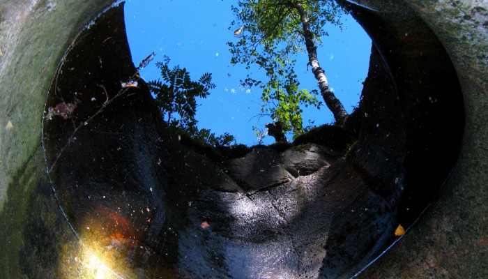
The world seen through a pothole. Credit: Mira Tammelin (distributed via imaggeo.egu.eu )