Since its discovery back in the late 1600s the origin of the spectacular polygonal columns of the Giants Causeway, located on a headland along the northern coast of Ireland, has been heavily debated. Early theories for its origin ranged from being sculpted by men with picks and chisels, to the action of giants, through to the force of nature. It wasn’t until 1771 that Demarest, a Frenchman, sugges ...[Read More]
Imaggeo on Mondays: Giants Causeway
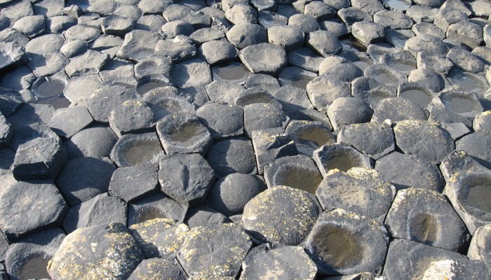
Giants Causeway. Credit: Bernhard Aichner (distributed via imaggeo.egu.eu)
