Despite its alluring turquoise waters and rugged mountain backdrop the story behind this beautiful lake is rather more troubling. In today’s Imaggeo on Mondays, the first post since our short break from the traditional format during the General Assembly, Alexander Osadchiev writes about the shaky origins of Sarez Lake. Lake Sarez is situated in Tajikistan, deep in the Pamir Mountains. In 1911 a lo ...[Read More]
Imaggeo on Mondays: Earthquake Lake
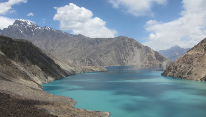
Sarez lake, born from an earthquake. Credit: Alexander Osadchiev (distributed via imaggeo.egu.eu)