Geologists are often fascinated by the processes (and their products) taking place at the sea. Perhaps the fact that we do not have easy access to most of these processes is what puzzles us as geoscientists. Subduction can be considered as one of these “mysterious” processes for which several mechanisms remain to be better understood. Fortunately, subduction zones can be studied through their ancient analogues allowing us to access “frozen” pieces of crust, now scattered around the globe. In these rocks, minerals formed at great depths within subduction zones can help to improve our understanding of the mechanisms involved, since we do not have direct access to what happens at depth in active subduction zones. Curiosity is heightened when it comes to the subduction remnants of oceanic crust – after all, we are talking about the oceanic seafloor being transported kilometres into the Earth’s interior and eventually released to the surface!
Syros is a Greek island, part of the Cycladic archipelago in the Aegean Sea (Fig. 1), known worldwide as one of the best examples of preserved high-pressure rocks and type locality of the mineral glaucophane (Hausmann, 1845), recording a fossilized subduction channel (Laurent et al., 2016). The name glaucophane is related to the Greek words for bluish (Γλαύκος, glaukós) and appearance (φαίνω, phaínō). The island was formed by subduction and collision of the Apulian microcontinent with Eurasia, followed by post-orogenic extension associated with the retreat of the African slab. Most of Syros is covered by the Cycladic Blueschist Unit, an intensely deformed and metamorphosed sequence of blueschist and eclogite facies rocks, formed at ca. 50–35 Ma (see Laurent et al., 2016, 2017 and 2018 for a review). But what kind of rocks are we talking about here?
Although the Cycladic Blueschist Unit can be classified as consisting mainly of marbles, metapelites and metabasites, it should be noted that the rocks may not correspond exactly to what is expected from this rather simplistic description. In fact, the category “marbles” includes homogeneous calcitic and dolomitic marbles that are distributed all over the island and can be seen, for example, at Katerghaki Cape on the southern coast of the island. Most impressive, however, is the sequence at Achladi Cape near the small town of Vari, with rocks described as breccias or conglomerate-like texture marbles, containing clasts of eclogite, pseudomorphs after aragonite, marble, and high-pressure minerals in the matrix, such as glaucophane, garnet, pyroxene and phengite (Figs. 2 and 3). The interested reader can read Schumacher et al. (2008) for more information on the glaucophane-bearing marbles from Syros.
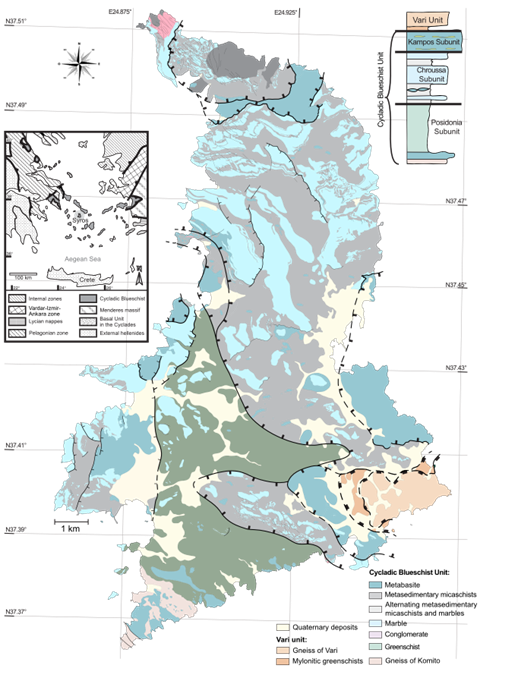
Figure 1: Geological map of Syros modified after Laurent et al. (2016) and Keiter et al. (2011).
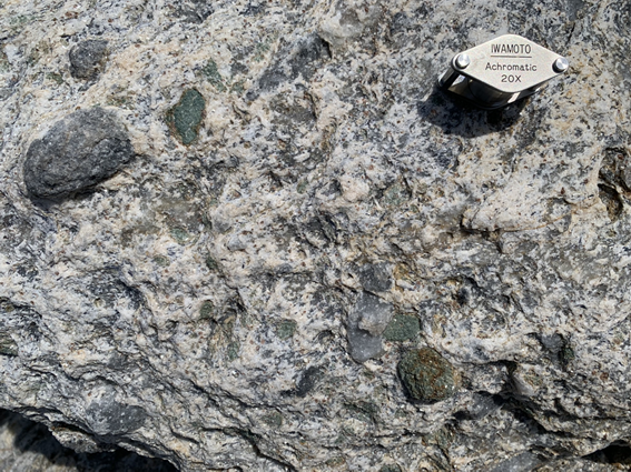
Figure 2: High-pressure marble with conglomerate-like texture containing clasts of eclogite and grey marble from the Achladi Cape.
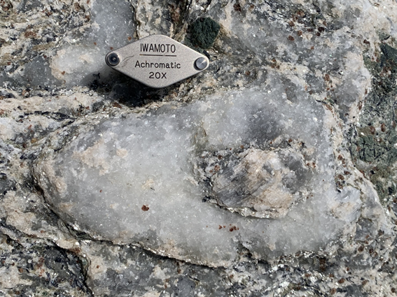
Figure 3: Clast of pseudomorph after aragonite surrounded by carbonate in the conglomerate-like texture high-pressure marble with garnet, quartz, glaucophane and phengite in the matrix.
At Katerghaki Cape, excellent outcrops of highly deformed high-pressure metapelites and metabasites can be found. The first includes a sequence of mylonitic rocks of quartz-feldspathic matrix containing xenoliths of zoned eclogite and blueschist or cm-size garnet porphyroblasts tectonically interleaved with well-preserved blueschists and eclogites (Figs. 4 and 5). In the north of the island, at Lia Beach, impressive outcrops of deformed blueschist (Fig. 6) and massive blueschist partially retrogressed to greenschist facies (Fig 7) can be seen. And, of course, this article would not be complete without mentioning the lawsonite pseudomorphs from Grammata bay and Finikas (Fig. 8).
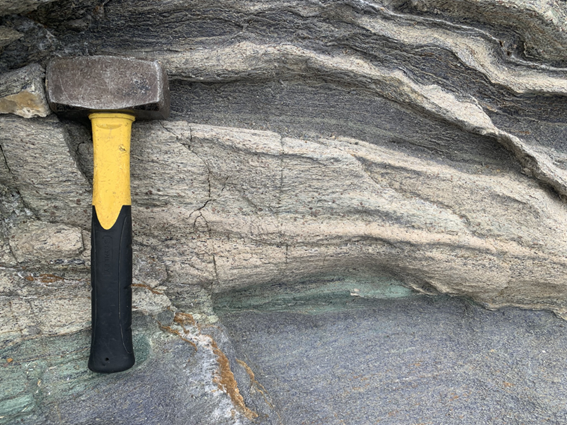
Figure 4: Metasediments hosting the zoned xenolith with eclogite facies on the rim and blueschist on the core.
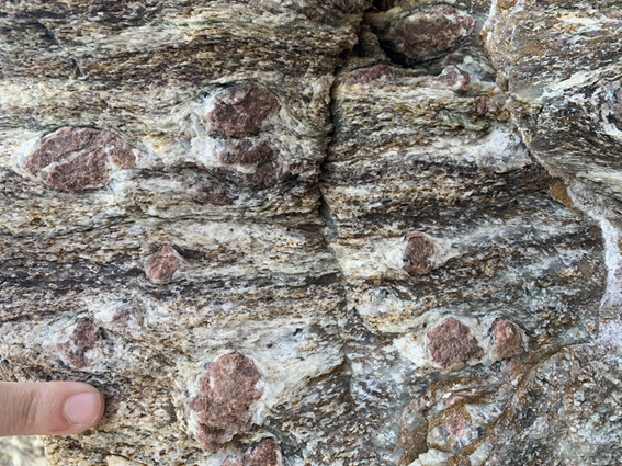
Figure 5: Biotite-garnet mylonite from the Katerghaki Cape.
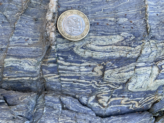
Figure 6: Intensely deformed blueschist from Lia Beach.
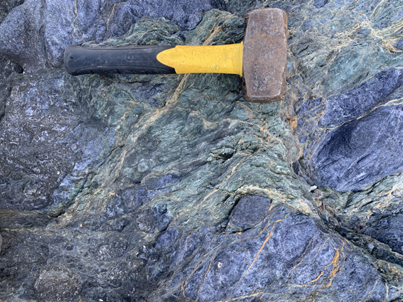
Figure 7: Massive blueschist partially retrogressed to greenschist facies at Lia beach.
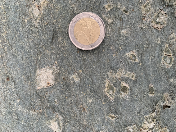
Figure 8: Pseudomorph after lawsonite in blueschist at Finikas locality.
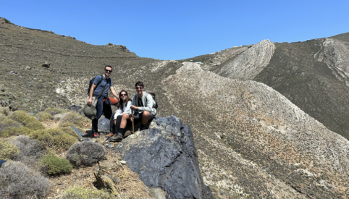
But why are we geologists still interested in Syros? Last May, members of the Computational Petrology & Geochemistry (CPaG) research group that I joined for a year fellowship from CAPES (Coordination for the Improvement of Higher Education Personnel) at the University of Bern (Fig. 9) went on a field trip to Syros to better understand the fluid-rock interaction processes that occur in subduction zones. This research is part of the ERC Starting Grant project PROMOTING (PROgrade metamorphism MOdeling: a new petrochronological and computing framework). This was my chance to see these rocks – and now – to share a bit of my delightful experience with you!
I also have great news for those who are interested in visiting the island, petrologists or not. The Syros GeoPaths mobile app, developed to assist visitors of the Syros GeoPark, is now available to those who wish to learn more about the island’s geological significance while hiking in a protected area (see Koutsabasis et al., 2023). If you are not yet convinced that Syros is worth a visit for its geology, I am sure that the landscapes, the unique cuisine, and the friendly people will convince you! (Figs. 10 and 11)
Jassas jassas kalimera, agapo ti Syros!
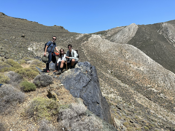
Figure 9: Members of the Computational Petrology & Geochemistry (CPaG) research group (University of Bern) at the blue cliffs (outcrop of blueschist) on the way to Lia beach. The hiking trail can be found in the Syros GeoPaths mobile app that has been recently released (Koutsabasis et al., 2023).
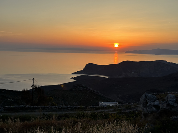
Figure 10: Sunset from the Plakostroto restaurant in the Ano Meria area.
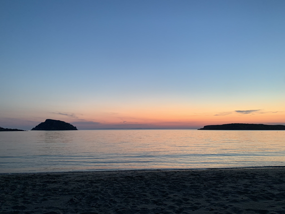
Figure 11: Sunset from the beach of Komito overlooking the Mediterranean Sea.
By: Mahyra Tedeschi (UFMG) with the contribution from Pierre Lanari and Thorsten Markmann (UniBe)
Huseyin Öztürk
Very informative page, Thanks Mahyra..