How can we use GPS velocities to learn more about present-day plate motions and regional deformation? In this edition of Minds over Methods, one of our own blogmasters Mehmet Köküm shares his former work with you! For his master thesis at Indiana University, he used block modeling to better understand the plate motion and slip rates of Anatolia and surrounding plates.

credit: Mehmet Köküm
Using block modeling to constrain present-day deformation of Anatolia and slip rates along the North Anatolian Fault
Mehmet Köküm, researcher at Firat University, Turkey
Until the late 1980’s, geological features such as offset of geomorphological markers were mainly used to determine historical slip rates along faults. Since the mid 1990’s, however, GPS has been widely used since it gives more accurate estimates of present-day slip rates by calculating strain accumulation at the crust. In this work, I use a GPS derived velocity field of Anatolia including data from 1988 to 2005 by Reilinger et al. (2006).
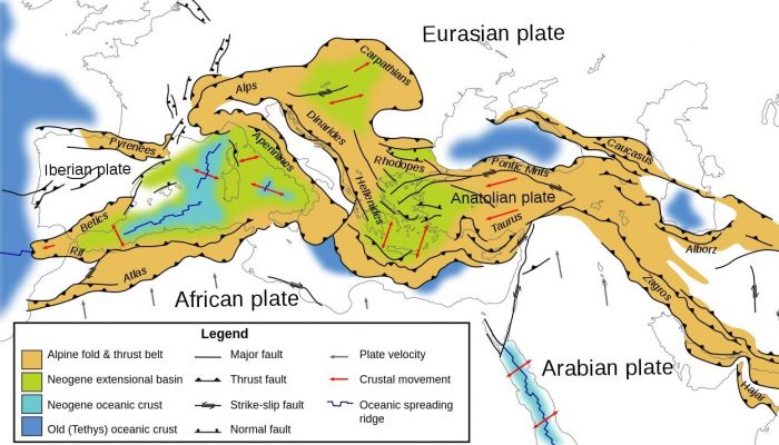
Turkey (Anatolian Plate) is located in the center of the Alpine fold and thrust belt. Due to the closure of different branches of the Neo-Tethys Ocean, main tectonic features of the Anatolian Plate are complicated by interactions between several tectonic plates. The Arabian plate collides with the African plate in the south and the Eurasian plate in the north while the African plate subducts beneath the Anatolian plate along the Hellenic-Cyprus trench. As a result of these complex tectonic structures, the Anatolian plate displays various tectonic styles simultaneously.
Modeling and Data
Kinematic block modeling of interseismic surface motions has been used in different formats by several authors (e.g., McClusky et al. 2000; Westaway 2000; Barka and Reilingier 1997, 2006). The block modeling approach used here is described by Johnson and Fukuda (2010). In this study we used an elastic block model, which is a traditional block model that assumes no long-term deformation of the blocks. For simplicity, all faults are vertical, plates are considered as blocks and are assumed to be rigid. Block boundaries are defined from historic earthquakes, mapped faults and seismicity. Many of the major structures in Anatolia are well known except for a few submarine structures.
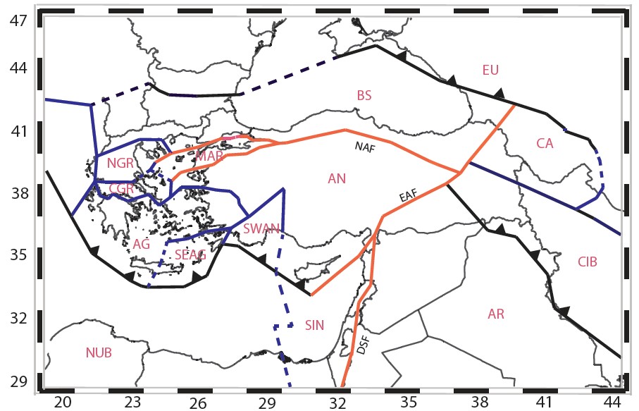
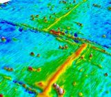
Map showing selected block model including of 14 blocks (or plates). Credit: Mehmet Köküm
Locking Depth
Locking depths indicate the depth for which a fault is completely locked above and creeping below. Estimates of these locking depths are output of the modeling studies and should correlate with the depth of major earthquakes along related faults. Meade and Hager (2005) suggest that there is a relation between locking depth and fault slip rates. Shallower locking depths correlate with slower slip rate estimates; therefore, GPS velocities near locked faults have slower velocities (Reilinger et al., 2006).
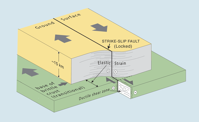
Elastic-half-space model showing fault creep at surface, locked (nonslipping) fault at depth, and freely sliding zone at great depth. (source: SFSU CREEP Project)
Results
On the basis of the GPS velocity field, the Anatolia and Aegean blocks show counterclockwise motion with respect to the Eurasian plate and the rate of the motion increases towards the west. The locking depth variations of the work are between 20-25 km, which correlates with the focal depths of significant earthquakes. The major fault slip rates are consistent with some of the geological slip rate estimates.
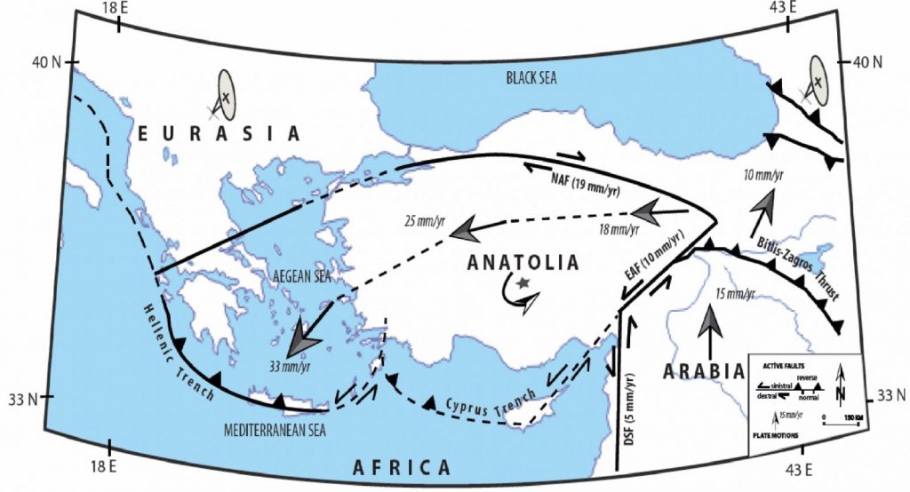
Results of the model. Figure shows Anatolian plate motion and slip rate estimates of major faults. Credit: Mehmet Köküm


