EGU Blogs

Rock Magnetism

A round-up of some newsworthy geomagnetism stories

Happy New Year to you all!

We’ve had a long Christmas break at Geology Jenga, but we are back! For 2014 we’ve got some really interesting 10 minute interviews lined up, as well as the continuation of the ‘Making the most of your PhD’ series and musings on all the things that interest Dan & I. So without further ado, let’s get started!

The past few weeks and months have seen some exciting newsworthy stories regarding the Earth’s magnetic field. I thought I’d highlight a few of them for our first post of the New Year.

The Aurora that never was.
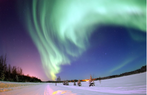
Credit: Wikimedia Commons, user: United States Air Force, This image or file is a work of a U.S. Air Force Airman or employee, taken or made as part of that person's official duties. As a work of the U.S. federal government, the image or file is in the public domain.

Credit: Wikimedia Commons, user: United States Air Force, This image or file is a work of a U.S. Air Force Airman or employee, taken or made as part of that person’s official duties. As a work of the U.S. federal government, the image or file is in the public domain.

On 7th January, there was a large solar flare with an associated fast traveling Coronal Mass Ejection (CME), which was headed straight for the Earth, and was expected to hit our planet by the 9th of January. Space weather scientists, the media and people across the UK and Europe were glued to the night skies in hopes of seeing aurora borealis at abnormally southerly latitudes. Perhaps the excitement surrounding the potential to observe these mysterious phenomena was fueled, at least in the UK, by the timely airing of the first episode of the new series of Star Gazing Live, in which the team (made up of Prof. Brian Cox and comedian Dara O’Brien) took on the challenge to capture the northern lights.

Space weather has featured heavily in the UK media in the run up to the Christmas, as the UK government pledged a £4.6 million investment in the forecast of space weather. From early this year, the Met Office will forecast, deliver alerts and warnings to key sectors that might be adversely affected by  solar flares and CMEs.

Despite the hype, the skies did not deliver. A great blog post by Dr Gemma Kelly, at the geomagnetism team of the British Geological Survey, explains the reasons behind why the Northern lights didn’t quite happen!

For more information on solar flares, CMEs and why they are important: have a look at my guest blog post for GeoSphere on the Earth’s protective shield and also the information pages of the British Geological Survey.


Magnetic Interactions 2014

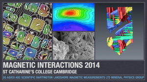
For two days last week, I was at Cambridge University at the UK conference for the geomagnetism community. This year there was also a strong international presence. I would usually write a blog post on the highlights of the research that was

Logo courtesy of Richard Harrison.

Logo courtesy of Richard Harrison.

being showcased at the conference; however, the meeting organisers beat me to it! Read about the science behind fundamental, applied rock and mineral magnetism, as well as, how an ancient voyage by naturalist Alexander von Humboldt might help us understand the geomagnetic field prior to the 1800s  in this blog post by Dr. Richard Harrison, of Cambridge University.


It’s been a long time coming: SWARM!

After a long time waiting, the SWARM mission was finally launched on the 22nd November, 2013. A very exciting time for geomagnetist across the globe, as well as the European Space Agency

The SWARM mission is a European Space Agency mission to study the intensity (strength), direction and changes in the Earth’s magnetic field using high precision and resolution measurements collected by instruments aboard three identical satellites. The three satellites will collect data from all the sources of the Earth’s magnetic signal: core, mantle, crust, oceans, ionosphere and the magnetosphere. Two satellites will fly at lower latitudes, whilst the third will fly at a higher altitude to measure all the vectors of the magnetic field and to reduce the uncertainty associated with not having high quality spatial and temporal data.  The data set will be used in models to better understand the Earth’s magnetic behaviour, including how it may be changing over time. It will assist in deciphering processes such as weakening magnetic shield, space weather and radiation hazards.

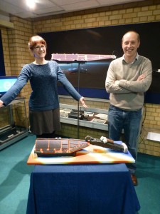
Photo courtesy of Victoria Ridley, who also baked this impressive SWARM cake!

Photo courtesy of Victoria Ridley, who also baked this impressive SWARM cake!

For a great blog covering the build-up to the mission launch, impressive launch videos and cake, head over to the ESA mission blog. If you are interested in more details about the satellites, the mission aims and all sorts of other details, follow the links in the ESA blog too.

Introducing The 10 minute Interview!

The Ten Minute Interview is a feature we will run regularly as part of our blog.

Dan and I feel passionate about promoting the work of Early Career Researchers (ECRs) and also all the people behind the scenes who actually make research happen. The unsung heroes of our labs if you like; technicians and support staff. The key idea is that it shouldn’t take long to read these interviews, you should have enough time to do so whilst you drink your morning coffee or have a quick tea break in the afternoon. The interviewees details are at the bottom of all the posts, so if you find the person particularly interesting, get in touch with them!

Kicking off the ten minute interview feature is Elliot Hurst, one of our lab technicians at the Geomagnetism Laboratory at Liverpool University. Elliot has helped me out with a lot of my research, particularly all the fiddly bits associated with the instruments I use. I should say he is very patient with me and has dug me out of a hole a fair number of times!

Vital Statistics

  • You are: Elliot Hurst (elliot.hurst@liv.ac.uk)Elliot
  • You work at: University of Liverpool Geomagnetism Laboratory
  • Your role is: Laboratory research technician


Q1) What are you currently working on? I work simultaneously on a variety of different projects, depending on the demands of the lab and the main ongoing research at the time.  Currently my time is split between carrying out microwave palaeointensity experiments on pottery sherds from the south west Pacific islands and cataloguing, sampling and measuring magnetic remanences on a collection of rhyolites and basalts I helped drill from Scotland.

Q2) What is a typical day like for you? I normally spend most of time using several of the machines in the lab, measuring magnetic remanences or various magnetic properties in different rock or pottery samples.  The rest of my time is divided up amongst making small repairs on the lab equipment, preparing samples for measuring and training visitors and students in the operation of our machines.

Q3) Does your job allow you to have any academic outputs? In a way, yes.  While I don’t write papers myself, the majority of the work I do in the lab contributes significantly to the results shown in papers, and in the next couple of years I am hoping to have my work included in several of them.

Q4)What has been the highlight of your career so far? I’d probably have to say when I went to Lincolnshire, digging up part of an early Iron Age site.  We were involved in helping trying to date the site using archaeomagnetic techniques, and our results may show that the site is one of the earliest examples of iron workings in Britain.  I’m really looking forward to see where my career takes me in the next few years though.  It’s early days yet!

Q5) To what locations has your research taken you and why? I mostly just live in the lab, but I have been to Lincolnshire for a quick excavation of an early Iron Age site, and I recently went to Scotland to help take rock cores from a number of outcrops.

Q6) Do you have one piece of advice for anyone wanting to have a career similar to yours? Keep in contact with your teaching staff after you graduate university.  I would never have known that my position was available unless my lecturers were easily able to contact me.

Q7) If you could invent an element, what would it be called and what would it do? Netherrack from the game “Minecraft”.  I know I’m not inventing it as such, but it would be awesome to have a material in the real word that could burn indefinitely!


I am originally from Ramsbottom in Lancashire, and I came to Liverpool in 2006 as an undergraduate student studying geophysics.  Once I graduated, I worked for a year in a customer service centre before starting working for the Geomagnetism Group in 2011.  In my spare time I enjoy hanging out with friends, playing computer games, and spending time outdoors.

Becoming a Ghost Buster: What triggers sapropel formation?

As I touched upon in our first post, we can use the magnetic properties of minerals in sediments (and other environmental materials) to understand changes in environmental and climatic conditions. This is known as environmental magnetism. The basic idea is to identify links between the magnetic properties of a material and environmental conditions and depositional processes. This approach is not as modern as you might think and was first used back in 1926! Understanding and characterising how and in what quantities magnetic minerals form can give key indicators of past climates. A great example of how useful this tool can be for understanding rates of deposition, geochemical conditions and past climate changes was shown in our post last week. Magnetic iron oxides and sulphides can form and be dissolved in deep-sea sediments, depending on the geochemical conditions and this can be used to identify ghost sapropels, (Langereis & Dekkers, 1999). Combining evidence for change in the magnetic signature of sediments and changes in composition can indicate changes in the climatic or tectonic setting in which the material was being deposited.

Magnetostratigraphy as a dating tool

In addition, magnetostratigraphy can be used to date sedimentary (and volcanic) sequences. It is, essentially, a correlation technique, which aided by independent isotopic ages, can be used to date a sedimentary section or core. The Global Magnetic Polarity Time Scale (GMPTS) is used for this . The direction of the field recorded in a stratum can be normal or reversed and this will coincide with a known normal or reversed chron of a given age. In the 1950s the first GMPTS, of sorts, was established using the sea floor magnetic anomaly patterns (the familiar bar code type outline seen spreading away from the North Atlantic Ridge). However, it was later on, when each reversal was accurately dated using the astronomical polarity time scale (APTS ) that magnetostratigraphic became a valuable chronology tool. The rates of sediment accumulation within a sequence or core can also be established by plotting the age of the each reversal versus the stratigraphic level at which the reversal is found, giving deposition rates in meters per million years.

What triggered sapropel formation?

We explained in our last post some of the proxy techniques capable of distinguishing sapropels from the background sediment matrix. A dramatic environmental change must have been necessary to create the depositional conditions suitable for their formation. Investigating the nature of this change has been a key task for palaeoceanographers over several decades!

The critical condition for sapropel formation was deep water anoxia (water depleted in oxygen) within the eastern Mediterranean Sea. So, periodically, dissolved oxygen was unable to reach the deeper sea because the water column was vertically stratified; in other words, surface water had quite low salinity while the deeper waters were highly saline (Rossignol-Strick et al. 1982). An influx of freshwater to the Mediterranean would have decreased the salinity of its surface waters; scientists have therefore posed the questions “from where did this increased flow of freshwater come and what was its trigger?” A number of hypotheses have been put forward over recent decades, all of which invoke a strong link between climate and sapropel formation, although the primary trigger has been more widely debated.

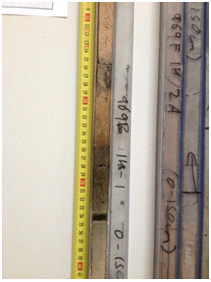
The darker sapropelic layer is clearly visible in this photographic core log. Photograph used with the kind permission of Dr Mike Rogerson, University of Hull.

The darker sapropelic layer is clearly visible in this photographic core log. Photograph used with the kind permission of Dr Mike Rogerson, University of Hull.

The original hypothesis from E. Olausson (1961) proposed massive volumes of meltwater from Eurasian ice-sheets entered the Mediterranean from the north at the beginning of warm interglacials. While this has undoubtedly occurred periodically through the Quaternary, improved dating (using magnetostratigraphy as described above, for example) indicates a mismatch between the timing of sapropel formation and meltwater influx.

More recent research linked the formation of sapropels to enhanced solar insolation. Insolation refers to the amount of solar radiation reaching an area of the Earth’s surface, which varies through the day, annually and on longer timescales (i.e., Milankovitch cycles). Over these longer timescales, it appears phases of insolation maxima during the Northern Hemispheric summer caused stronger monsoons to form over northern Africa, bringing more intense rainfall. As a result, flow in the River Nile (and likely in other rivers draining into the Mediterranean from North Africa that have since dried up) was greatly increased, delivering substantial volumes of freshwater.

The most widely accepted hypothesis today expands on the Nile freshwater hypothesis and suggests warmer sea surface temperatures (due to higher insolation) occurred simultaneously (Emais et al. 2003).  Together, the influx of freshwater and warmer sea surface temperatures were sufficient to create an upper water layer of sufficiently low density to interrupt circulation and create the oxygen-poor conditions at the sea bottom necessary for the formation of sapropels.


Olausson, E. (1961) Studies in deep-sea cores. Reports of the Swedish Deep-Sea Expedition, 1947-1948, v.8, Sediment cores from the Mediterranean Sea and Black Sea. [d1]