Between a Rock and a Hard Place

Between a Rock and a Hard Place

Science Snap (8): White Island erupts!

James Hickey is a PhD student in the School of Earth Sciences at the University of Bristol. A geophysicist and volcanologist by trade, his PhD project is focussed on attempting to place constraints on volcanic unrest using integrated geodetic modelling.

White Island is a small volcano roughly 30 miles off the coast of the Bay of Plenty in New Zealand. It is part of the Taupo Volcanic Zone, which is also home to the impressive Lake Taupo, a flooded caldera that formed in an eruption (a ‘super-eruption’ if you must) approximately 27,000 years ago. White Island, or Whakaãri in Maori, has been one of the most active volcanoes in New Zealand for the past 150,000 years, and its close accessibility makes it a haven for volcanologists and tourists alike. It was even once mined for sulphur. However, its danger shouldn’t be underestimated.

On the evening of the 11th October 2013 (local time) a small explosive eruption occurred, throwing up a column of ash and depositing mud over the crater floor – as can be seen in the image below (and check the video here, including volcanic lightning at 15 seconds). Alert levels were immediately raised and the Aviation Colour Code upped to Orange. This activity was preceded by 15 months of unrest, that is deviation from the background behaviour of a volcano towards a level that might be cause for concern in the short-term. The aviation warning was soon reduced back down, but the volcanic alert level remains at 2, as a similar event can be expected without prior warning.

Before (left) and after (right) images of the small eruption taken from a web camera positioned on the north crater rim. You can clearly see the mud layer deposited by the explosion. Image credit: GNS Science


Fortunately no one was injured in this recent eruption. But as this island offers such a unique opportunity for tourists, with up to 10,000 visitors a year, there is a real need to maintain the monitoring and improve our understanding of the processes that preclude volcanic eruptions.

Above: a photo I took as a bumbling 18 year-old tourist in 2006 whilst on a visit to White Island. It’s likely the stream of people in the picture would have been seriously injured by the eruption that took place. In the background you can see steam from fumaroles that give the island its ‘White’ name. Credit: James Hickey


Rocky secrets – fifty shades darker?

Mel Auker is an Earth Sciences PhD student in the School of Earth Sciences at the University of Bristol. A mathematician by trade, Mel’s PhD uses numerical approaches to better understand past, present, and future global volcanic hazard and risk.

You might remember Charly’s “Fifity Shades of Grey” post, highlighting the colourful spectrum of rocks; fifty shades of grey they are not. On a purely aesthetic level, rocks are incredibly varied and interesting.

But the thing is, a lot of the samples us volcanology and petrology PhD students spend our time looking at are some shade of grey. The trick to staying interested in all things grey is to learn to read between the lines. Grey volcanic ash, for example, has a whole host of dark secrets to share if you know what to look for… [Read More]

Science snap (7): Thrusting under our noses

As Earth Science researchers, we are extremely fortunate that fieldwork often necessitates trips to exotic and far-flung places. But sometimes we are guilty of ignoring the riches right on our doorstep.

In Bristol (UK), perhaps our greatest geological asset is the Avon Gorge. At the end of the Last Glacial Maximum, torrents of icy meltwater scoured out a 2.5km long gouge through a series of Devonian and Carboniferous limestones and sandstones. The bottom of the 90m deep gorge is now filled with the River Avon and the sheer cliffs of the north side are home to fossil corals, rare plants and challenging climbing routes; they also expose an excellent thrust fault.

This particular example lies at the intersection between Bridge Valley Road and the Portway, just underneath the Clifton Suspension Bridge (see here for map). Compressional forces associated with the formation of the supercontinent Pangea (~290 Ma) caused the the older Clifton Down Limestone to be thrust over the younger Upper Cromhill Sandstone. Friction along the overhanging fault plane deformed the younger sediments, and the resulting instability of the rock face has caused major issues for the adjacent roads.

IMG_0399

Thrust fault in the north side of the Avon Gorge where the older grey Clifton Down Limestone (right) has been thrust over the younger red Upper Cromhall Sandstone (left); the intensity and friction of the thrusting is manifest in the deformation of the younger sediments. The fault outcrops at the intersection between Bridge Valley Road the Portway (A4) and is conveniently located adjacent to set of traffic lights and a cycle path – look out for it next time you’re stuck on a red light or peddling past.

Science Snap (9): Sentinel-1

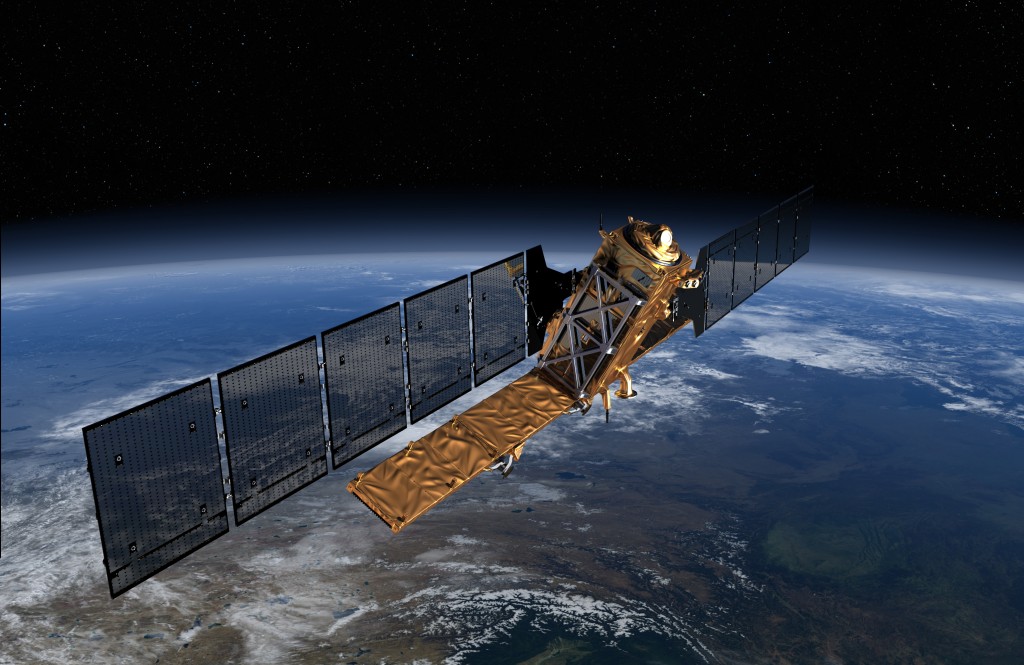
Sentinel-1 satellite to be launched in Spring 2014. Copyright: ESA/ATG Medialab

Sentinel-1 satellite to be launched in Spring 2014. Copyright: ESA/ATG Medialab


This isn’t strictly a photograph but an artist’s impression of a new satellite launching soon that will hopefully change the pace and advancement of a satellite remote sensing technique I use in my PhD, InSAR. Sentinel-1 will be the first of five European Space Agency (ESA) satellites to be launched as part of Europe’s Global Monitoring for Environment and Security (GMES) ‘Copernicus’ programme. This multi-billion (euro) project “will be engaged in wide range of land and ocean surveillance tasks, such as oil-spill monitoring and earthquake hazard assessment”.

Sentinel-1 will be a polar-orbiting radar satellite that can collect data day-and-night, in any weather condition, and will be ready for launch in spring 2014. The launch of this satellite is exciting for scientists as it will see the continuation of Synthetic Aperture Radar (SAR) data collection that was, until recently, collected by the ENVISAT satellite.

Aside from InSAR, the ESA website highlights other uses of SAR imagery including “monitoring Arctic sea-ice, routine sea-ice mapping, surveillance of the marine environment, including oil-spill monitoring and ship detection for maritime security, monitoring land-surface for motion risks, mapping for forest, water and soil management and mapping to support humanitarian aid and crisis situations”.