This blog post is part of our series: “Highlights” for which we’re accepting contributions! Please contact Emma Lodes and Anna van den Broek (GM blog editor, elodes@asu.edu, a.j.vandenbroek@uu.nl), if you’d like to contribute on this topic or others.
by Florian Betz, Principal Investigator at the Earth Observation Research Cluster at University of Würzburg. Email: florian.betz@uni-wuerzburg.de
What is biogeomorphology and why is it important?
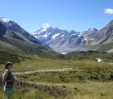
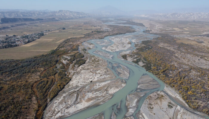
Rivers are shaped by the feedbacks of geomorphic processes and vegetation development. Here, we clearly see the interplay of sediment bars and riparian vegetation in different stages of development (photo credit: Florian Betz)
Biogeomorphology is the study of the interaction between ecologic and geomorphic processes. This can be small-scale processes such as biologic micro-crusts influencing rock weathering, or large-scale processes such as forests stabilizing entire hillslopes. Also, the impact of fauna on earth surface processes falls within the scope of biogeomorphic research. The history of biogeomorphology goes back to the holistic approach of Alexander von Humboldt and to Charles Darwin, who investigated the geomorphic work of earth worms. Today, biogeomorphology is still considered as emerging field within the broader context of geomorphology. As most of the earth’s surface is impacted by biota to at least a certain degree, understanding their interaction with geomorphic processes is crucial to analyzing how a landscape is changing through time.
In my own research, I am specifically focusing on the interaction between riparian vegetation and hydro-geomorphic processes to understand the development of riverine landscapes and their ability to provide ecosystem services such as carbon sequestration. Currently, I am leading a research project funded by the German Research Foundation (DFG) focused on biogeomorphic feedbacks across multiple scales. We aim to understand how small-scale feedbacks between vegetation and hydromorphology, e.g. through a single plant or piece of large wood, are affecting the formation of larger landforms, and how larger-scale structures influence these small-scale processes. Ultimately, we want to improve our scientific understanding of how biogeomorphic feedbacks across multiple scales shape riverine landscapes, and how we can use this knowledge to guide nature-positive river management and restoration efforts.
Which methods am I using to study biogeomorphology of river corridors?
The main tool I am using for studying biogeomorphic processes is satellite remote sensing. With recent satellite missions such as the European Sentinel-2 constellation we can get new images every couple of days what enables us to get an unprecedented amount of information – continuous in space and in time. This comes, however, with significant challenges in data processing. This is also the reason I joined the Earth Observation Research Cluster (EORC) at University of Würzburg when I had the opportunity to decide on my affiliation with own funding as PI of the project I am currently leading there. The EORC is a dedicated remote sensing department and is a great environment for pushing the limits of how we use remote sensing for analyzing river dynamics. Among others, we have access to a high-performance computing environment that enables us to process satellite data at scale. At the same time, I have really great colleagues with whom I can collaborate on the use of cutting-edge AI models for classification tasks or – jointly with a PhD student I am co-supervising – computing super-resolution Sentinel-2 data. This enables us to have 2.5 m instead of the native 10 m data while maintaining high temporal frequency and gives unprecedented possibilities for monitoring river dynamics at larger scales.
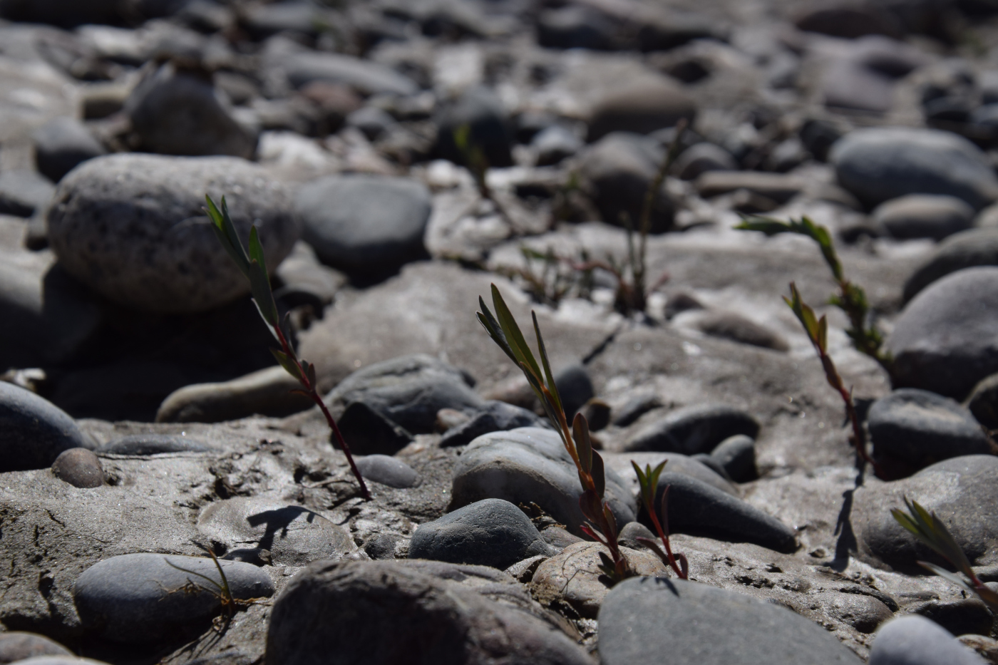
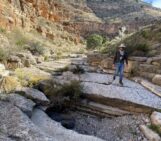
This is where new floodplain forests start: young poplar seedlings on a gravel bar (photo credit: Magdalena Lauermann)
While I am fascinated by these opportunities of earth observation, field work is also a crucial part of my scientific work. Ground truth data is necessary to train and validate remote sensing data and some small-scale processes just cannot be observed from space. I commonly collect data in the field and later work on upscaling information via satellite data and machine learning. For instance, this enables us to predict riparian vegetation communities and their biogeomorphic succession stage along with their temporal trajectory for entire river networks. Or, to take an example from geomorphology, we have collected grain size data of gravel bars along the Naryn River in Kyrgyzstan using photosieving from ground photos and low altitude UAV images. Now, we are working on the prediction of grain size from our super-resolution Sentinel-2 data by training machine learning models.
Where is my main research area?
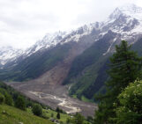
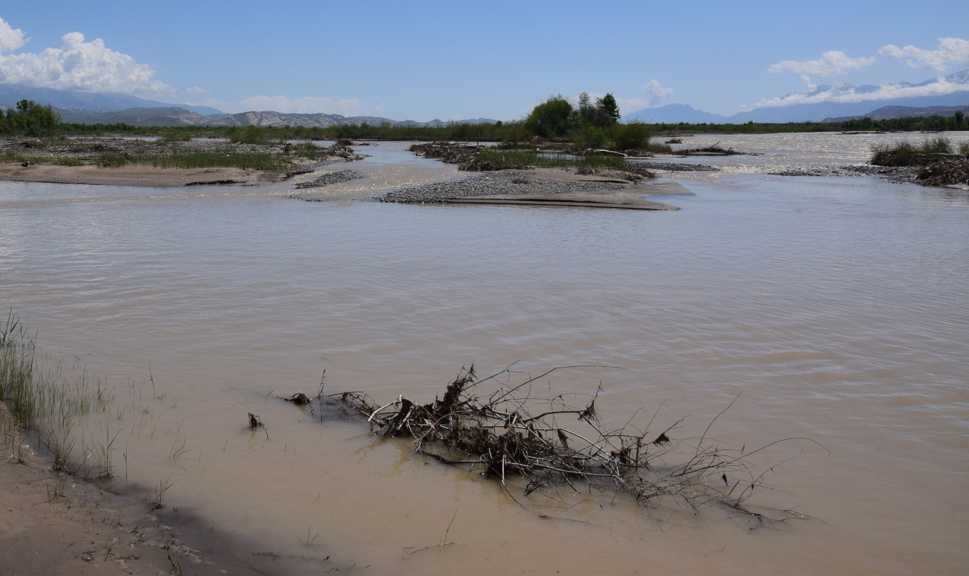
My main research area is the Naryn River in Kyrgyzstan. This is a still free flowing river on a length of more than 600 km. Along with an average active channel width of 400 m, this makes the Naryn a perfect case study to analyze biogeomorphic dynamics through satellite observations. If we look across Europe, we will hardly find similar rivers anymore as we just have altered our river systems too much. At the same time, it is exciting to do research on fluvial geomorphology and riparian ecosystems there, as the Naryn river had hardly been studied before I started working there back in 2014. In this time, not even high-resolution Google Earth imagery was available for the region and we spent quite some time generating the first overviews of geomorphic structure, riparian ecosystems and their ecosystem engineer species. After a decade of research, we have of course closed many research gaps. At the same time, Kyrgyzstan remains an exciting region for research. The Naryn River forms the headwater of the Syr Darya, one of the two large tributaries of the Aral Sea. Therefore, research on this river, even if we focus on fluvial biogeomorphology, is always tied into the wider context of water resource issues, which are ubiquitous in Central Asia. Therefore, river research in Central Asia almost always has a policy dimension.
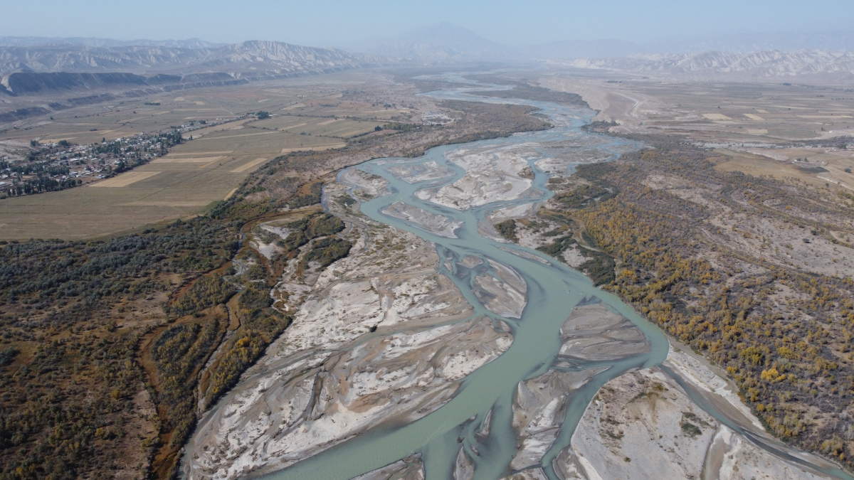
Drone image of the Naryn River in one of the braided sections (photo credit: Florian Betz)
How did I get involved in science-policy activities and capacity building?
Already while doing my PhD research, I got involved in capacity building measures as I was carrying out trainings for students of our local partners in Kyrgyzstan on vegetation mapping, statistics or GIS. Over my PhD research and in my early Post-Doc phase I was mainly working on transdisciplinary projects dedicated to the sustainable management of rivers and floodplains in Central Asia. Therefore, I had the opportunity to be closely engaged with stakeholders from water and forestry management as well as with local communities living on the riverbanks. It was always a great privilege to bring our research findings, like the significance of hydrologic and geomorphic dynamics to the long-term conservation of floodplain forests, to the ears of practitioners. At the same time, I also had to learn that sometimes decisions are made in a way I wouldn’t agree on. Currently, a hydropower plant is being built along the still free flowing Naryn River. It is clear that this will have significant negative impacts on the biodiversity of the riverine and floodplain ecosystems and might even lead to the total loss of floodplain forest in the long-term. Over a couple of years, we were regularly placing arguments about the potentially negative consequences of such hydropower dam and even demonstrated that replacing power generation with solar power plants would be more cost-effective. Still, the decision was made to build the dam, which is now under construction. For a while, I took this really personally and had feelings of anger and sadness. Today, I have finally accepted it and at least know that I took the chance and spoke up to communicate about this to politicians, authorities and local communities.
My current project at the Naryn River is more dedicated to fundamental research on biogeomorphic feedbacks and how to use remote sensing to study them. Still, I feel it as my obligation to engage with local scientists and communities to communicate findings and support students and early career scientists. It is a great privilege to have the possibility to do field work in Kyrgyzstan, and it is a matter of real importance to me to give something back.
What comes next for me?
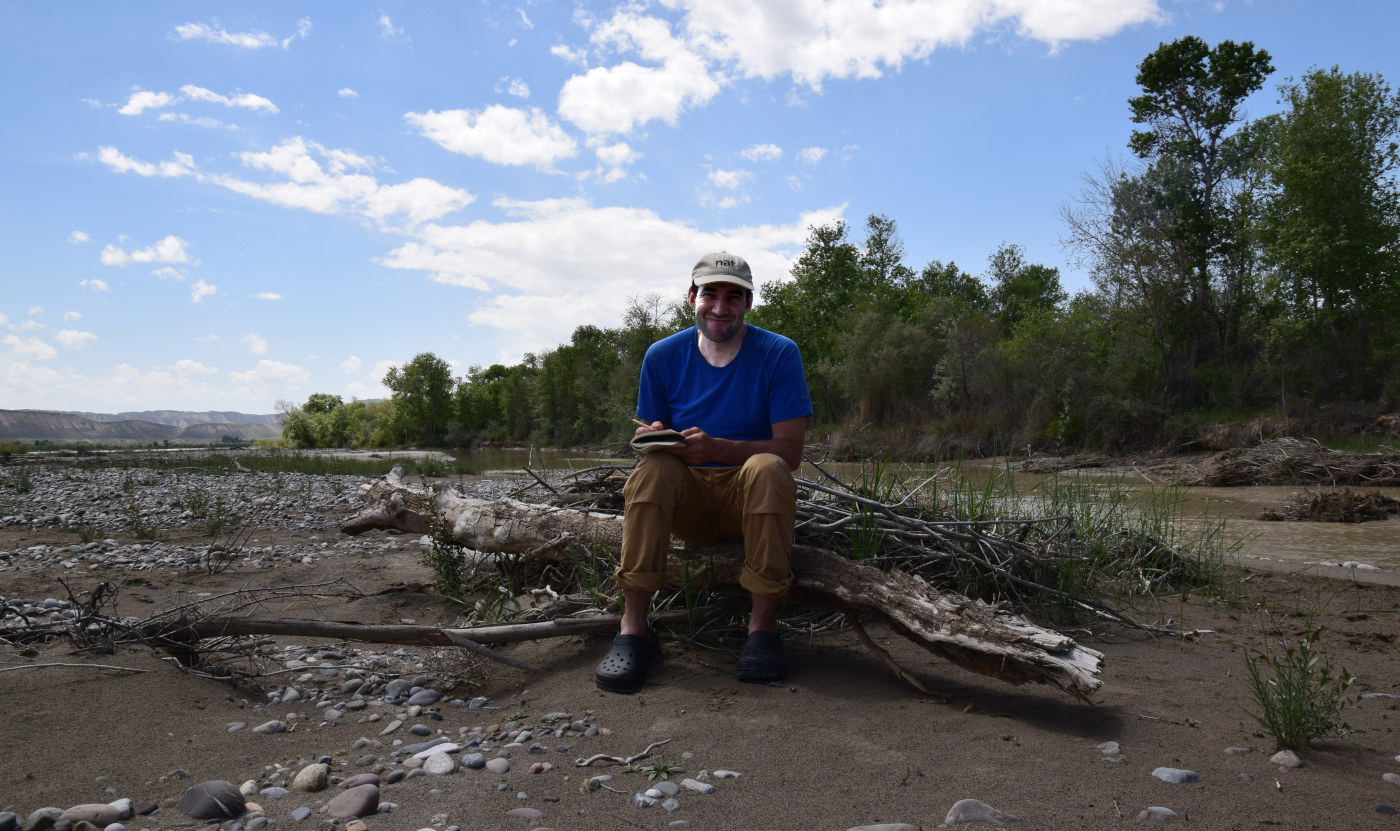
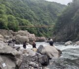
Me during field work at the Naryn River (photo credit: Magdalena Lauermann)
For sure, I will continue the research on the Naryn River and the wider river system of the Aral Sea basin. With the completion of the hydropower project at the Naryn River, we will have the sad opportunity to study the ecologic and geomorphic consequences of this project. Beyond this, my colleagues and I are extending our focus and work towards global analysis of fluvial biogeomorphology. With the growing earth observation archives and advances in cloud computing and AI for data processing, we are currently entering an era of unprecedented opportunities for studying biogeomorphic dynamics in river corridors and I want to contribute shaping this development.