EGU Blogs

Classics

Pilgrimage to Pompeii

Pilgrimage to Pompeii

One of the highlights of my honeymoon in Italy was our trip to Pompeii. Both my wife and I are big classics nerds so for us a visit to Pompeii had something of a pilgrimage aspect to it. For me, as a geologist, it was doubly impactful to see the effect of Vesuvius on the town. For the record, we got in a huge discussion about what actually constitutes a pilgrimage.

gopr3923

It’s hard not to feel emotional during a trip to Pompeii. Photo: Matt Herod

As a bit of background, Mount Vesuvius, pictured below, erupted in 79 AD releasing a massive cloud of ash and rock which rained down upon the nearby town of Pompeii killing over 1,000 residents and entombing the town. In addition to the ash fall, pyroclastic flows also hit the town bringing more destruction and were responsible for most of the death. Mount Vesuvius is still active to this day with its last major eruption occurring in 1944.

gopr2501

Looking at Mount Vesuvius from Sorrento across the Bay of Naples. I hope you all like my hat! Photo: Matt Herod

The Pompeii site is absolutely massive. My wife and I spent about 5 hours walking throughout the town and feel like we only saw maybe half. Around every corner was another incredibly preserved relic of ancient Roman life along with poignant reminders of its fragility. The contrast between everyday life juxtaposed with the destruction is very moving.

gopr3786

The ancient amphitheater of Pompeii. I learned that Pink Floyd once recorded here. Photo: Matt Herod

gopr3817

An incredible fountain in the back garden of one of the villas. Photo: Matt Herod.

gopr3822

A very well preserved fresco showing the birth of Venus. Photo: Matt Herod


gopr3826

A frescoed room. Pretty much every room had incredible designs telling stories. To be honest it kind of makes we wonder why painting a room a single colour is the trend today, when this is clearly so much cooler. Photo: Matt Herod

gopr3837

A reminder that ancient Roman life did not differ that much from ours is found here at the food stand.

gopr3848

Wagon tracks in the stone as well as these convenient crossing stones.

gopr3910

Another cool fountain in the back garden

gopr3927

The theatre. It is in such great shape it could still be used…maybe it is?

gopr3941

A beautiful room with a crazy mosaic floor.

Another cool fountain? I think water bubbled out of that hole in the middle.

Thanks for reading!

Update: Concidentally, renowned Canadian naturalist David Suzuki is doing a CBC special on Pompeii. Check it out here: http://www.cbc.ca/natureofthings/episodes/pompeiis-people 

It’s Been a While

It’s been a long time since my last post. This is mainly due to the ridiculously busy summer I have had. The biggest thing was getting married, but the honeymoon, work trips and deadlines as well as working on a few papers kept me pretty occupied. I’m sad to say that blog updates dropped lower on my priority list then I would’ve liked.

In any case, I am going to try to get back at it now that life has settled down a bit. Stay tuned for some detailed posts on research, geopolls and other stuff. I am of course always open to guest posts so if anyone would like to volunteer I’d be more than happy to host.

In the meanwhile here is a great photo from my honeymoon on the Amalfi coast of Mt. Vesuvius taken from Sorrento. Maybe I’ll write about Pompeii….just a thought.

GOPR2509

Looking across the Bay of Naples towards Mt. Vesuvius from Sorrento. Photo: Matt Herod

From the GeoSphere Archives: The Wooden Wall

It is once again time to write about geology and classics and the incredibly important impact the geosciences had on the ancients and their way of life. My previous post on this topic can be found at my old blog location as the post: The Odyssey and Geology. I’ll begin by relating a story:

File:Themistokles.jpg

Themistocles (Wikimedia Commons)


The two fleets, the Persians the the Greeks, which was composed of the navies of all the city states, but mainly Athens, met in the narrow Strait of Salamis for a final and deciding battle. The Persian king, Xerxes, was so certain of victory that he set up a throne in nearby Athens to watch the battle. The true architect of the battle though was not Xerxes, but the Athenian Themistocles, a politician and general. Indeed, it had been Themistocles who had convinced the Athenians to build a navy of over 200 additional ships in the years prior to the war and it was he who stationed the Greek navy in the Strait of Salamis, which was advantageous for the smaller Greek navy. The battle proceeded according to Themistocles’ plan and the Greeks were able to out-maneuver the Persians in the narrow strait and succeeded in decimating the Persian navy. This was a great blow to Xerxes who fled back to Persia with much of his army. The next year the Greeks were able to defeat the remainder of the Persian army driving them out of Greece and winning the war. Salamis was the turning point of the war and saved Greece from certain doom.In 480 BC the ancient Greeks were faced with their biggest threat in history: the invasion of the Persian king, Xerxes and his armies. The Greeks, despite being horribly outnumbered had fought bravely but been defeated in the Battle of Thermopylae. The Persians then advanced through Greece nearly unchecked and conquered Athens.  However, the Persians knew that to fully conquer Greece they would have to do so at sea as well as on land. Things were looking pretty grim for the future of ancient Greece at this point.

File:Battle of salamis.png
Source: Wikimedia Commons

The hero of Salamis, Themistocles was a very persuasive politician as well as tactician. In fact, it was he who convinced the Athenians to build the 200 triremes (ships) that made of up the bulk of the Greek navy and can be credited with saving Greece. The credit cannot be only given to Themistocles though. In fact, the idea came from the Oracle of Delphi. The Greeks were very worried about the impending Persian invasion and decided to consult the oracle for advice on how to win the war. The oracle cryptically answered along the lines of the “wooden wall will save you”. Clearly, this answer could not refer to the building of an actual wooden wall since that would be stupid and obviously could burn down. Themistocles interpreted the oracles advice to mean build a navy. Unfortunately, the ancient Greeks had the same problem with national defence requisitions as governments do today and money for such a venture was not easily at hand. However, geology was going to come to the Greeks rescue in the form of a major silver discovery at Laurium, a small mining community just south of Athens, providing the Athenians with enough money to afford a new navy. Without the discovery at Laurium it is possible the navy would never have been built and ancient Greece would have fallen into Xerxes hands. Ergo, geology saved ancient Greece from total domination by the Persian empire.

So now what about Laurium?

File:Mineurs grecs 2.jpg
Miners in Laurium. They were all slaves. (Source: Wikimedia Commons)
Google Maps

The Laurium silver mines are located just south of Athens and are world renowned for the excellent mineral samples the area still produces in addition to its storied past. The mineralization is of lead, zinc and silver and is associated with the emplacement of an igneous body within metamorphosed sediments. The ore occurs mainly within marble especially at the contact with other metamorphic or igneous rocks (www.mindat.org). The list of minerals found in the Laurium mining district is a mile long and it is actually the type locality for about a dozen minerals as well, making it a world class mineralogical site. The mineral Laurionite is named in honour of the location. In addition to the minerals occurring in the mines there are a host of others that occur in the ancient slag piles left by the Greeks. The slag has reacted with the sea water used in processing the ore in ancient times to produce a suite of new and unusual minerals there as well.

Agardite, Laurium, Greece (Source: www.mineral-forum.net – Used with permission)
Diaboleite, Laurium, Greece (Source: www.mineral-forum.net – Used with permission)
Conichalite, Laurium, Greece (Source: www.mineral-forum.net – Used with permission)
Nealite, Laurium, Greece (Source: www.mineral-forum.net – Used with permission)
Annabergite. Larrium, Greece. (Source: www.mineral-forum.net – Used with permission)

The ancient ore processing techniques of the Greeks were obviously primitive relative to today’s, however, they were still able to extract both lead and silver from the ore. The process essentially involved numerous washes with water in a sloped basin. The heaviest material was collected and smelted, and the resulting slag was carted away and dumped. Since then the slag has had a few thousand years to oxidize and this process has resulted in the growth of all sorts of interesting minerals like the ones pictured above. Laurium is still geologically relevant today from the perspective of the mineralogist or mineral collector as the area still produces some world class specimens.

It has always amazed me how deeply geology is integrated with our lives today, what with our dependence on natural resources for nearly everything. However, it would appear that this is not a new phenomenon and that geology always has been and will always be a crucial part of our lives.

Thanks for reading!

Matt 

The Search for Ithaca

This post unifies two of my absolutely favourite topics: geology and classical Greek history. I have always had a soft spot for the classics. In fact, when I started my undergrad I was planning on doing a double major of geology and classics. I decided to focus on geology, but I have not lost my love of ancient civilizations particularly the ancient Greeks and Romans.

File:Head Odysseus MAR Sperlonga.jpg

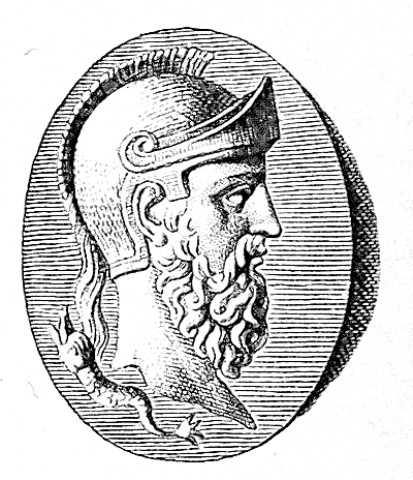
Odysseus (Source: Wikipedia)

Most of us are familiar with the story of the Odyssey, but I’ll recap it here briefly. The Odyssey is the tale of Kind Odysseus’s journey back from Troy to his home island of Ithaca. Odysseus, despite being a pretty shrewd guy, angers the god Poseidon who condemns him to wander the ocean for decades before he can go home. During this time Odysseus experiences many wild adventures in is quest to return home to his wife, Penelope and his son, Telemachos. Eventually, Odysseus returns home, but just in time to prevent his kingdom falling into rival hands. It is a classic good guy triumphs over evil tale and one of the best classical poems ever written. Homer obviously took substantial creative licence in the poem, as was customary at the time, however many of the places he mentions are real, as are the people such as Agamemnon, Menelaus, Troy, Mycenae, Sparta, etc. However, there has always been a question…where is Ithaca?? Indeed, Ithaca was missing. The home of the principle character in the poem was nowhere to be found and this just doesn’t jive with the accurate nature of rest of the poem.

This is a question that had baffled classical scholars for decades. At first, many believed that Homer just made up Ithaca since at that time Troy was believed to be fictional as well. However, once Troy was discovered it no longer made sense to think that Ithaca was made up and therefore, it must be some place amongst the Greek islands.

The passage in the Odyssey that describes the location of Ithaca is as follows:

 εἴμ’ Ὀδυσεὺς Λαερτιάδης, ὃς πᾶσι δόλοισιν

ἀνθρώποισι μέλω, καί μευ κλέος οὐρανὸν ἵκει.

ναιετάω δ’ Ἰθάκην ἐυδείελον: ἐν δ’ ὄρος αὐτῇ

Νήριτον εἰνοσίφυλλον, ἀριπρεπές: ἀμφὶ δὲ νῆσοι

πολλαὶ ναιετάουσι μάλα σχεδὸν ἀλλήλῃσι,

Δουλίχιόν τε Σάμη τε καὶ ὑλήεσσα Ζάκυνθος.

αὐτὴ δὲ χθαμαλὴ πανυπερτάτη εἰν ἁλὶ κεῖται

πρὸς ζόφον, αἱ δέ τ’ ἄνευθε πρὸς ἠῶ τ’ ἠέλιόν τε,


I am Odysseus, Laertes’ son, world-famed

For stratagems: my name has reached the heavens.

Bright Ithaca is my home: it has a mountain,

Leaf-quivering Neriton, far visible.

Around are many islands, close to each other,

Doulichion and Same and wooded Zacynthos.

Ithaca itself lies low, furthest to sea

Towards dusk; the rest, apart, face dawn and sun.


So there you have it in beautiful Homeric Greek. The location of Ithaca…it is the westernmost of the Greek islands, which today is Cephalonia, formerly known as Sake, and not Ithaca. As for the current Greek island called Ithaca it in no way meets the description of Homer’s Ithaca and therefore it cannot be the same island, unless Homer was trying to play a massive joke on us all or did not understand basic geography, neither of which is very likely. So where did ancient Ithaca go?

Over the past few years a new theory has emerged to answer this question. In short the idea is that the thin isthmus of land between Paliki and the rest of Cephalonia was at one point underwater separating the two places and resulting in two islands. Indeed, there is classical text to back up such and idea. Strabo, the renowned ancient geographer wrote “where the island is narrowest it forms an isthmus so low-lying that it is often submerged from sea to sea.” If we trust Strabo, this means that during classical times there were actually two islands that are now one. Perhaps, westernmost Paliki was Ithaca during Homer’s time and the current island called Ithaca was another island was Doulichion. However, how can we prove that this idea is more than just an interesting theory?

Elevation map of Cephalonia. The white test is the current names and the yellow text is the name in Homer’s time. (Source: Odysseus Unbound)

Well, to answer this question we must turn to geology…we had to get there sometime.

The geological investigation of Stabo’s channel, now known as the Thinia valley, is being carried out by John Underhill, a professor of seismic and sequence stratigraphy in the University of Edinburgh department of geosciences. The geological evidence that Strabo’s channel existed is outlined in a paper by Dr. Underhill published in Nature Geoscience and is freely available online. However, I’ll give a brief outline of the evidence here.

In order to prove that Paliki was once an island the geology must show that the Thinia valley was once under water. However, the problem is that the elevation of the Thinia valley is 180m above sea level…and sea level certainly has not changed 180m is only 3000 years!!! However, there are other geologic features that can account for some of the uplift. The Eastern side of the Thinia valley is divided by a large thrust fault known as the Aenos Thrust, which is an extremely active fault to this day. Indeed, the last major earthquake on Cephalonia was a 7.2 magnitude in August 1953. The seismicity is generated by the collision of the Eurasian plate with the African plate. However, the earthquakes, while they cause substantial uplift did not occur often enough or have enough displacement to result in over 180m of uplift since the time of Homer. Therefore, another mechanism is needed to fill in the valley and raise it to 180m. Mapping of the island and the valley revealed a possible solution to this problem. The mapping revealed the occurrence of several large landslides and rockfalls in the valley. In fact, large blocks from the valley walls are easily observable within the valley. These massive landslides and rockfalls were caused by the earthquakes and storms and a lot of material fell from the steep valley walls into the valley.

A resitivity survey of the Thinia valley. The blue is Cretaceous bedrock, red is water, and the green and yellow are unconsolidated sediments. (Source: Odysseus Unbound)

 To further prove the existence of Strabo’s channel, however, direct evidence of marine sediments must be observed underneath all of the landslide fill. In order to do this Underhill’s team drilled numerous boreholes around the valley and found many places where there was indeed marine sediment. In addition to drilling they also conducted geophysical surveys in order to map the subsurface geology of the valley in greater detail, which would allow them to map the channel and prove that it actually separated Paliki from the rest of Cephalonia. The geophysical techniques allowed them to determine the amount of fill in the valley from landslides, the depth to bedrock and the bedrock contours. Further surveys also revealed that there were drainage features in the sediment of the embayments on either side of the valley which shows that water flowed into the sea through the valley. Combining the boreholes, and the geophysical mapping all of the evidence points to the fact that Strabo’s channel did exist 2000-3000 years ago and that since that time uplift from earthquakes, landslides and rockfalls has filled in the channel and joined Paliki (Ithaca) to the rest of the Cephalonia concealing Ithaca from us!!!

Thanks for reading and please feel free to post any questions or comments!

References:

Odysseus Unbound: http://www.odysseus-unbound.org/

Underhill, J. (2009). Relocating Odysseus’ homeland Nature Geoscience, 2 (7), 455-458 DOI: 10.1038/ngeo562

Note: This is a repost from my pre-EGU blog location with minor updates. It was originally posted in June 2012.