During the last ice age*, ~70,000 to 20,000 years ago, the climate was much colder in Europe. As a result, the northern part of Europe was fully covered by the Fennoscandian (a.k.a the Scandinavian ) ice sheet, which extended up to the British Isles and some parts of Poland and Germany. In central Europe, the Alps were also almost fully glaciated. The storage of all this ice on the continent lower ...[Read More]
Image of the Week — Last Glacial Maximum in Europe
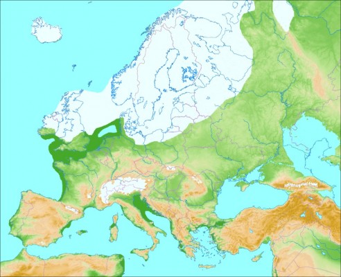
Last glaciation in Europe, ~70,000-20,000 year BP (credit: Wikimedia Commons user Ulamm)